Friday, April 3, 2015

Coyote Creek Trail 2015-04-03

I'd been wondering if I could do long-ish hikes, say 15-20 miles - or more. Well, there was only one way to find out. So I donned my shoes, sneaked out behind Apollo, and asked Jaya to drop me at Morgan Hill where the Coyote Creek Trail starts. I'd parked my car at Hellyer Ave, right by the Hellyer County Park, which would make this a ~16 mile hike. I didn't want to take a chance in pushing Apollo to do something this long, so he ended up getting more goodies this morning as compensation and chilling out at home. Dogs are allowed on this trail, though, by the way!

The trail starts at the intersection of Eagle View Dr. and Morning Star Dr. in Morgan Hill. It was a typical spring morning today, slightly nippy at 46 ⁰F, when I began around 8:30 am. The mountains and general greenery gave a crisp look to the trail as it started meandering in a northwestern direction. A little more than a mile into the hike, I crossed over Hwy 101 and came upon the Santa Clara County Model Aircraft Skypark, a club for model aircraft flying enthusiasts. 

The steady freeway road noise became a background hum as I came upon Coyote Creek Park Chain, the next landmark. With several lakes and waterfowls in them, this section of the hike was slightly annoying. I was surrounded by a swarm of flying insects - moths of some kind - even though the scenery was very nice.

About 5 miles into the hike, I came across Coyote Creek Golf Club. Right after the golf club, the trail moved eastward and closer to Hwy 101 around Bailey Ave exit. The background hum became more pronounced, as though someone was turning up the volume of the road noise. 

A couple of miles later, the trail crossed over the creek. The warning sign about creek waters overflowing the trail seemed so irrelevant today. Entering its fourth year of drought, California is suffering, and how dry and cracked the creek bed appeared was proof to that.

About 7.5 miles in, Coyote Ranch showed up on the right. There were a few horses grazing there, but it was clear that they had seen greener pastures at different times! 

Less than a mile from the ranch was the PG&E Metcalf transmission substation, with high voltage transmission lines running overhead.
Right after that, I crossed Metcalf Road and came upon Parkway lakes on my right. While there was still water in the lakes, it looked so anemic compared to what it must be normally.

For the next mile or so, the trail ran close to Forsum road in San Jose, through Metcalf Park. As I had hiked nearly 10 miles, the restroom facilities at this park were a relief! Right after, the trail crossed over Hwy 101 again, this time at the 101/85 split. This was the most overpowering underpass I've ever come across!


Over the next 3~4 miles, I found several workers taking to the trail at lunchtime. There are several employers by Silver Creek Valley Road, and it was good to see the general awareness among various employers who seemed to be encouraging employees to stay healthy and fit. 

By this time, I was looking forward to end of the hike. The mile markers on the trail and my GPS tracker were off slightly. I knew we had to cross over Hwy 101 once more to reach Hellyer Park and when I saw the highway with the exit sign to Hellyer Ave, it was a welcome sight for my sore eyes.  

4 hours and 51 minutes from the time I started - not including about half an hour of break - I reached the spot where I'd parked my car. This was the place where I'd turned around when I hiked Coyote Creek Trail earlier on 23rd Jan. I essentially covered all of Coyote Creek Trail with today's hike!

Having done a few half marathons and one ultra-half marathon (16 miles), this is probably the longest I've stayed on my feet, both in terms of time and distance. Tomorrow will tell if I am ready to do something like this over several back to back days for a larger project I have in mind.

Several more pictures from the hike.
#Hiking, #HikingWithDogs, #CoyoteCreekTrail


Saturday, March 28, 2015

Stanford Dish Trail (No Dogs Allowed) 2015-03-28


It was a beautiful spring day to hike a Bay Area classic that has so far eluded us – Stanford Dish Trail. Jaya and Jana were my hiking buddies today with Apollo chilling out at home after having a double breakfast. 

The paved blacktop trail takes you around the radio telescope that is still actively used and goes by the popular name of “the Dish.”


Neither dogs nor bicyclists are allowed here, making this trail - more a well paved road than a proper hiking trail - popular for joggers and walkers. The four mile trail is a completely exposed, so it's best done when it is not too hot. Street-side parking is available on Stanford Ave off Junipero Serra Blvd in Palo Alto.
The walk nevertheless offers panoramic views of Stanford, bay bridges, the East Bay, as well as Arastradero Preserve and beyond on the other side. 


View of the Dish, Stanford clock tower, Jaya and Jana debating

I’d recommend doing the hike as an anti-clockwise loop for to take in the best views offered on the hike, especially of Stanford University and the bay.

Our hike was especially interesting today with several engaging conversation topics between Jaya, me, and our fast maturing Wildcat daughter, Jana. 
With each of us standing on different ends of the spectrum on economic systems, we had a healthy debate on the merits and lack thereof between capitalism, socialism, and communism. We also put Jana in a spot to arbitrate between debates Jaya and I have all the time and she was ever so tactful in keeping both mom and dad happy :)


We covered 4.5 miles at a leisurely pace of about 3 mph. Here are some more pictures from the hike.

#StanfordDish


Friday, March 27, 2015

Pearson Arastradero Preserve, Palo Alto 2015-03-27

It was a beautiful spring day and we decided to hike at Pearson Arastradero Preserve in Palo Alto / Los Altos Hills. The parking lot at the trail head is located by Arastradero Road, a short distance from 280 / Page Mill Road exit. The bulk of the preserve and trails lie south of Arastradero Road, while a smaller 1.7 mile loop, Redtail Loop Trail, is right by the parking lot.

My older daughter, Sanjana, was home for her Spring Break and joined Apollo and I on the hike today! Apollo was quite glad to be led by her today, enjoying liberties that he normally wouldn’t get from me. Walking about 500 feet from the parking lot, we crossed Arastradero Road and started our hike with Juan Bautista de Anza Rrail. About half a mile of walking led us to Arastradero Lake on the left. We continued south by the Arastradero Creek Trail, walking for nearly a mile. Both the de Anza and Arastradero Creek trails are fire road / dirt trails that are quite exposed.


We turned right at Woodrat Trail, a narrow trail that required us to go single file, but provided some shade. Less than half a mile of hiking with some elevation led us to Meadowlark Trail. An immediate right took us to a vista point, providing awesome views of Felt Lake, Stanford Dish, and the bay.

At about 775 feet, this is the highest point in the preserve. From there, we came back to Meadowlark Trail, slowly turning around the preserve, continued north on Woodland Star Trail, Bay Laurel Trail, and Ohlone Trail to reach the de Anza Trail junction. During the first section, we walked very close to a neighbor who evidently had a sheep farm in his backyard!

As you can see, I’ve mentioned several trail names, each of relatively small distance. A map would come in handy for anyone choosing to visit the preserve, and you can choose to hike different trails and extend your hike by a mile or so. This is one of the smaller preserves I’ve hiked in. With gentle rolling grass hills, plenty of deciduous oak trees, easy elevations (less than 500 ft. of ascent, at best), and well maintained dirt trails, this would be a fine option for beginners.

We wrapped up by taking the Bonus Hill Trail and Meadowlark Trail, joining de Anza Trail again and retracing our way back to the parking lot. Our hike today was a 4.8 mile loop completed in a comfortable pace in 1½ hours.

More pictures from the hike.

 #Hiking #HikingWithDogs #PearsonArastradero #ArastraderoPreserve #PearsonArastraderoPreserve #PaloAltoOpenSpace


Friday, March 20, 2015

Guadalupe River Trail 2015-03-20

We wanted a change of pace, scenery, and setting for our next hike. Guadalupe River Trail in San Jose bubbled up in the selection. Running along Guadalupe River, the 11 mile paved trail runs through San Jose all the way to Alviso. We started our hike today at Guadalupe River Park and Gardens, at the intersection of Autumn St. and Coleman Ave. We parked at the large shopping complex, but there is street-side parking available a little ahead, by the trail on W Taylor St.

The first 1¼ mile was through Guadalupe River Park and Gardens, with an option to follow the trail that hugs the river or the ones that meander in the gardens. When we crossed the 880 underpass, the scene changed. The trail ran right next to SJC airport on one side and the river on the other. While the section in the gardens was shaded, the trail became fully exposed from this point on. For the next two miles, the trail runs right by the airport. You’ll get to see flights landing and taking off and cars zipping by to the airport to send off and pick up people.

You may even get to see a pair of wild geese crossing the Airport Blvd. and causing a traffic situation! I couldn’t believe it when I saw the geese walking across a fairly busy road. The situation was tense for few minutes before a Good Samaritan driving a van decided to stop, get out of his van and shoo the birds. The thankless birds decided to fly away, leaving me wondering why they chose to waddle across the road on their webbed feet in the first place!

When you reach the end of the airport infrastructures, the trail moves over to the other side of the river and continues up north. Getting across the Hwy 101 underpass will provide a change of scene from the ultra-urban setting by SJC airport. We continued past Trimble Road and decided to turn around after about 4½ miles from where we started.
I got an opportunity to click a couple of great shots of Apollo by the Trimble Underpass. My boy was ever so willing to pose for a photo!

The entire section we hiked was completed and opened to public only in April 2013. Sections of the trail still looked new! There were more people on their bikes using this trail than people on foot. This wasn't a surprise, as the well-paved, level blacktop road running 9 miles with no interruption should be very enjoyable for biking. This trail will also attract hikers (I daresay I can call walkers and joggers that) who crave an urban setting or are looking for a trail that runs by an airport!

Near Airport Blvd, there is a section where the trail runs on both sides of the river. On the way back, we used the eastern section. We noticed that San Jose is well prepared for pumping storm waters - all along the trail, there were plenty of warning signs about Guadalupe River flooding. Today, though, the river was looking anemic, with water flow reduced to a trickle at best.

The 9 mile out and back walk took us nearly 2 hours and 25 minutes to complete. My tracking software crashed midway, so you will find the other map that completes the one on the right in the photo album below.

More pictures from the hike.
#Hiking #HikingWithDogs #GuadalupeRiverTrail


Monday, March 16, 2015

Almaden Quicksilver County Park 2015-03-16

Apollo and I were soon back at Almaden Quicksilver Park, a park with 34 miles of hiking trails and a depth of history. This time, we tried out the Hacienda entrance located off Almaden Road / Almaden Expwy in San Jose. Parking is free and there is plenty available in this lot too.

Almaden Quicksilver Park was home to mercury mining from the late 1800s until 1976. In fact, San Jose Mercury News owes its name to this bit of valley history.

The sky was cloudy when we started and it stayed that way through our hike. A half mile hike on Mine Hill Trail took us to English Camp Trail. This is the closest I've come to high voltage transmission lines - English Camp trail runs close to it for about a fourth of a mile. It was a steady climb of ~1000 ft. before we reached English Camp, one of the historic sites we visited. 
Apollo couldn’t have enough of the place! He checked out Church Hill, the school site, and picked up a couple of ticks along the process that I had get rid of.


Continuing on Castillero Trail, we stopped by Rotary Furnace, the second historic site in our chosen path. There was a nice description of the process of extracting Mercury from cinnabar (Mercury Sulphide ore). Unlike English Camp, our next historic site stop, Spanish Town, had all traces completely removed in the 1930s. We made our way to Hidalgo Cemetery Trail - a dead end, apparently!


There were a couple of spots providing great views of the valleys on this trail.

On the return, we took the Yellow Kid Trail to reach English Camp again and continued on Deep Gulch Trail to the Hacienda parking lot. At 5.7 miles, this was one of our shortest hikes. We ascended some 1100 feet in the first 3 miles and gave it all up on the return. Our route today was Mine Hill Trail -> English Camp Trail -> Castillero Trail -> Hidalgo Cemetery Trail -> Yellow Kid Trail -> Deep Gulch Trail from the Hacienda parking lot trail head.

There is plenty more to explore at this park - and at its neighbor, Sierra Azul Open Preserve. Although the scenery in these two neighboring places is similar, each trail provides its own unique charm.  After a break, we will be bound to explore more trails at these two locations.


Update 2015-06-20

Apollo and I were back at the Hacienda staging area and did about 5.5 miles this morning with my friend Shubho Nag and three of his friends, Ethan, Farhana, and Sridhar. We did a slightly different loop from what I'd done earlier and made our way to English Camp by starting off on Deep Gulch Trail and connecting to English Camp Trail. From English Camp, we took Castillero Trail and turned around at Mine Hill Rd towards the Hacienda parking lot.


Our early morning hike was at a leisurely pace and interspersed with conversations on various topics from workplace diversity, gender equality, regulated monopolies, and sharing stories of my SF Bay Walkabout and hikes with Apollo.  


More pictures from the hike.

#Hiking #HikingWithDogs #AlmadenQuicksilverCountyPark #AlmadenQuicksilverPark #EnglishCamp

Monday, March 2, 2015

Almaden Quicksilver County Park 2015-03-02

Almaden Quicksilver County Park has more than 34 miles of hiking trails! The park has three entrances. This time, we chose the one on Mockingbird Hill Lane, off of Almaden Road and Almaden Expwy. Plenty of parking is available here. The park has several trail systems – I’d recommend having a map with you just so you can follow the highly interconnected trail system properly.


Our hike today was 8 miles long and the route we took was as follows. Hacienda Trail -> Capehorn Pass Trail -> Mine Hill Trail -> Great Eastern Trail -> Mine Hill Trail -> Prospect #3 Trail -> New Almaden Trail. While Hacienda and Mine Hill Trails were dirt roads, Great Eastern, Prospect #3 and New Almaden Trails were narrow hiking trails just wide enough for one person. 
We ascended some 1100 ft. by the time we were out of the Great Eastern Trail over the first 3 miles and gave up most of it during the next 2 miles on Mine Hill & Prospect #3. The last 3 miles on New Almaden had some ups and downs, but nothing as intense as the first 3 miles.

Hacienda, Capehorn Pass, and the first section of Mine Hill trails reminded me of the Sierra Azul hike. They were broad, dirt/fire roads ascending steadily with views of the bay unfolding gradually. They are multi-use trails, so expect to encounter mountain bikers and the occasional horse rider. However, the scene changed when we entered Great Eastern Trail. The heavily shaded path will lead you up the mountains and into the forests. We skipped the section to April Tunnel; in retrospect, we should’ve checked it out. About a mile of extra hiking would let you do that once you come out of Great Eastern Trail.


The next section of Mine Hill Trail, even though it's a fire road, was more shaded and cooler. Don’t miss the short detour to Catherine Tunnel and view from the top. From Catherine Tunnel, the hike becomes downhill and the Prospect #3 Trail is quite steep.

The best part of the hike today was the final 3 miles on New Almaden Trail. This largely downhill trail is quite scenic. We crossed several creeks along the way, although all but one had no water flowing through them.
A couple of grass hills will provide a change of scenery before a gentle climb in the last half mile that gets you to the Mockingbird Hill parking lot.

It's going to take a few more visits to cover the breadth of the trails in this beautiful county park bordering Sierra Azul Open Preserve. With a rich history in mining, this park has a lot of interesting things to offer.


More pictures from the hike.
#Hiking #HikingWithDogs #AlmadenQuicksilverCountyPark #AlmadenQuicksilverPark


Friday, February 27, 2015

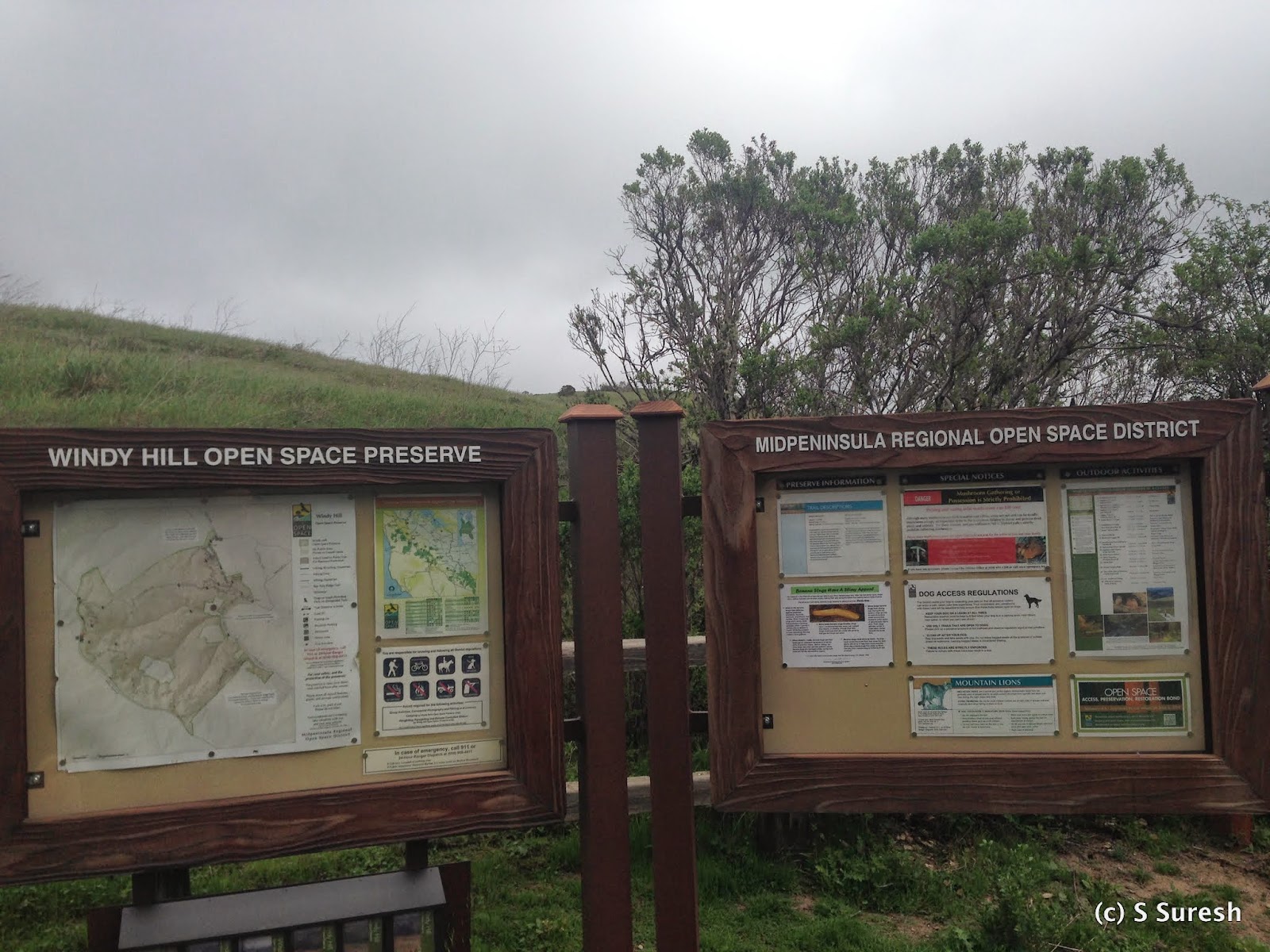
Windy Hills Open Space Preserve 2015-02-27

Skyline Blvd Trailhead
You would expect something interesting from a place with a name like Windy Hills Open Space Preserve - and you sure won’t be disappointed should you choose to come here. Located in the town of Portola Valley, Windy Hills Open Preserve provides you with two options to enjoy the 12+ miles of trails it contains. You can park at the Portola Road parking lot (from 280, take Alpine Road exit, go west towards Portola Valley, turn right on Portola Road) or the Skyline Blvd parking lot. The trails are uphill from Portola Road to Skyline Blvd and downhill the other way.

We used the Portola Road parking lot and started off at Spring Ridge Trail. Having been here a while ago, we decided to do a loop by taking Hamms Gulch Trail to the summit and returning by Spring Ridge Trail. You will see Sausal Pond on your right as you make your way towards Hamms Gulch. All of the trails in Windy Hill are unpaved, dirt trails.

Once you enter Hamms Gulch Trail, you'll see a distinct difference. Heavily wooded, narrow, and involving a steady climb, the trail will quickly lead to a point where two creeks, Hamms Gulch and Jones Creek, join.
Apollo had fun crossing the creek and wading through the water. For the next mile or so, the trail will climb up with Hamms Gulch on the right. You'll find yourself in the forests, with just the sound of the creek and the birds and little else. As you climb up, the ravine on the right with Hamms Gulch will get deeper.  

Hamms Gulch Trail itself is about 3 miles long, completely through forests. We came across just two other hikers along the way. Every now and then, you will get glimpses of the valley. Some 3.5 miles from the starting point, you will come across a fork leading to Razorback Trail on the left and Windy Hills summit on the right. Stay right on the Lost Trail towards the summit.

View of the Pacific Ocean side & Skyline Blvd
You will first pass the Skyline Blvd entrance before entering the Anniversary Trail for the last stretch to the summit. Windy Hills summit provides breathtaking 360⁰ views of the Pacific Ocean on one side and the Bay Area on the other.
View of SF Bay side
From the top, you can easily make out Stanford Tower, Dumbarton Bridge, and more.

Apollo was clearly elated to reach the summit. It was also an amazing experience to see the rain clouds from the Pacific move in on us and dust us with a light rain. The climb to the summit from Portola Road was just shy of 1400 ft.

We made our way back by Spring Ridge Trail, which had more traffic compared to the one we took to ascend. A steady descent over the next 2.8 miles led us back to our starting point. We took the Betsy Crowder Trail towards the end to make it a 8 mile hike. While Spring Ridge Trail was wider with more traffic, it was also predominantly exposed.

You can make several variations if you choose to hike Windy Hills. And if you are so inclined, you can also hike Razorback Trail one way to make it that much harder and longer, but I don't believe dogs are allowed on Razorback Trail.

More pictures from the hike.
#Hiking #HikingWithDogs #WindyHills #WindyHillsOpenPreserve #HammsGulchTrail #SpringRidgeTrail #MROSD