Thursday, June 18, 2015

Hayward Regional Shoreline (SF Bay Trail) 2015-06-18

Part of the San Francisco Bay Trail, I had covered the Hayward Regional Shoreline on Day 2 of my SF Bay Walkabout in April. Plenty of parking is available at the end of Winton Ave, off Hwy 880 in Hayward. Dogs are allowed north of Winton Ave on the trail. Both my daughters, Sanjana and Kavya, joined us on our hike this morning. 


Planning the walk
From the parking lot, a half mile walk by the flood control channel will get you to the shoreline and the SF Bay Trail. We turned right and headed north towards San Leandro. The last time I walked this stretch was during high tide, while today was low tide. That changes the whole experience, although my daughters didn't mind the fact that it was low tide and less scenic as a result. 


Bockman Channel & Sewage Plant
About three-quarters of a mile further is Sulphur Creek and another three-quarters of a mile north is Bockman Channel. In high tide, I had seen several anglers by the bridge north of Sulphur Creek. Ahead of Bockman Channel is a Sewage treatment plant and San Lorenzo Creek. 


Great Egret
Essentially an out and back trip, we turned around at San Lorenzo Creek, a little more than 2.5 miles from where we started. As with my previous hike, we saw plenty of birds - Snowy Egrets, Great Egret, American Avocets, Black-necked Stilts and a Red-winged Blackbird. My daughters were amused that I was reeling out the bird names each time we came across a bird!


With such a breathtaking variety of birds, I told them that it would be a shame to walk any segment of the Bay Trail and not observe them closely or learn to identify them. We also came across several squirrels that had made the shoreline their home and one of them put on a great show for us, chirping away as he did it.


As with most East Bay Regional Parks, dogs are allowed off-leash in undeveloped areas, which covered our entire trip today on the dirt trail running right by the bay. Apollo had complete freedom to expore as much of the landscape as he could while we kept him on a verbal leash.


We covered 5.3 miles today at a leisurely pace of 3 mph, in about an hour and fifty minutes. This is an easy trail for anyone at any fitness level. 

More pictures from our hike today.
#Hiking #HikingWithDogs #HaywardRegionalShoreline #EBRPD #SFBayTrail


Tuesday, June 16, 2015

Dry Creek Pioneer Regional Park 2015-06-16

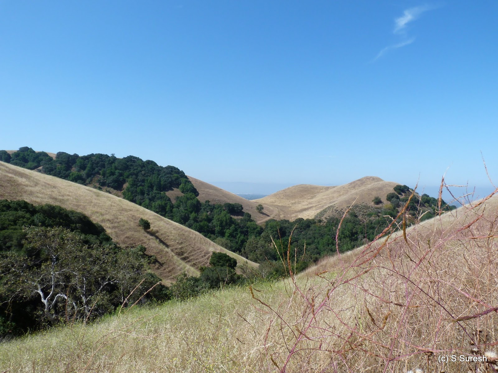
When we hiked Garin/Dry Creek Pioneer Park in February, we had experienced lush green rolling hills following rains in the days before. In sharp contrast to that, the same place was brown with dry grass in the Hayward hills today. We parked at the May Rd staging area, off Mission Blvd & Decoto Rd in Union City. My daughter, Sanjana, is back home for her summer break, so she joined Apollo and I for the hike today. 


It was a fine spring day to do a longish hike in the hills. From the May Rd parking lot, a short walk on May Rd Trail and High Ridge Trail got us to Meyer Ranch Trail . A wide dirt trail / fire road, Meyer Ranch Trail will lead you to Meyer Ranch. There is a nice oak tree in the middle of the trail; when I suggested to Apollo that he climb it, he showed no hesitation in demonstrating his tree-climbing skills - that I didn't know he possessed!


From here, we took the mile-long Pioneer Trail, a single track trail through heavily wooded forests in the hillside. Midway, we had to maneuver around a tree that had fallen in the trail, but otherwise, this is a beautiful trail this park has to offer. 

Pioneer Trail connects to High Ridge Loop Trail. After climbing some 500 feet, the half mile hike in High Ridge Loop Trail is an easy descent. My daughter and I engaged in discussions around stereotyping and the India-Pakistan partition. Dogs are allowed off-leash in this park and Apollo was happy to be on his own for much of the way, especially in the next segment of our hike to Tolman Peak.

From High Ridge Loop, we went left on Tolman Peak Trail. The next mile or so is quite exposed, and it leads you to the junction of South Fork Trail. We hiked clockwise around the Tolman Peak loop, choosing the shorter and more exposed segment to ascend. The views from this segment are quite impressive as we gain some 900 feet or so in less than a mile. 


The trail ends abruptly at a fenced portion that is not accessible to the public. On our way down, we took the longer South Fork Trail. It was getting warmer, but a gentle breeze and the well-shaded portions of the South Fork Trail made our descent very enjoyable. We also saw a beautiful Western Scrub Jay right after we got out of Tolman Peak Trail.


We wrapped up the hike by retracing our steps on Tolman Peak Trail, continuing in High Ridge Loop Trail again before reaching the May Rd. parking lot. With nearly 1600 feet of climbing, we took 3 hours to complete the 8.3 mile hike today that was entirely within the Dry Creek Pioneer Regional Park. 

More pictures from our hike today.
#Hiking #HikingWithDogs #DryCreekPioneerPark #TolmanPeak #GarinDryCreekPioneerPark #EBRPD

Monday, June 15, 2015

Pulgas Ridge Open Space Preserve 2015-06-15

At 366 acres with 6 miles of hiking trails, Pulgas Ridge Open Space Preserve is compact and is managed by the Midpeninsula Regional Open Space. It is located at the border of San Carlos & Redwood City off Hwy 280 and Edgewood Road. The parking lot on Edmonds Rd is big enough to have about 20 cars. Pulgas Ridge Preserve has an off-leash dog area and is exclusively a hiker's park - no bicyclists and no equestrians. 


Apollo and I started off our hike on Blue Oak Trail. After a steady climb and less than half a mile into the hike, we continued onto Dick Bishop Trail rather than doing the Hassler Loop Trail in the off-leash area. Both of these are single track trails with plenty of shade. 


Dick Bishop Trail connects to Hasslers Trail and leads you to Dusky-footed Woodrat Trail. Not only the name is a mouthful, but at 2.2 miles, this is the longest trail in this park. By the way - dusky-footed woodrats are nocturnal rodents. The first mile or so of this long trail on the ridge top is in an open rocky terrain with views of hillside and canyons. 


The second half of Woodrat Trail travels through wooded forests and it ends at Polly Geraci Trail. You could turn left here and trek the half mile to the parking lot; Apollo and I headed right and uphill here. After about a mile, Polly Geraci Trail reaches Hassler Trail right by another entrance to the off-leash area for dogs.


Apollo was delighted to hike on his own for the next half mile, enjoying his freedom. We wrapped up the hike by descending the last half mile on Blue Oak Trail to reach the parking lot. 

Our 5.8 mile loop involved climbing some 600 feet during the first 2.5 miles and another 300 feet on Polly Geraci Trail. 


Apart from Hassler Rd, which happens to be a black-top road in bad repair, all other trails are either single track or slightly wider dirt trails that involve climbing up and down the hills in the preserve.

More pictures from our hike today.
#Hiking #HikingWithDogs #PulgasRidgePreserve #PulgasRidgeOpenSpacePreserve #MROSD

Thursday, June 11, 2015

Stevens Creek Trail 2015-06-11

Stevens Creek Trail is the third riparian trail in the South Bay connecting to the San Francisco Bay Trail, the other two being San Tomas Aquino Creek Trail and Guadalupe River Trail. I had hiked this trail by myself as part of my SF Bay Walkabout, but today was the first time with Apollo. Street-side parking by Heatherstone Way (off Bernardo / Mary Ave) in Mountain View will allow you to get to the trail head. 


The first four miles of this trail are dog friendly. Dogs are not allowed beyond Crittenden Lane, north of Hwy 101. The trail starts off crossing Hwy 85 and heads north. Soon after crossing Hwy 85, there is a nice nature trail section where the flora of the region is labeled. 

We started our hike around 9 am. Mirroring our experience from the San Tomas Aquino Creek Trail hike, this happened to be peak bicycle commute time. Apollo had to be on a short leash to stay away from the cyclists zipping by us, predominantly heading north.


We met a tabby cat during our hike today sitting comfortably by the trail. When Apollo got close to the cat, it simply stood up and gauged him. Impressive! The cat went into the bushes when I got closer, but easily held its own. With some more coaxing, I suspect I could've taken a photograph of Apollo and the cat together!


The paved, blacktop trail passes through several underpasses and over bridges, including an impressive quarter-mile long bridge over Central Expwy, Evelyn, Caltrain, and light rail tracks. The trail runs right by Hwy 85 all the way until Hwy 101, crossing over once after Central Expwy. Road noise from Hwy 85 is very pronounced much of the way. 


Wanting to keep our hike close to 6 miles, I decided to turn around at Hwy 101 and skip the last mile that Apollo could've come on. This trail has reasonable shade cover compared to the other two trails I'd mentioned. It was welcome relief on a hot day like today. Even though it was overcast and in the high 60s when we started, by the time we finished, it was significantly warmer.


We completed 6.2 miles in an hour and 50 minutes. Stevens Creek Trail was in the news today - as the cities of Mountain View, Cupertino, Los Altos and Sunnyvale ponder over extending and/or bridging gaps from locations south to Heatherstone Way. 

Here are some more pictures from the hike. I have borrowed a few photographs from Day 1 of my walkabout. 
#Hiking #HikingWithDogs #StevensCreekTrail


Wednesday, June 10, 2015

Almaden Quicksilver County Park 2015-06-10

Senador Mine Trail
Apollo and I had hiked Almaden Quicksilver County Park twice in March, on the 2nd and the 16th. We had focused on the southeastern portions of this 4,152 acre park. Today, we returned to the northern part of the beautiful park. The McAbee entrance does not have a parking lot, but street-side parking is available in the neighborhood. You can reach this entrance from Camden Ave and then turning right on McAbee Rd.


Senador Mine
For Apollo's sake, I'd decided to keep this a 5 mile-ish hike, given the hot, humid, tropical weather pattern we were experiencing. A quick walk from the McAbee entrance crossing a circa-1924 bridge will get you to the park entrance. We started at Senador Mine Trail, a wide dirt trail. In about half a mile, you will come across the remnants from the Senador Mine itself.


We continued our hike by Guadalupe Trail. This trail borders Guadalupe Creek for a good portion and at one point is right by the creek. This is a nice spot - shaded with a picnic table by the creek. 


Guadalupe Reservoir
From here, the trail continues further to the Guadalupe Resevoir, which was standing at less than 60% capacity today. Apollo was happy to wet his feet in the reservoir, although I was uncomfortable to let him off-leash here.


New Almaden Trail


We continued further on Mine Hill Trail and Cinnabar Trail to connect to New Almaden Trail. New Almaden Trail is a single-track, shaded trail, much like our earlier experience hiking a portion of it. Except this one mile segment, there was reasonably heavy traffic today, especially for a weekday! 


We wrapped up our hike, connecting yet again to Mine Hill Trail and reaching the trail head. Our 5.4 mile hike today took us little more than an hour and 45 minutes. And involved some 800 feet of climbing. 

I suspect with one more trip, we'll be done with most of the trails in this park, though not the entire 34 miles of it!


More pictures from our hike today.
#Hiking #HikingWithDogs #AlmadenQuickSilverCountyPark #AlmadenQuickSilverPark

Monday, June 8, 2015

Joe's trail at Saratoga de Anza 2015-06-08

The forecast for today called for the hottest day of this year yet, with the high near 100 degrees. I decided to do an easy hike earlier in the day and chose Joe's Trail at Saratoga de Anza. In the city of Saratoga, this 1.6 mile trail runs by the Union Pacific Railroad. I parked at the huge parking lot off Glen Brae Dr., opposite Congress Springs Park. 

The trail is in two segments. One segment runs from Saratoga Ave & Hwy 85 to Cox Ave. The other segment runs from the other side of Cox Ave. to Sunnyvale - Saratoga Rd. Crossing Glen Brae Dr., Apollo and I headed towards Cox Ave first. 


The dirt trail is really wide, well-maintained with a wooden fence keeping people out of the railroad. The trail is bordered by high voltage lines on one side and the railroad on the other. Before we knew it, we reached Cox Ave, behind the fire station. While the trail ends here, it is possible to walk by the railroad and cross Cox to join the second segment. 


Like the previous segment, the second is also a wide, well-maintained, and short dirt trail. We had reached Sunnyvale-Saratoga Rd where this segment ends. I could see that beyond the official trail segment, there was a good pathway and decided to check it out. 


I am glad I did. While it is not an official trail, there were also no signs that asked people to stay off of it. The dirt trail was used by runners, bicyclists and dog-walkers. We continued ahead, crossing Arroyo de Arguelo first and Prospect Rd. next. 


Running parallel to Sterling Rd for a while, the railroad and the trail continued into Cupertino. It was already in the high 70s, so we soon turned around and made our way back to the trail head at Glen Brae Dr. The trail is predominantly exposed, but there is a segment after Prospect Rd that provides some shade.


Apollo was quite ready to call it a day when we came to the parking lot. After a water break, with Apollo waiting in the car, I quickly made my way to the end of the trail at Saratoga and returned. 

This walk was more enjoyable than I expected it to be. Walking by Union Pacific tracks took me back to my childhood in India when I used to walk by a railroad on my way to school every day. If a walk by a railroad was what the doctor ordered, then Joe's Trail at Saratoga de Anza and our excursion beyond fit the bill nicely.

By the time we completed the 5.3 mile hike in about 100 minutes, it was already in the mid-80s. 

Google map and some more pictures from the hike today.
#Hiking #HikingWithDogs #JoesTrailAtSaratogaDeAnza #DeAnzaTrail


Friday, June 5, 2015

Water Dog Lake Park 2015-06-05

After hiking Water Dog Lake Park earlier this week, Apollo and I were soon there again. My original intent was to park in the same spot, at the Lake Rd. entrance off Ralston Ave., do the Upper Lake Rd. Trail, connect to Sheep Camp Trail, and explore the Crystal Springs Cross Country course trails. I learned that Apollo is not welcome at Sheep Camp Trail, so we backtracked, drove to Hastings Dr. and finished exploring the remaining trails in Water Dog Lake Park.

I parked by the Hastings Dr. Tot Lot and I wouldn't recommend it to people not used to parking in hilly roads. Instead, I would recommend going to the Carlmont Dr. parking lot - it is spacious, on level ground, and you can essentially complete everything we did today starting from this trail head.


Finch Trail

Like I mentioned in the previous post, there are 14 numbered, named, color-coded trails in Water Dog Lake Park. From the Hastings Dr. trail head, we started with Raccoon Run Trail, descending steadily until we turned left on Upper Creek Trail. A relatively easy climb on Upper Creek Trail will get you to the Canyon Creek / Finch Trail junction. I recommend taking the Finch Trail for a nice climb that zig-zags up the Belmont hills. 
Rambler Trail

At the next junction, we turned left on Rambler Trail and followed it all the way until Canyon Creek Trail. You will find another stripped down, rusted car on this trail. I have to believe they are here to provide character to the trails! Apollo was only happy to pose by relaxing on top of this relic!

Ohlone Trail

Turning left on Canyon Creek Trail, we came close to the Carlmont Dr. parking lot. After a water break, we continued on Chapparal Trail and then on Ohlone Trail. Ohlone Trail also has some interesting bridges and photo spots on it. 

Ohlone Trail ends at Rambler Trail, and this connected us to a portion we hiked earlier. This stretch of Rambler Trail can get confusing. You will find several options, but essentially, you are choosing between walking on the trail or paths carved out by storm run offs and mountain bikers. Whatever you do, so long as you head in the correct direction, you will not get lost.

After hiking the rest of the Rambler Trail, we came to the spot where we turned around last time. We continued our hike on Elevator Trail to once again come close to the Carlmont parking lot. 


We climbed back up on Raccoon Run Trail and wrapped up pretty much every single trail in this small but delightful park. Several trails were shaded and had lots of character to them. We hiked about 6 miles today, shy of a mile out and back on Upper Lake Rd Trail and 5.1 miles from the Hastings Dr trail head. 

Few more pictures from our hike today.
#Hiking #HikingWithDogs #WaterDogLakePark