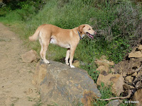
Anthony Chabot Regional Park together with the neighboring Lake Chabot Regional Park that we hiked last October add up to an impressive 5000+ acre park land offering not just miles of hiking but cycling, fishing, horse riding and more outdoor activities.
There are several staging areas around the park where one start from. We used Clyde Woolridge staging area in Grass Valley, Oakland, at the intersection of Skyline Blvd and Grass Valley Rd, accessed by taking Golf Links Rd exit from Hwy 580 and following it all the way to Grass Valley Rd and the staging area.
We started our hike heading north by Goldenrod trail right behind the staging area. Just a short distance ahead, the trail forks, three-way, Jalquin trail on the left, Goldenrod in the middle and Jackson Grade on the right. We stayed on Goldenrod trail which goes through a nice eucalyptus tree grove. In fact, Grass Valley Rd leading to the parking lot will welcome you with tall eucalyptus trees lined on both sides.
Goldenrod trail is a multi-use dirt trail with an easy uphill grade offering nice views of the mountains on the east. About a mile in, Jalquin and Goldenrod trails intersect. For those wanting to a short 2 mile loop, you can head back by Jalquin trail south to the parking lot.
We continued north on Goldenrod trail. Just around the 2 mile marker, the trail will go by the equestrian center and the staging area on Skyline Blvd. Horses are majestic animals and walking by the stables, we could see quite a few of them today.
We stayed on Goldenrod trail past the equestrian center where the trail has a short section where the uphill grade gets just a tad steep. Another mile ahead, we turned right on Buckeye trail. By now, we had gained about 400 feet in elevation. Buckeye trail is a single track dirt trail that goes by a creek through heavy woods. In the easterly direction that we hiked, it also descends rapidly giving up all the elevation in less than 1/2 a mile.
Buckeye trail ends at Bort Meadow, a large clearing with wide open meadows. Past the group camp area, there are two trails that head south. Brandon trail is the first, right by the restrooms. Little ahead is Grass Valley trail. Brandon trail and Grass Valley trail run parallel to each other on either side of the Grass Valley creek from Bort Meadow to Jackson Grade junction.
We took Grass Valley trail heading south. For a quarter mile or so, the trail is a wide gravel fire road before entering a cattle grazing zone. The scenery changes dramatically from here on. Grass Valley trail is bordered by gentle rolling hills on one side and wide open meadow land on the other, both sporting a lush green cover.
On and off, we would be able to see Brandon trail on the right. You will have an opportunity to cross over at the Redtail trail junction. A pair of tall California Bay trees standing in the wide open grassland provided an impressive contrast in the scenery here.
Apollo and I stayed on Grass Valley trail all the way to the Jackson Grade junction. For the last 1/2 mile, Grass Valley trail is bordered by a wire fence on one side. In retrospect, hopping over to Brandon trail wouldn't have been a bad idea.
We wrapped up the hike looping back by Jackson Grade to join Goldenrod trail and reach the trail head. All in all, this was a fairly easy 6 mile loop with a variety of scenery involving about 700 feet of climbing.
More pictures from our hike.
#Hiking #Hikingwithdogs #AnthonyChabot #AnthonyChabotRegionalPark #EBRPD


What lovely descriptions! Apollo seems to be enjoying everything. Super.
ReplyDeleteWhat lovely descriptions! Apollo seems to be enjoying everything. Super.
ReplyDelete