Friday, February 27, 2015

Windy Hills Open Space Preserve 2015-02-27

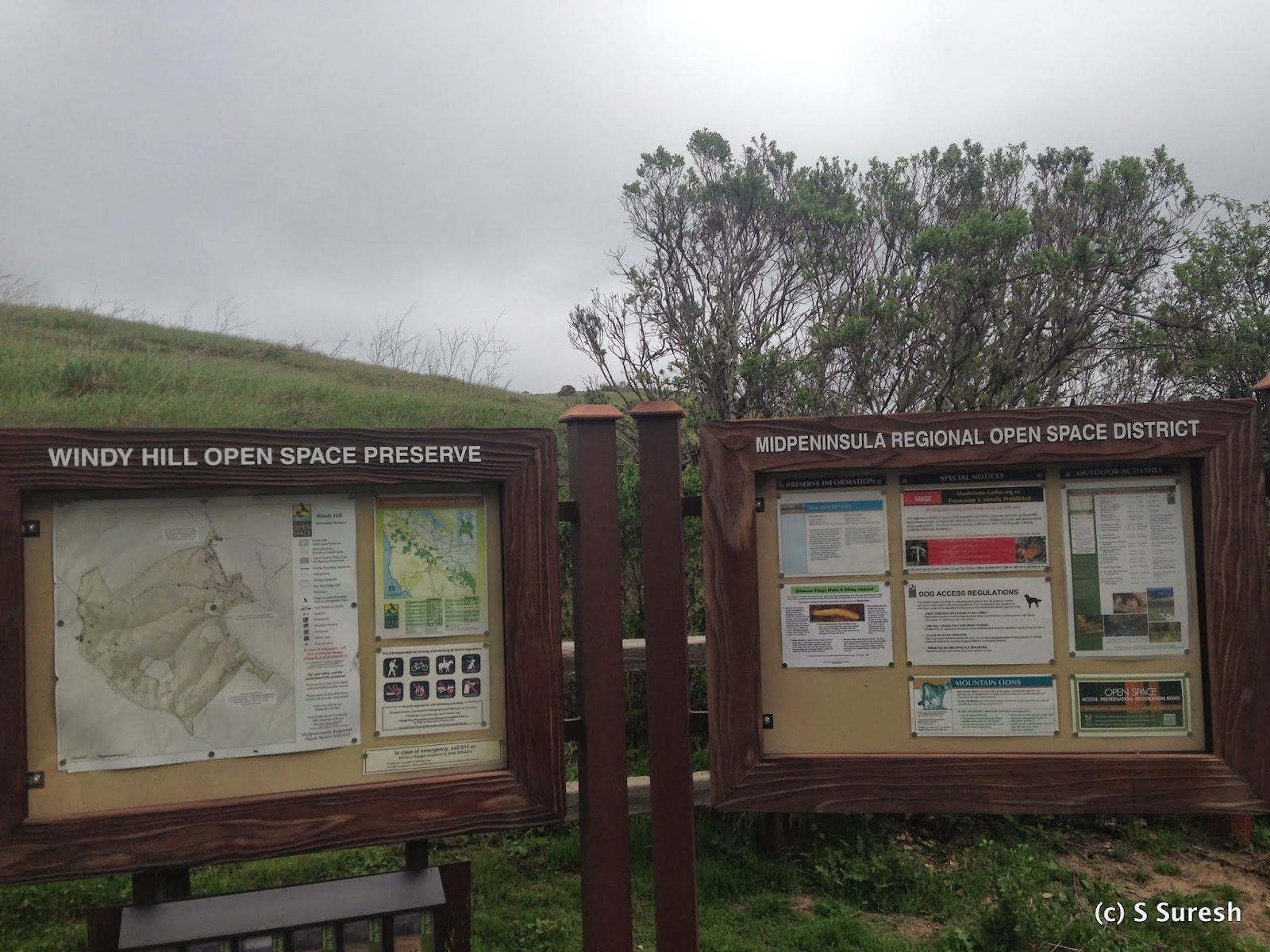
Skyline Blvd Trailhead
You would expect something interesting from a place with a name like Windy Hills Open Space Preserve - and you sure won’t be disappointed should you choose to come here. Located in the town of Portola Valley, Windy Hills Open Preserve provides you with two options to enjoy the 12+ miles of trails it contains. You can park at the Portola Road parking lot (from 280, take Alpine Road exit, go west towards Portola Valley, turn right on Portola Road) or the Skyline Blvd parking lot. The trails are uphill from Portola Road to Skyline Blvd and downhill the other way.

We used the Portola Road parking lot and started off at Spring Ridge Trail. Having been here a while ago, we decided to do a loop by taking Hamms Gulch Trail to the summit and returning by Spring Ridge Trail. You will see Sausal Pond on your right as you make your way towards Hamms Gulch. All of the trails in Windy Hill are unpaved, dirt trails.

Once you enter Hamms Gulch Trail, you'll see a distinct difference. Heavily wooded, narrow, and involving a steady climb, the trail will quickly lead to a point where two creeks, Hamms Gulch and Jones Creek, join.
Apollo had fun crossing the creek and wading through the water. For the next mile or so, the trail will climb up with Hamms Gulch on the right. You'll find yourself in the forests, with just the sound of the creek and the birds and little else. As you climb up, the ravine on the right with Hamms Gulch will get deeper.  

Hamms Gulch Trail itself is about 3 miles long, completely through forests. We came across just two other hikers along the way. Every now and then, you will get glimpses of the valley. Some 3.5 miles from the starting point, you will come across a fork leading to Razorback Trail on the left and Windy Hills summit on the right. Stay right on the Lost Trail towards the summit.

View of the Pacific Ocean side & Skyline Blvd
You will first pass the Skyline Blvd entrance before entering the Anniversary Trail for the last stretch to the summit. Windy Hills summit provides breathtaking 360⁰ views of the Pacific Ocean on one side and the Bay Area on the other.
View of SF Bay side
From the top, you can easily make out Stanford Tower, Dumbarton Bridge, and more.

Apollo was clearly elated to reach the summit. It was also an amazing experience to see the rain clouds from the Pacific move in on us and dust us with a light rain. The climb to the summit from Portola Road was just shy of 1400 ft.

We made our way back by Spring Ridge Trail, which had more traffic compared to the one we took to ascend. A steady descent over the next 2.8 miles led us back to our starting point. We took the Betsy Crowder Trail towards the end to make it a 8 mile hike. While Spring Ridge Trail was wider with more traffic, it was also predominantly exposed.

You can make several variations if you choose to hike Windy Hills. And if you are so inclined, you can also hike Razorback Trail one way to make it that much harder and longer, but I don't believe dogs are allowed on Razorback Trail.

More pictures from the hike.
#Hiking #HikingWithDogs #WindyHills #WindyHillsOpenPreserve #HammsGulchTrail #SpringRidgeTrail #MROSD


Monday, February 23, 2015

Fremont Older Open Space Preserve 2015-02-23

One of our favorite hikes that is close to our home is Fremont Older Open Space Preserve. The Prospect Road parking lot can be accessed by driving west on Prospect Road, past Stelling Road, Parker Ranch and just past the Saratoga Country Club. The parking lot has space for about 25 cars, but this open preserve has become exceedingly popular, making parking somewhat challenging over weekends.

With Parker Ranch on one side and Stevens Creek County Park on the other, both well connected with Fremont Older’s trails, one can do lot more than the 15 miles of trails available in the preserve. We started out on the Cora Older trail from the parking lot. You will start climbing right away through a rugged, narrow dirt trail for about half a mile, after which it opens up to a nice grass hill.
A sunny, blue sky and a spring-like day provided a really breathtaking contrast of colors of the lush green hills against azure blue skies. A perfect photo op for the good-looking Apollo who never fails to attract a compliment or two in each outing!

Hunter's Point is a popular spot with several hikers taking the quick hike up to the left, leading to the vista point. We wanted the scenic, long route, so we turned right onto the Seven Springs Loop Trail. Like Cora Older, Seven Springs Loop is also a rugged dirt trail that takes you up and down the hills in the preserve. After climbing down all the way and reaching Ranch Road, the trail starts ascending again with grass hills on one side and some real beautiful views of SF Bay Area on the other. You'll hardly notice the climb with the sights of the Bay Area on your right. Just shy of 2 miles into the hike, you’ll pass Rainbow Knoll Trail on the right. Stay on Seven Springs Loop unless you want to add another mile by going out and back on the Rainbow Knoll trail.
View from Hunters point

Soon after, you’ll see a fork to the Woodhills Loop Trail. That would lead you to Hunter's Point, the second highest spot in Fremont Older. Hunter's Point provides some breathtaking views of the Bay Area. Once you come down, you'll join the Hayfield Trail, with the option of going back to the trail head (doing approximately a 3 mile loop) or continuing further to explore Fremont Older. We continued on Hayfield Trail and reached Coyote Ridge Trail. Turning right here would lead you into Stevens Creek County Park and open up several more miles of hiking trails for you. We turned left on Coyote Ridge Trail and made our way to Garrod Farms via Maisie’s Peak.
 
View from Maisie's peak
Maisie’s Peak is the highest spot in Fremont Older, some 1150 ft. above sea level. As with Hunter's Point, you get some outstanding views of the Bay Area from here. Staying on Coyote Ridge Trail will lead you to Garrod Farms, which offers horse riding lessons as well as some fine wine tastings.
Garrod farms on the left
More than likely, you will find equestrians from Garrod Farms sharing the trails in this area. Apollo had his ears perked up when he saw two horses making their way past us. We had come to this point when we hiked Parker Ranch Trail a while ago.

We turned into the Bay View Trail from here to make our way back. Soon after, you’ll have the option of continuing on Bay View Trail or taking Toyon Trail on the right. Both would lead you back to the trail head. We chose to hike on Toyon Trail, which I knew would provide more shade, but it is narrower and more rugged than Bay View Trail.

We connected to Hayfield Trail and Cora Older and chose to include Creekside Trail on our way back to the trail head. As you can see, there are plenty of trail names, but Fremont Older is very well mapped and the signs are very easy to follow, should you choose to do a variation from the 6.2 mile hike we did today. With the various ups and downs, we probably ascended some 1000 ft. today.

As with all Mid Peninsula Open Reserves, there are no trash facilities and you have to pack out whatever you packed in. I ran into a ranger at the trailhead and had a good discussion on how to get trash facilities at least at the trail heads. 


Update 2015-06-29


Apollo and I did the Cora Older -> Seven Springs Loop -> Hunter's Pt -> Creekside Trail loop from the Prospect Road parking lot. This was a shorter version of the previous hike. While the preserve was decidedly sporting a summer, dry, brown look, we got to see a pair of deer in close quarters.
The interesting part was that they didn't gallop away at the sight of us. Instead, they posed for a few photographs - much the way Apollo does for me! Familiarity has apparently reduced the instinctive fear these animals have of humans!


More pictures from the hike.
#Hiking #HikingWithDogs #FremontOlderOpenPreserve #FremontOlder #SevenSpringsTrail #MROSD

Friday, February 20, 2015

Baylands Nature Preserve (SF Bay Trail) 2015-02-20

A blog about hiking in the Bay Area still doesn't have one by the bay? That situation got remedied today with our hike at the Baylands Nature Preserve in Palo Alto. We chose the trailhead located at the intersection of San Antonio Rd. and Terminal Rd., just off Hwy 101. There is plenty of street parking available on Terminal Rd.


The Baylands is part of the San Francisco Bay Trail, which promises to be a 500 mile path around our beautiful Bay someday. We chose to do the Adobe Creek Trail, a 5.6 mile loop from where we parked into the Baylands Nature Preserve maintained by the City of Palo Alto.
Charleston Slough
The trail runs through the wetlands and sloughs and creeks while at the same time providing glimpses of the bay. While it is dog friendly, there are warnings that are very particular about keeping your dog on leash.

The day started off with a stubborn morning fog and the sun chipping away at it steadily. A small segment leading from Terminal Rd. was paved, but it switched to a dirt trail soon after. When we were walking, there was low tide, so Charleston Slough on our right was a proper marshland. Baylands Nature Preserve is a bird-watcher's dream, with an opportunity to see a variety of birds in their natural habitat. If you are serious, a good pair of binoculars is a must to enjoy bird-watching.

The Adobe Creek on our left had water. We continued on and came across an island on our left – with the ultimate seagull party happening there! There are a couple of good spots to observe the bay beyond the wetlands before the trail turns left and starts heading inland. Soon, you will come upon a fork, where bearing left would keep you on Adobe Creek Trail and going right would take you to Byxbee Park & Recreation Area. Since it wasn't a long detour, we continued towards Byxbee Park to check it out. There is a parking lot here, accessible from Embarcadero Road (off Hwy 101). That way would've taken us further towards a duck pond where Apollo isn’t welcome, so we turned around and joined the Adobe Creek Trail.

Instead of taking the trail closely following Mayfield Slough on our left, we chose to climb the small hillock – Byxbee Hill – on the right. It did provide us with a slightly elevated view of the marshlands and SF Bay. The City of Palo Alto was doing some work firming up the landfills and creating a few more dirt trails that would run up the hillside. The only interesting happening there was a hare that ran past us. Apollo’s ears perked up as he closely followed the hare. Wonder who would have won a race between "the hare and Apollo" :).

View from Byxbee Hill
With the bay to our back, the trail got a little boring, although there was a spot where I felt we were in the prime of spring even though it is still winter! The plants and shrubs were green, sporting beautiful yellow flowers, and the temperature was in the high 60s with the sun having fully emerged from the fog. The dirt trail ends right at Hwy 101 / E Bayshore Rd. Turn left and walk towards the starting point.

Walking three-fourths of a mile by Hwy 101 on a well-paved trail will get you to a spot where you turn left towards Shoreline Lake and pass right by Terminal Road parking.

I’ve driven by the Baylands for nearly 20 years and have wondered what this open space contains…. Now that I have the answer, it’s interesting that in about a month’s time, this route will cease to be my commute! 

A completely flat trail by the marshlands, the 6.2 mile loop that we did today could be slightly shorter if you avoid the extra excursions we indulged in. Sure, this hike is by the Bay, but provided just glimpses of it. I will have to look into the 340 miles of the already laid out SF Bay Trail to find something that offers lot more of the bay.


More pictures from the hike.
#Hiking #HikingWithDogs #BaylandsPaloAlto #AdobeCreekTrail #SFBayTrail

Monday, February 16, 2015

St. Joseph's Hill Open Space Preserve 2015-02-16

This President’s Day holiday hike had two special companions – my wife Jaya and my niece Abhinaya. I’d identified St. Joseph’s Hill Open Space Preserve to provide us with a rousing workout without being very difficult. We parked in downtown Los Gatos in Lot 6 on W. Main St. and walked for few minutes to the trail head located at Maple Place & E. Main. St. I was here a few days ago when I did the second part of the Los Gatos Creek Trail hike.

Walking down from Maple Place, bear left to stay on Flume Trail. The right fork is the Los Gatos Creek Trail. 

While both trails border the creek, Flume Trail is shaded, rugged, narrow, and hilly. Little more than a mile of this hike will find you at Novitiate Park with a large grass expanse. Flume Trail joins the Jones Trail at this point. Jones Trail will lead you all the way to the Lexington Reservoir, which is what we intended to do.
Novitiate Park
Continue south on Jones Trail, which will be somewhat wider than the Flume Trail. About 1½ miles in, you’ll see Novitiate Trail on your left. We decided to explore St. Joseph's Hill on our way back and continued towards the reservoir. About 2 miles in, you will come upon a steep descent to Alma Bridge Road and the Lexington Reservoir.
Lexington Reservoir

Much bigger than Vasona, Lexington Reservoir was only 45% full. That didn’t stop a lab from swimming in the lake and fetching the ball his master was throwing for him. After his excursions in our previous hike, Apollo didn’t get a chance to muddy himself today!

Where we hiked today also marks the starting point for two more trails that are part of the Sierra Azul Open Preserve (Priest Rock and Limekiln trails). We’ll probably be back in this area again!

Breather at the hill top
Retracing our steps on Jones Trail, we decided to check out St. Joseph’s Hill and took the Novitiate Trail. There are several trails in this section – Novitiate, Manzanita, Range, Brothers Bypass, and Serpentine. They are also well marked so you can pick and choose the ones as you make your way up to the hilltop vista point. Our detour into this section was probably a little more than 2.5 miles, but we certainly got some fantastic views of both Lexington Reservoir and South Bay towns from the vista point. These trails are hilly and involve climbing, but they are not very difficult.

The holiday saw plenty of mountain bikers out on these trails. Sharing the narrow and rugged trails with cyclists meant paying close attention to the traffic around you. I retraced my path all the way down Flume Trail to downtown Los Gatos. Continuing on Jones Trail instead of Flume Trail would lead you to the end of Jones Road and was slightly shorter. Jaya and Abhi took the shorter route, while Apollo and I jogged our way back to the trail head by Maple Pl.


Overall, this 7+ mile hike involved ascending about 1000 feet. With the extensive shade, this would be a perfect trail to hike on a hot day. 

If you choose to start your hike from downtown Los Gatos, when you finish the hike, you can treat yourself to some nice beverage in one of the plentiful restaurants there.

More pictures from the hike.


Update 2016-03-23

Apollo and I repeated this hike, this time with my daughter Sanjana on what turned out to be a nice spring day. We essentially took the same path that we did earlier: started from the trail head at E Main St & Maple Pl, took the Flume trail, passed by Novitiate Park to enter St. Joseph's Hill Preserve, continued on Jones Trail to reach Lexington Reservoir at Alma Bridge Rd.

At 65% of capacity, the reservoir was in a much better shape today. On the way back, we turned right by Novitiate trail, looped around Manzanita trail and stopping by St. Joseph's Hill (1253 ft.) The views from the hilltop were as impressive as ever. 

Walking by Flume trail that runs parallel to Los Gatos Creek, we were lucky to spot a Great Blue Heron wading through the waters of the creek. Something I had only mentioned in passing before, this hike involves climbing about 1100 feet with a slightly steep grade in couple of sections.


Few more pictures from the second hike.
#Hiking #HikingWithDogs #StJosephsHillOpenPreserve #StJosephsHillPreserve #StJosephsHill #NovitiatePark #MROSD

Friday, February 13, 2015

Garin/Dry Creek Pioneer Regional Parks (High Ridge Loop Trail) 2015-02-13

Garin and Drycreek Pioneer Regional Parks seamlessly blend with each other and provide more than 20 miles of hiking trails in the foothills of Hayward. We started our hike from Drycreek Pioneer Park, parking at the end of Tamarack Dr. (off Mission Blvd) in Union City. Only after reaching did I realize that an easier (and more courteous) option would have been to use the May Rd. staging area to enter the park. There is plenty of parking available at the end of May Rd., and it is literally round the corner from where we started.

There were lush green rolling hills extending every way we looked – a beautiful sight. The rains from last weekend had given the grass a fresh look, but the unpaved trails were wet and muddy in several spots  - you win some and lose some! We decided to do the High Ridge Loop Trail today, starting from the Tamarack Dr. entrance and going clockwise.

It was a gentle climb right away, and very soon, we were able to get some great views of East Bay cities as well as the Bay itself. It took a while to get used to the vastness of these two parks, but the hills provide a good workout without being too difficult. The various trails in these two regional parks cut across each other multiple times. We took a short detour to the Ridge View Trail to see what views the trail offered. We also came very close to the Dry Creek Trail and the Jordan Pond. You’d have crossed over into Garin Regional Park by now – a fact you might have overlooked, except that you’d be right at the entry kiosk area of Garin Park.

Apollo had a field day today. Unlike most hiking trails, there is no requirement to leash your dog in these two parks. He was off leash and happily gallivanted by my side. Dry Creek wasn’t dry today and had some water flowing in it. Apollo decided to cross the creek by jumping right in… and came out completely dirty! There was a bridge just ahead and that provided the perfect crossing point for me :)

Continuing on the loop, we came across several cows grazing the pastures. A calf turned out to be lying smack in the middle of the trail and as we closed in, the mom quickly appeared and kept a stern watch on us. Apollo and I calmly walked past them. As soon as we crossed them, the mom went back to grazing while the calf still didn't know what to do next and stood in the trail. With this much of grass and greenery, you'll share this trail with cows and bulls grazing the green pastures along with cyclists and equestrians.


More than 4 miles into the hike, we continued to have fantastic views of the hills and the busy East Bay cities even as the trail became predominantly downhill. Until now, the trail had been largely exposed with little or no shade. The last mile or so of the High Ridge Loop Trail was different. Bordering another creek, the trail will give you plenty of shade for more than half a mile, something you’d be thankful for on a hot day. We came upon the Tolman Peak Trail, something I chose to skip today, skirted by the May Rd. entrance, and reached our starting point to finish the loop.


The 6.4 mile loop involved ups and downs, about 1000 ft. of ascent during the first 4 miles, and a more brisk descent during the last 2 miles. Apollo, in addition to wading the creek and dirtying himself, had put his snout in places that met with strong disapproval from me; then again, he certainly had a swell dog day today. 

A trip to Petfood Express to freshen up was on the cards for my dear Apollo.

More pictures from our hike today.
#Hiking #HikingWithDogs #GarinPark #DryCreekPioneerPark #HighRidgeLoopTrail #GarinDryCreekPioneerPark #EBRPD


Monday, February 9, 2015

Los Gatos Creek Trail (South) 2015-02-09


We were back at the Los Gatos Creek Trail today to start from where we left off two days agoWe began our hike at Lark Ave. You should be able to find parking in the lot by Charter Oaks Dr. or by the roadside on Arroyo Grande Way. As with the previous section, this segment of the trail is also paved with a black top.

My first impression was that the greenery in this section was much more vibrant. Within a short distance, you’ll come upon Vasona Reservoir. 

Vasona Lake Reservoir
Standing on top of the dam, you'll have a great view of the lake and the greenery around it. The trail meanders around, closely following the lake. In the Vasona Lake County Park, there are several offshoots of the trail. Take care to stay on the Los Gatos Creek Trail as it continues south. To your right, you will see Billy Jones Wildcat Railroad – a children’s railroad and carousel that operates on weekends and special occasions.

Leaving the park behind, continue south, crossing the Blossom Hill Rd underpass. If you were missing the background road noise of Hwy 17, don’t worry; you’ll start hearing it from this point on. The Saratoga Road underpass will be next. After you cross Miles Ave, you’ll walk across a long wooden bridge, at the end of which you'll have an opportunity to bail out of the trail and enter downtown Los Gatos. We chose to follow the trail, crossing Hwy 17 by a colorfully painted bridge and coming to Los Gatos High School's backyard.  

Main St underpass mural
The paved section of the trail ends once you cross Hwy 17. To continue onto Los Gatos Creek Trail, make a right at the History Museum of Los Gatos at Forbes Mill. Soon, you’ll come upon the Main St. underpass. There is a beautiful mural painting there. Stop for a moment to enjoy the realistic depiction of the Ohlone village scenery.

At the next fork, keep right to stay on the Los Gatos Creek Trail. The left will lead you to Flume Trail, which is part of the St. Joseph's Hill Open Preserve. With Hwy 17 to your right and the Los Gatos Creek to your left, you’ll travel nearly 2 miles on the unpaved trail and reach the Lexington Reservoir.

I had the option of continuing onto Lexington Reservoir County Park and checking out the reservoir or turning back. We had already hiked just shy of 5 miles from where we started, so this would become the longest hike Apollo and I have done together so far. The last mile was also a gentle climb, probably some 200 ft. of ascent. We decided to turn back, knowing that we would be back at the Lexington Reservoir area real soon, especially as this is an excellent point to start out on couple of interesting trails in the Sierra Azul mountain range.

As with the last few times, a gentle jog helped us shave some 15 minutes on the return. Technically, we should be tired and the return should take longer. But it didn’t and some 150 minutes into the hike, we were back at Lark Ave.


Essentially flat, except for the last couple of miles leading to the very beginning (end?) of the LG Creek trail, this is an excellent option for folks wanting a nice hike by the Vasona Lake County Park. As an added incentive, there are several places one can rest and restroom facilities and water fountains in the park. While we hiked nearly 10 miles today, one can easily customize this hike to their personal preference. Personally, I preferred this section over the first section we did a couple of days ago.


Update 2015-04-09
Exactly 2 months to the date, I did a 5.5 mile out and back hike with Jaya and Apollo. This segment on Los Gatos Creek Trail is indeed an enjoyable hike. I added a couple of pictures from the hike today to the album.

Update 2015-05-31


Jaya, Apollo and I were back on this trail for the 2015 ILP (India Literacy Project) run. Jaya & I have participated in this run several times. The 10K run was an out and back course, starting at Vasona Lake Park going north until Camden Ave (where the dog park is). The course included portions from this blog post as well as some from the LGCT (middle) section.


Apollo and I have also run this 10K race once a couple of years ago - with much better timing than the 81 minutes it took today.

More pictures from the hike.
 #Hiking #HikingWithDogs #LosGatosCreekTrail #VasonaLake

Saturday, February 7, 2015

Los Gatos Creek Trail (Middle Section) 2015-02-07

A cloudy and damp day with light drizzle set the stage for our hike today at Los Gatos Creek Trail. Located smack in the middle of suburban South Bay towns, Los Gatos Creek Trail is very popular among Bay Area residents. More than 11 miles long, Los Gatos Creek Trail can be accessed from several locations, running through multiple cities and towns. Campbell Park (Campbell Ave & Gilman Ave), closer to the north end of the trail and a stone’s throw away from downtown Campbell, is a very popular spot to access the trail. Starting from Blackford School in San Jose, the trail runs south to Campbell, continues onto Vasona Reservoir, downtown Los Gatos, and all the way to Lexington Reservoir.

We started today at Campbell Park. The blacktop trail attracts cyclists, runners, and walkers alike. From Campbell Park, the trail runs south on both sides of the creek. A good way to experience the trail is to cross the foot over bridge and turn right, southward. This section is little more than a mile long. At the end, you’ll come across another bridge that'll get you back to the trail. Want to do just a 2 mile-ish hike? Turn right here and walk north towards the Campbell Park. Fancy something longer? Turn left here and continue south – you can go down as long as you like. As an out and back trail, you have the opportunity to hike for nearly 20 miles.

Dog Park
We chose to go south for another couple of miles, intending to do about 6 miles overall. You’ll first cross the San Tomas Expressway underpass. Right after that is a very nice dog park that can accommodate both small and large dogs. Although we've been to this dog park multiple times, we chose to skip it today and focus on the hike.

After the dog park, on your right, you’ll find the Los Gatos Creek County Park. On its heels you’ll find three ponds – they are the Camden groundwater recharge ponds. The drought has made the water levels in the ponds extremely low. With a light drizzle upon us,  we kept moving south and soon came upon the Hwy 85 underpass.
Hwy 85 underpass
Our hike today started from the town of Campbell, moved through Santa Clara country jurisdiction, and subsequently to the town of Los Gatos. I was trying to figure out how much further to go when the heavy rains from yesterday helped make the decision for us. The trail was flooded close to Lark Ave and we decided to turn around.

Flooded trail, turn around point
While the 6 mile out and back hike was great, there are a couple of annoying aspects of this trail that are worthy of mention. The trail runs parallel not just to the Los Gatos Creek, but also Hwy 17. This means there is continuous road noise in the background that can get to you. The black top means you share the trail with cyclists. While the posted speed limit is 15 mph, more than one cyclist zipped past us much faster. You should be attentive, especially if you are hiking with your dog.


The trail is absolutely flat and along the creek, and today was especially nice with the creek flowing fuller after the rains from yesterday. As with the Coyote Creek Trail, you can choose how much to do depending upon your fitness level. Our intent is to complete the trail all the way to Lexington Reservoir soon.


Update 2015-11-04


Apollo and I frequent this trail often, especially this middle section of this long trail. I decided to update the blog after doing something slightly different in our walk today.

Camden Perc pond
Walking south from the Campbell park, after crossing the San Tomas Expwy underpass, I decided to walk around the Camden percolation pond. This pond is in three sections. The largest pond that we walked around allows recreational fishing. The middle pond is ear marked for water craft hobbyists. 

Doggie social

On the way back, we went into the off leash dog park. Apollo enjoyed the dog social while working out some of his seemingly endless energy!


Our walk this crisp fall morning was a respectable 4 miles at a decent walking pace. 

More pictures from the hike.  
#Hiking #HikingWithDogs #LosGatosCreekTrail