Anthony Chabot Regional Park together with the neighboring Lake Chabot Regional Park that we hiked last October add up to an impressive 5000+ acre park land offering not just miles of hiking but cycling, fishing, horse riding and more outdoor activities.
There are several staging areas around the park where one start from. We used Clyde Woolridge staging area in Grass Valley, Oakland, at the intersection of Skyline Blvd and Grass Valley Rd, accessed by taking Golf Links Rd exit from Hwy 580 and following it all the way to Grass Valley Rd and the staging area.
We started our hike heading north by Goldenrod trail right behind the staging area. Just a short distance ahead, the trail forks, three-way, Jalquin trail on the left, Goldenrod in the middle and Jackson Grade on the right. We stayed on Goldenrod trail which goes through a nice eucalyptus tree grove. In fact, Grass Valley Rd leading to the parking lot will welcome you with tall eucalyptus trees lined on both sides.
Goldenrod trail is a multi-use dirt trail with an easy uphill grade offering nice views of the mountains on the east. About a mile in, Jalquin and Goldenrod trails intersect. For those wanting to a short 2 mile loop, you can head back by Jalquin trail south to the parking lot.
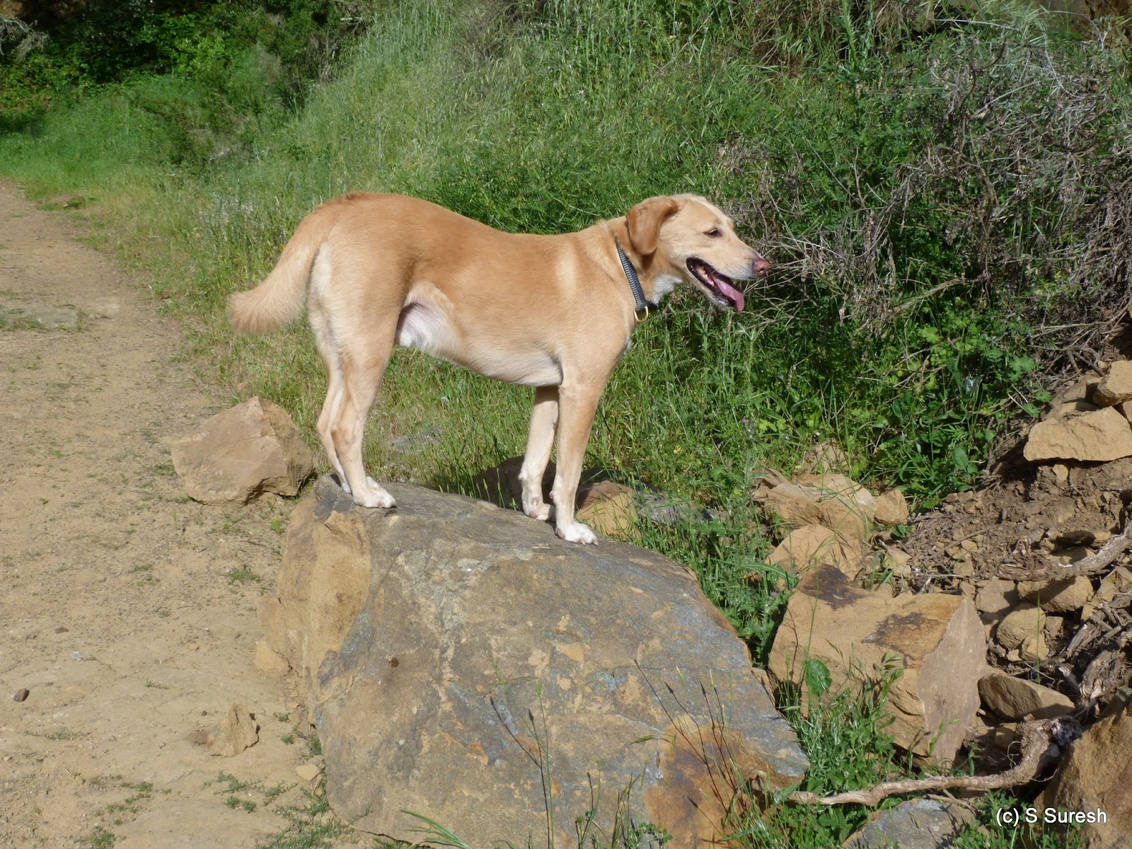
We continued north on Goldenrod trail. Just around the 2 mile marker, the trail will go by the equestrian center and the staging area on Skyline Blvd. Horses are majestic animals and walking by the stables, we could see quite a few of them today.
We stayed on Goldenrod trail past the equestrian center where the trail has a short section where the uphill grade gets just a tad steep. Another mile ahead, we turned right on Buckeye trail. By now, we had gained about 400 feet in elevation. Buckeye trail is a single track dirt trail that goes by a creek through heavy woods. In the easterly direction that we hiked, it also descends rapidly giving up all the elevation in less than 1/2 a mile.
Buckeye trail ends at Bort Meadow, a large clearing with wide open meadows. Past the group camp area, there are two trails that head south. Brandon trail is the first, right by the restrooms. Little ahead is Grass Valley trail. Brandon trail and Grass Valley trail run parallel to each other on either side of the Grass Valley creek from Bort Meadow to Jackson Grade junction.
We took Grass Valley trail heading south. For a quarter mile or so, the trail is a wide gravel fire road before entering a cattle grazing zone. The scenery changes dramatically from here on. Grass Valley trail is bordered by gentle rolling hills on one side and wide open meadow land on the other, both sporting a lush green cover.
On and off, we would be able to see Brandon trail on the right. You will have an opportunity to cross over at the Redtail trail junction. A pair of tall California Bay trees standing in the wide open grassland provided an impressive contrast in the scenery here.
Apollo and I stayed on Grass Valley trail all the way to the Jackson Grade junction. For the last 1/2 mile, Grass Valley trail is bordered by a wire fence on one side. In retrospect, hopping over to Brandon trail wouldn't have been a bad idea.
We wrapped up the hike looping back by Jackson Grade to join Goldenrod trail and reach the trail head. All in all, this was a fairly easy 6 mile loop with a variety of scenery involving about 700 feet of climbing.
More pictures from our hike.
#Hiking #Hikingwithdogs #AnthonyChabot #AnthonyChabotRegionalPark #EBRPD
Hetch Hetchy trail in Milpitas runs between two neighborhood parks, Peter Gill park in the south (at Paseo Refugio & Beresford Park) and Sandalwood Park in the north (at Escuela Pkwy & Russell Ln). This is a blacktop, multi-use trail that runs through a nice green stretch all the way bordering a residential neighborhood. Plenty of parking is available near both ends, including street side parking.
Parking near Sandalwood park, Apollo and I walked south. Hetch Hetchy trail crosses Jacklin Rd and Tramway Dr before it reaches Gill park. Along the way, the trail also crosses another small park, Oliver Jones Memorial park. Little more than a mile long, the trail is bordered by what looks like manicured grass lawns, a treat for the residents of this neighborhood.
Peter Gill park is a nice residential park with tennis & basketball courts, a baseball field and the usual children's play area. Crossing Paseo Refugio, we continued our walk by Berryessa Creek trail that runs east-west along the creek. A blacktop trail runs on top of the levee that borders the creek. There is also a rough dirt trail that runs on either side of the creek, slightly below the levee level.
If Hetch Hetchy trail had a manicured look, Berryessa Creek trail looked like in need of repairs, with several cracks in the pavement, weeds and wild grass not just by the trail but in it as well. This trail crosses N Milpitas Blvd and goes all the way until N Abel St.
Before reaching Abel St, the trail goes by Hidden Lake Park, a beautiful artificial lake set against the backdrop of hills on the east. There is also a nice trail that goes around this lake, shy of a 1/2 mile loop. After a walk around the lake, we headed back the way we came.
The walk by Berryessa Creek trail eastward did not change the scenery much, heading north by Hetch Hetchy trail was much more enjoyable with an impressive view of the picturesque hills in the distance.
Not necessarily a destination hike, our outing in this urban residential neighborhood was surprisingly nice and I am glad I decided to take advantage of the fact that I had to visit Milpitas High School near Sandalwood park. Overall, we did 4.4 miles in this out and back walk with a small loop around hidden lake.
More pictures from our walk.
#Hiking #HikingWithDogs #HetchHetchyTrail #BerryessaCreekTrail #HiddenLakePark
Part of Golden Gate National Recreation Area (GGNRA), Ocean Beach in San Francisco offers more than 3.5 miles of uninterrupted and wide open beach, plenty of opportunities to wet your feet in the chill Pacific Ocean and impressive sunsets if you are there at the right time in favorable weather conditions. Flanked by Cliff House in the north and the Zoo in the south, the coastline runs parallel to the Great Highway.
Free parking is available along Great Hwy in the north and at the Sloat Blvd lot in the south. We had parked at the Sloat Blvd parking lot and walked north. The beach sand was black, just like Fort Funston that we had hiked last year. Apollo had to stay on leash almost entirely due to posted restrictions although I saw several dog owners flout the rule.
 |
| Seal Rocks |
It was low tide when walked the beach and the water had receded considerably. The surf report I checked mentioned that the tide level was -0.62 ft. To put this in perspective, it was at 6.15 ft. seven hours earlier. This meant we could walk in portions that was not sandy. The wet ground was firm that made walking far more easy, compared to walking in beach sands.
The beach was not very crowded. Still, there were plenty of folks taking advantage of the low tide and firm beach to jog. There was a man who pitched a rod to hold his bag and made his way into the sea with an intent on catching something. A popular spot with surfers, there were few who braved the chill ocean waters and made their way into the ocean with their surfboard.
I also got to see different kinds of shorebirds. At the south side, there were whimbrels and sandpipers wading in the beach. All along, there were sea gulls. And at the north side, I caught a flock of willets amidst the waves. I had noticed ravens by the coast in my previous hikes and today was no exception. A dead dungeness crab attracted Apollo's keen nose but a whiff of it was all I allowed him.
 |
| Cliff House |
Little more than three miles into the walk, we reached the north end of the beach. The low tide offered a chance for me to see Cliff House from a unique angle. And we were able to go reasonably close to Seal Rocks that you can also observe from the other side of Cliff House at Lands End.
We turned around here and opted to walk away from the beach on the return. For those not interested in getting their feet wet, there are couple of options. From Balboa St intersection to Fulton St and beyond to Lincoln Way, there is a cement boardwalk along Great Hwy.
Fulton St & Great Hwy marks the northwest corner of the Golden Gate park. There is a Dutch Windmill located here amidst a small green park with beautiful flowers. Apollo and I did a quick side trip to check out the windmill and the park.
South of Lincoln Way, there more options to walk. Lower Great Hwy Park belonging to the city of San Francisco is on the east side of Great Hwy, running all the way from Lincoln Way to Sloat Blvd. A multi-use, paved, blacktop trail runs the two mile stretch. We walked in this stretch on and off, crossing over to the west side of Great Hwy couple of times.
On the west side, from Lincoln Way until Noriega St, there is a sand trail that runs through the sand dunes bordering the beach. South of Noriega St, there is a tiled boardwalk for a while following which the sand trail shows up again that goes until Sloat Blvd.
We had clocked 6.5 miles by the time we reached the Sloat Blvd parking lot. The gps tracker may indicate we walked on water, but I guess that is due to the fact that it was very low tide and we walked well into the ocean side on the way forward. Ocean beach is situated south of Lands End and north of Fort Funston, both locations that we have hiked in the past.
More pictures from our hike.
#Hiking #HikingWithDogs #OceanBeach #GGNRA #LowerGreatHighwayPark
Our second trip to Morgan Territory Regional Preserve was a marked contrast from the previous one in January. A picture perfect spring day with not a cloud in the sky set the backdrop for our hike from the same staging area located on Morgan Territory Rd - from Hwy 580, take N Livermore Rd exit, travel north, turn right on Morgan Territory Rd and follow the one lane county road to the parking lot.
We started our hike by Clyma trail at the northwest end of the parking lot. The trail crosses Morgan Territory Rd and continues by a creek for a brief while before opening up. Clyma trail is a fire road, a wide dirt trail. The ground was dry with light grass cover in some stretches, uneven with cattle foot prints dried in the mud on others.
 |
| Pond, Clyma trail |
Nearly 2.5 miles long, Clyma trail moves predominantly through rolling green hills with excellent views all around. The trail gains couple of hundred feet in elevation for the first mile or so and then slopes down rest of the way. Along the way, the trail curves around a cattle pond that was full from the recent rains.
 |
| Clyma trail |
Clyma trail also offers respite from the open every now, especially when it crosses the creek which it does twice. At the junction with Highland Ridge trail, we kept right. Turning left will lead you to more expansive region on the west side of the Regional Preserve. Highland Ridge trail is quite similar to Clyma trail in that it is also wide fire road.
 |
| Highland Ridge trail |
The trail gradually descends and crosses Morgan Territory Rd back into east side of the park. From here, for the next mile or so, Highland Ridge trail ascends steadily gaining more than 400 feet. Apollo had to go back on leash for much of this section with plenty of cattle out grazing.
 |
| Highland Ridge trail |
As steadily as it ascended, the trail also unfolded fine views of the hills around, which were filled with lush green grass cover. At several spots, you will find one or two trees standing amidst this open landscape providing excellent contrast against the spotless azure sky.
We turned right at the next intersection with Eagle trail, walked a short stretch by it before turning left on Volvon Loop trail. Volvon Loop goes around Bob Walker ridge and it marked the high point of this hike, if I am forced to single out one section for its beauty.
 |
| Bob Walker Ridge |
The climb had leveled off, the ridge was expansive, the grass lush green which was also covered with purple and yellow wildflowers. The sight was simply amazing and Apollo had a field day running through the grassland to his hearts content.
If the views of Bob Walker ridge weren't enough, as Volvon Loop trail turned around, the hills on the left and Livermore valley on the right offered even impressive views. We turned left at the next junction, taking Valley View trail. As the name suggests, the trail offers excellent views of the Livermore valley. In the distance, you will also be able to see the Altamont pass, the wind turbines and Los Vasqueros reservoir.
We walked by an interesting section in Valley View trail. As it comes to a cattle pond on the left, there was a significant water body on the right side as well giving me the feeling that the trail cuts across a pond. This was the only muddy section we had to negotiate today.
 |
| Volvon trail |
At the next junction, we turned left onto Volvon trail. The next mile of our hike was by Volvon trail. As with all the previous ones, this is also a wide dirt trail, the only difference being there were several rocky patches. This trail also runs parallel to Blue Oak trail that we hiked by last time.
 |
| Condor trail |
To wrap up our hike, we turned right by Condor trail. A single track hiking only trail, the 1/2 mile section we did in Condor provided some variety to the otherwise fire road style trails all through. Condor trail comes around yet another cattle pond before reaching the trail head in the parking lot.
Our hike today was essentially a larger 8 mile outer loop of the park compared to the previous 5 mile hike in January. Along the way, we had climbed around 1300 feet with couple of steep stretches by Valley View and Highland Ridge trails.
More pictures from our hike.
#Hiking #HikingWithDogs #MorganTerritoryRegionalPreserve #MorganTerritoryPreserve #EBRPD