Our first hike in Marin County was at King Mountain Open Space with an extended trip to Dawn Falls, technically situated in the neighboring Baltimore Canyon Open Space. The trail head is located in Willow Ave, off Magnolia Ave in Larkspur. The easiest way to drive there is to set "Citron Fire Rd" as the destination in Google map. While parking is free, do pay attention to the posted restrictions.
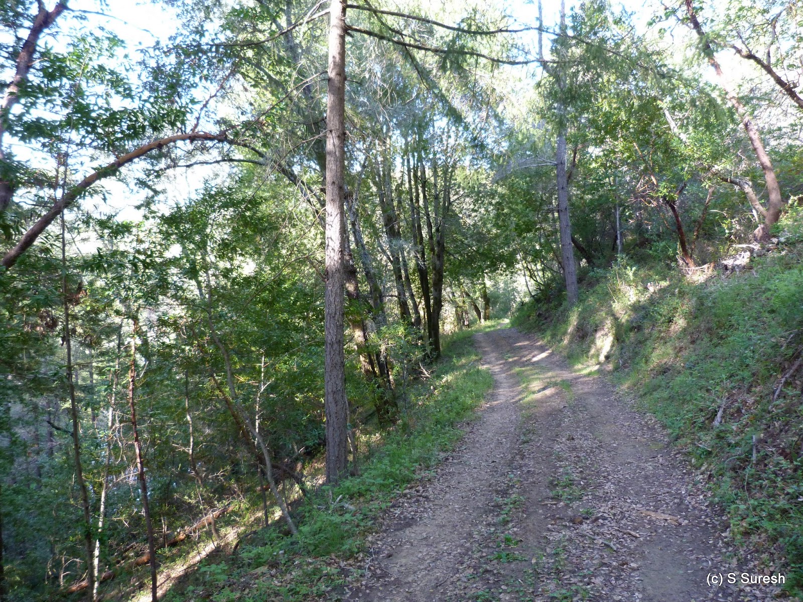
We started our hike by Citron Fire Rd which will cross a gate welcoming hikers to King Mountain Open Space. The fire road continues ahead as it gradually gains in elevation. Predominantly dry, there were several muddy patches in the fire road over the next 3/4 of a mile. And as it gains in elevation, the San Pablo bay, Richmond bridge and the hills beyond will open up nicely in the east.
Where Citron Fire Rd intersects King Mountain Loop trail, you have the option of going left or right. We turned right and did the loop in a counter clockwise direction. Shy of 2 miles, the loop is a narrow single track dirt trail that goes around King Mountain. For those interested in just doing the loop, the hike from Willow Ave trail head will be about 3.5 miles overall.
The loop trail winds its way around the mountain through heavy wooded forests for a while before coming upon a flight of steps. The stairway zig-zags and gains more than 100 feet in a short order before crossing Ridgecrest Rd. In his inimitable way, Apollo would always look out for my wife if she fell behind in stretches especially those that involved some climbing!
From here, the trail descends a little. In this stretch, the iconic Mt. Tamalpais will open up on the right. It was a fine spring day, but there were some high clouds obscuring the peak for a while before moving away completely.
About a mile into the King Mountain Loop trail, you will come upon the Ladybug trail junction. We took the Ladybug trail which zig-zags and gradually descends over the next 3/4 of a mile to reach Larkspur Creek. A nice wooden bridge gets you across the creek to Dawn Falls trail.
The falls is on the right in the opposite direction to the flow of the water in the creek. Dawn falls trail is perhaps a bit wider than the previous two single track trails, but goes through couple of narrow patches alright. Essentially hugging the creek, the Dawn Falls trail also had few tricky wet patches that we had to negotiate.
The falls is about a mile's hike by Dawn Falls trail. You will come across a huge boulder. The trail climbs steeply for a short stretch from where the boulder is to reach the top of the falls in a short while. While the flow was not copious, the 30 feet cascade did sport a respectable showing today.
We turned around at this point, making our way back by Dawn Falls trail to the foot over bridge and Ladybug trail junction. The return by Ladybug trail involved regaining the elevation we had given up on the way down.
At the King Mtn Loop trail junction, we turned right to complete the loop, shy of a mile from this point. The characteristics of the loop remains the same for this stretch as well - single track dirt trail through heavy woods. However, just before the loop trail reaches Citron Fire Rd, the bay along with Corte Madera Creek, Richmond bridge and more opens up in a real picturesque fashion on the right.
We wrapped up our hike by walking down Citron Fire Rd to the trail head. Nearly 6.8 miles with about 1100 feet gain overall, this will be a perfect hike for warmer days given how well shaded most of the route is.
More pictures from our hike.
#Hiking #HikingWithDogs #KingMountainOpenSpace #KingMountainOpenSpacePreserve #KingMountainPreserve #DawnFalls #MCOSD
A picture perfect spring like day set the backdrop for our second visit to Presidio, this time focusing on the east side of the national park, a marked contrast to our previous visit in January that was on a chill and foggy day. We parked in the Presidio Golf course parking lot (Arguello Blvd & W Pacific Ave) which offers complimentary parking for 3 hours.
 |
| The Spire |
My daughter joined Apollo and me in this hike. We started off hiking westward by the Bay Area Ridge trail. Right off the bat, you will come across an impressive structure - The Spire by Andy Goldsworthy. Rising above 90 feet, the structure was crafted from the trunks of 37 Monterey cypress trees felled in Presidio as part of its reforestation efforts in 2008.
We also had young Ethan and his dad, visiting bay area from Nebraska join us here for couple of miles. Apollo motivated Ethan to keep walking as the Ridge trail made its way through tall trees, bordering the golf course on one side. By the time we reached the National Cemetery overlook, Ethan had become mighty comfortable with Apollo and it was hard to keep him away from Apollo!
We had walked the stretch between Ridge trail and Presidio Promenade by Park trail during our previous hike, albeit in the other direction. The view from the Cemetery overlook was crisp, reflecting the spring like weather. There wasn't a cloud in the sky and Golden Gate bridge looked fabulous.
From the overlook, we continued by Park trail and reached the Presidio Promenade. We turned to our right, walking by the paved black top trail that runs parallel to Hwy 101 and the pacific ocean on the left. The Promenade curves around National Cemetery and passes by the front entrance to the facility. You nearly get to walk on top of Hwy 101 as it makes its way through a tunnel with Crissy field and Golden Gate to the left.
We turned right at Anza Esplanade that goes by the parade grounds, making our way to Pershing Square and the Main Post of Presidio. The post is rich in history dating from the Spanish bastion days of 1776. Today, the place is surrounded by a school, a dance theater, a chapel and an inn. Young Ethan and his dad bade us goodbye here, giving relief to my daughter who had to walk not just Apollo but Ethan :)
 |
| Inspiration Pt Overlook |
From the Main Post, we took the sidewalk on Arguello Blvd to reach Inspiration Point overlook. With lush greenery at your footsteps, the overlook also offers an impressive view of Alcatraz island and beyond. We were quite close to our starting point, but we were eager to continue hiking further. Taking a flight of steps from here, we connected to the Ecology trail, turning left and making our way back up into the park.
 |
| Lover's Lane |
There were several young school kids out and about the Ecology trail, learning about the environment. The dirt trail brought us back close to the Main Post at the intersection of Moraga & Funston. We made our way to the beginning of Lover's Lane, a narrow well laid paved trail that goes directly to the southeast corner of Presidio.
Turning right, we took Mountain Lake trail that runs parallel to W Pacific Ave, going past Julius Kahn park to Arguello Gate and the Golf course parking lot.
We essentially covered rest of Presidio today in our 5 mile hike today. The park is well directed, but feel free to print this map if you would like a printed copy before heading out. The trails we covered today are highlighted in turquoise.
More pictures from our hike.
#Hiking #HikingWithDogs #Presidio #PresidioSanFrancisco #GGNRA
Watsonville Wetlands is a rare freshwater slough set amidst 800 acres near Watsonville. The six mile trail system by the sloughs is maintained by the City of Watsonville. You can also learn about the fresh water slough system from Watsonville Wetlands Watch, an organization dedicated to the protection, restoration and appreciation of wetlands.
 |
| Ramsey Park |
The trails have several entry points, but the best place to start from is the Nature Center located at Ramsey Park on Harkins Slough Rd (off Main St. exit from Hwy 1). Apollo and I started by exploring Ramsey Park before crossing Harkins Slough Rd and taking the trail by Watsonville slough. Most of the trails we walked today are paved, blacktop trails. The map that is available at the Nature Center is detailed and color coded. The trails are not clearly named and marked, however.
Watsonville Slough trail runs from Harkins Slough Rd to Ohlone Pkwy, bordering the Watsonville slough. The trails were wet, but not muddy; the slough lush, green and full of water. The greenery all around was thoroughly enjoyable, made possible by the excellent rains we had recently.
At Ohlone Pkwy, we turned right, walked by the elementary school and continued the walk by Ohlone Loop trail across the road. Ohlone Loop trail curves around and makes a wide U turn before running parallel to Struve slough on the left.
While the trails are not named, there are numbered markers along the way, compliments of the local Girl Scout troop. Ohlone Loop trail crosses Harkins Slough Rd at Ohlone Pkwy and goes behind a business center before coming to Main St.
Crossing Main St, we continued our walk by Upper Struve Slough trail that runs between Main St and Pennsylvania Dr. As you probably guessed, the slough and the trails run within the city, both residential and business districts. We turned around at Girl Scout marker #2, walking back to Main St.
Bearing right as we approached Main St, we crossed the busy road and continued to walk by Ohlone Loop trail, this time on the west side. On this side, the trail curves around couple of times, crosses Harkins Slough Rd and ends at Westridge Dr. Evidently, the water levels in the sloughs have risen considerably from the recent rains. The underpass at Harkins Slough Rd was flooded; fortunately, we were able to circumvent it.
Struve Slough looked expansive and huge here, with Hwy 1 and Westbranch Struve Slough directly ahead. At this time, there is no option but to retrace your path from here, although there are plans to connect this spot to Watsonville Slough trail.
All along, I was able to see several birds from the waterfowl family (mallards, ducks, cormorants and more). I was wondering whatever happened to egrets and pelicans when a large American White Pelican flew down and settled down in Struve slough.
Back at Harkins Slough Rd, I turned right and used the sidewalk to reach Ramsey Park where I'd parked the car. Our 5.4 mile walk covered much of the slough trail system, skipping but one disconnected segment on the south (also called Watsonville Slough trail).
More pictures from our hike.
#Hiking #HikingWithDogs #WatsonvilleWetlands #WatsonvilleSloughTrails #WatsonvilleSlough
Loch Lomond is a mountain lake tucked away near the town of Felton in Santa Cruz county. The lake actually supplies water to the residents of Santa Cruz and Loch Lomond Recreation Area is maintained by the Water Department. There is a $fee to enter the facility. Here are the directions to reach the recreation area.
Loch Lomond is usually open to public from March - Labor Day. However, on account of the drought, the water department had closed the facility for the past two years. I was delighted that they opened it yesterday and promptly went there with Apollo to check it out. While there is several miles of hiking amidst redwood, douglas fir trees as well as the shoreline of the lake, it is fishing and boating that is more popular with visitors of this park.
 |
| Loch trail |
We started our hike at Loch trail. The single track dirt trail hugs the coastline until Deer Flat picnic area. Along the way, there are several popular fishing spots for those anglers willing to do a small hike and not interested in using one of the rental boats.
 |
| Loch trail |
Hiking by Loch trail does involve negotiating ups and downs multiple times as well as few spots where the trail is really narrow. Loch trail ends at the junction with Loch Slay trail. We turned left on Loch Slay trail, heading towards Deer Flat picnic area.
 |
| Loch Slay trail |
The much wider dirt track Loch Slay trail still is close to the shoreline albeit at a slightly higher elevation. At the Deer Flat picnic area, the trail turns right and heads inland into the redwood forest. Highland trail also starts gradually ascending over the next two miles, gaining more than 600 feet.
For the first mile or so, the climb up is through shaded trees, redwoods and firs. Quite suddenly, the trail comes out of the woods, offering views of the mountains and plenty of sunshine. And a short hike on the ridge top brought us to a clearing and the high point of Highland trail: a panoramic view point of Loch Lomond tucked in the valley and surrounded by the Santa Cruz mountains.
 |
| Highland Trail |
From the vista point, Highland trail still goes through few more ups and downs before starting to descend rapidly. Past the four mile mark on the hike, we came to the Big Tree Nature trail intersection. We turned left, opting to do the longer loop.
 |
| Big Tree Nature Trail |
The 3/4 mile Big Tree Nature trail loop is a narrow, single track dirt trail that climbs steeply on one half and descends rapidly on the other. The trail was filled with foliage from the trees which I suspect meant we were one of the first hikers in this trail after couple of years of light usage.
There are three picnic areas in this park accessible by cars. Big Tree Nature trail ends in one of them - Glen Corrie picnic area. From here, we continued on Gilchrist trail, another single track trail, skirting the other two picnic areas to reach the parking lot by the park ranger office.
 |
| Drummond Point |
From this parking lot, there is a short out and back hike by Mac Bain trail to Drummond point. I would highly recommend not skipping this section. Along the way, the trail gets close to the lake and you will get to experience some outstanding views of Loch Lomond.
At Drummond point, there are several rocks and Apollo was kind enough to pose for what I believe is a great picture, standing across two rocks. My hiking companion is definitely an enthusiastic and adventurous one!
We wrapped up our nearly 6 mile hike walking back by the main road to where we had parked our car. If you are planning to hike this hidden gem, I'd recommend checking their website to ensure they are open. While I did confirm with the park ranger that there were no plans to close early in 2016, that can certainly change if the drought is persistent.
More photos from our hike.
#Hiking #HikingWithDogs #LochLomond #LochLomondRecreationArea