Friday, July 24, 2015

Calero County Park 2015-07-24

My second visit to Calero County Park was with the intent of covering the Serpentine Loop. We were here earlier this month on July 13th. I parked in the same parking lot, located on McKean Rd, San Jose, south of the Bailey Ave intersection.


The first mile had some overlap with our previous hike. We had to use the Access Trail followed by Los Cerritos Trail and pass the Los Cerritos Pond. We then continued on Pena Trail all the way until the Serpentine Trail loop started. This 1.5 mile portion involved a steady climb of more than 500 feet by a dusty fire road with little shade. The clear summer day offered fine views of the Calero Reservoir and the mountains in Almaden Quicksilver Park and Santa Teresa Park, just like before.


Serpentine Trail
We hiked Serpentine Trail in a counter-clockwise direction. This is also a fire road, but it goes through the woods offering some shade cover. We were able to see a pair of deer in close quarters. One of them was definitely the curious kind. It stood on the trail looking at us and as long as we were still, it was just observing us. 


Fish Camp Pond
A little more than a mile later, Serpentine Trail loops around. The forward loop is a nice descent, which we had to start gaining on the way back. I suspect the trail is undergoing some maintenance - I noticed lot of fresh mud that was not yet compacted. 


More than three-fourths of a mile into the return, you'll come to the Fish Camp. There is a pond and a picnic bench in the shade of a large tree here. As we continued on the loop, the curious deer greeted us again, having cut through the forests and avoiding the long loop that we had to. As long as Apollo and I were still, the deer behaved exactly the same way, observing us with interest. 


We returned to the parking lot by taking the slightly longer route after completing the Serpentine Loop. We took the Figueroa Trail first and Vallecito Trail next before turning onto Pena Trail and the now familiar Los Cerritos Trail. I'd taken this route primarily to include Vallecito Trail and I am glad I did it. 


Vallecito Trail is a half-mile, single-track, dirt trail that gently climbs through the hilly meadows. It was dry and the grass and weeds were brown, but being able to walk right through the meadows provided some awesome views of the hillside.


We clocked 6.5 miles in 2:15 minutes today. And climbed about 1300 feet overall.

More pictures from our hike today.
#Hiking #HikingWithDogs #CaleroCountyPark #SerpentineTrail
  

Tuesday, July 21, 2015

Garin Regional Park 2015-07-21, 2015-08-03

This is my third hike in this beautiful East Bay park - we've done the Tolman Peak in June and High Ridge Loop in February. I parked by the Ziele Creek Dr entrance which can be reached by taking Carlos Bee Blvd from Mission Blvd, going around CSU, and continuing on Civic Ave and Dobbel Ave.


Today was one of those days when the choices I made took me away from my intended path. I started the hike turning right onto Ziele Creek Trail, a narrow, single-track dirt trail. The scenic trail winds through a heavily wooded forest before coming up on a fork.  I turned right at this fork and followed the trail all the way to a fire road. This was my first mistake today. If you pass a very narrow wooden bridge and happen to see an overturned and abandoned car by the trail, you are making the same error. 


To the left, the road dead ends in a quarter-mile or less at a graffiti-ridden gathering spot, possibly for CSU students. To the right, the road turns into a dirt trail and goes over a couple of hills before reaching the CSU campus entrance on Harder Rd. This mistake cost me more than 2 miles of unplanned adventure. I retraced my steps to reach the spot where I took the wrong turn, but not before enjoying some great views from the hilltops by the CSU campus.


Going left here, the trail crosses Ziele Creek, which had some water trickling through it. I decided to skip the Vista Peak Loop and instead took the Upper Garin Woods Trail. This is also a nicely shaded, single-track dirt trail. About half a mile into this segment, I made my second mistake of the day and took a right turn. It led me to a meadow and a pond. I followed what looked like a trail but was more likely the path used by cattle when they graze here. This excursion led me to the three-way junction on Vista Loop Trail.


With more than 4 miles done and the temperature warming up, I decided to head back to the Ziele Creek Dr entrance by taking the Lower Garin Woods Trail instead of the longer and more exposed Vista Loop. An extraordinary tree up the hill was one of the highlights of this hike.  


I didn't do what I'd intended to do today, but we still had an interesting hike at Garin Park. We covered 6 miles in a little over 2 hours and did most of the Ziele Creek and Garin Woods trails, some parts of Vista Loop, and had an an excursion to CSU campus.


I will likely repeat this hike from this entrance once more and do it "properly," if there is such a thing. From how engrossed he was even at the end, Apollo would argue this was a perfect hike!

More pictures from our hike today.
#Hiking #HikingWithDogs #GarinRegionalPark #GarinDryCreekPioneerPark #EBRPD


Update 2015-08-03

After a week break from our hikes, Apollo and I were back at the Ziele Creek Dr entrance to do the hike I had intended to do few days ago. 

We started the hike by turning left on Ziele Creek Trail which runs right by the creek the first three-fourths of a mile or so. Initially quite shaded, the single-track dirt trail opens up to brown rolling hills, meadows, and bright light before it meets Vista Loop Peak trail.


Vista Loop Peak Trail goes around Garin Peak, standing at a not so imposing 950 ft tall that you can reach by ascending about 700 ft with some ups and downs. Vista Peak Trail is a fire road dirt trail. The 2.5 mile loop is fully exposed, running amidst beautiful rolling hills and views of the bay and San Mateo Bridge.  


Off-leash, Apollo had a field day leading the way, sniffing out the path correctly about 50% of the time. The rest of the time, I had to call him back to the right path! 


We took the Ziele Creek Trail back to the trail head to complete the loop, making this a 4.2 mile hike. We were glad to be back on the shaded Ziele Creek Trail; while it wasn't hot, it certainly was a warm summer day. If you include some portions of the hike from our previous visit, this can easily be a nice 7+ mile hike. 


More pictures from our hike today.
#Hiking #HikingWithDogs #GarinRegionalPark #GarinPeak #EBRPD #GarinDryCreekPioneerPark

Sunday, July 19, 2015

Sweeney Ridge (Hwy 1 trailhead) 2015-07-19

This is our second visit to Sweeney Ridge. During our previous visit in May, we hiked from the Sneath Lane entrance. Today, we used the trailhead behind Shelldance Orchid Gardens, off Hwy 1 in Pacifica. The entrance is accessible only when traveling north on Hwy 1 (2000 Pacific Coast Hwy, Pacifica, CA 94044). There is ample parking by the trailhead.


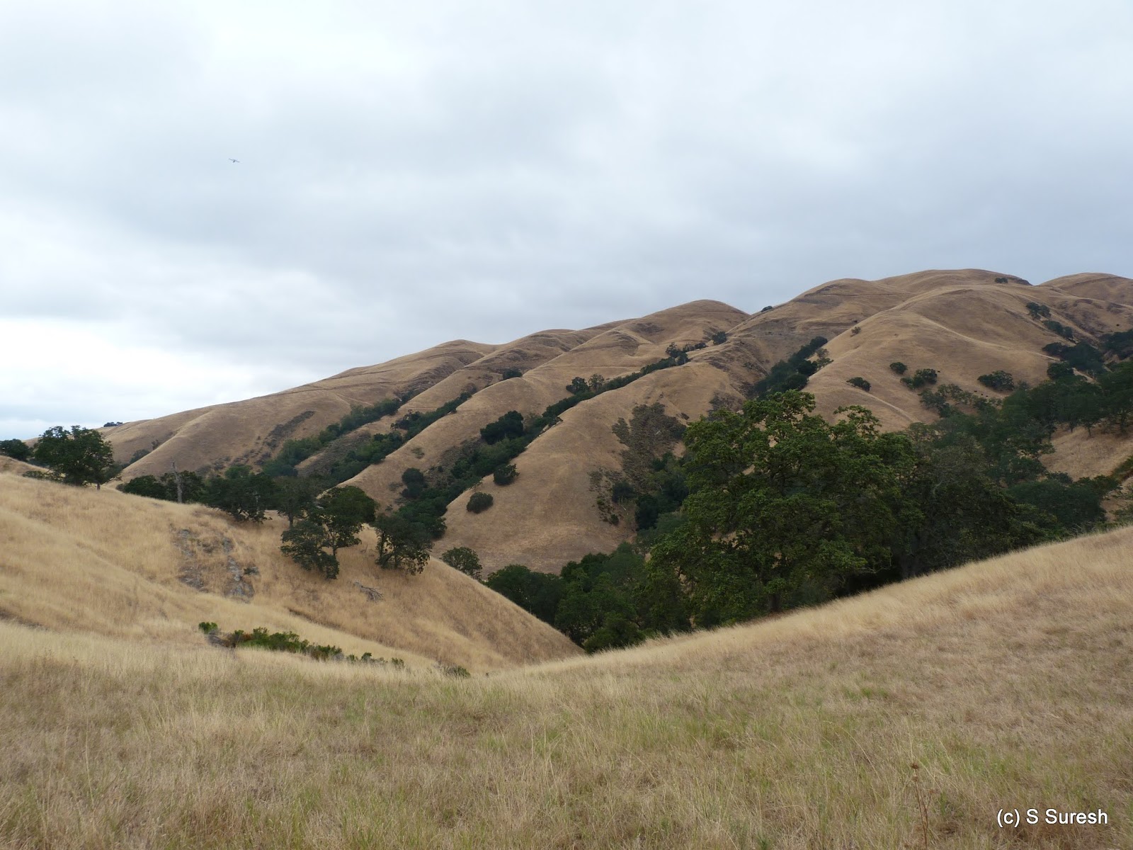
This is the first time we hiked in the afternoon. It was warm and 80⁰ when we started, but as the afternoon progressed, it became progressively cooler. We had to negotiate a killer 1000 ft. ascent over the first mile by Mori Ridge Rd, a wide dirt trail. There is pretty much no shade cover either during this section or on the rest of our hike today. We were climbing with our back to the Pacific but looking at the ridge covered by dense greenery ahead. 

Nike Missile Control Site SF-51
The trail changes name to Sweeney Ridge Rd after Notch Trail intersection. Hiking another half-mile or so got us to Nike Missile Control Site SF-51, a Cold War-era defense installation that is an eye sore with graffiti today. Do take a moment to read up on the history of this interesting site that got decommissioned in 1974 once ICBMs came into being. 

The hike gets very interesting once on Sweeney Ridge Rd. For one, the grueling climb is done with. In addition, right before the Nike Missile Station, you have a breathtaking view of the Pacific Ocean on the left, San Francisco in the center, and SFO airport and the bay on the right with San Andreas Reservoir tucked behind it. Simply amazing! 


Sweeney Ridge Rd becomes a paved blacktop road from here for the next half-mile or so. We were walking on top of the ridge that was a distant mountain when we were climbing a while ago. The stretch is level and offers views of the pacific coast on one side and San Francisco Bay on the other. We came upon the San Francisco Discovery site, a place we visited during our first hike. 

Farallon Islands
After a very brief overlap with our path from before, we turned right on Baquiano Trail towards Farallon Trail. While it was partially cloudy and somewhat hazy, I could still clearly see Farallon Islands in the ocean, floating beautifully amidst the glistening waters of the Pacific. 

Baquiano Trail heads west, towards the ocean. Over the next mile, the trail descends gently before coming up on Farallon Overlook Trail. Apollo and I continued on the trail before I stopped at a spot where I felt the overlook would provide the best view. For Apollo's sake, I was consciously trying to keep the hike to less than 8 miles, given the afternoon heat and humidity.

Mori Point was right behind where we started our hike from Mori Ridge Rd. Right ahead of where we turned around were Rockaway Beach and Farallon Island in the distance. We had hiked the section between Mori Point and Rockaway Beach right by the coast in May, a day after our first hike at Sweeney Ridge. 

Our hike today would look exactly like a mirror image of the letter C. We turned around and retraced our path, by Baquiano Trail -> Sweeney Ridge Rd -> Mori Ridge Rd to the trailhead by Shelldance Orchid Gardens. The 7.4 mile out and back hike involved about 1400 feet climb, including the grueling 1000-foot first mile and took us nearly two and a half hours. This hike is tougher than the hike from Sneath Lane. But it is well worth the extra effort!

More pictures from our hike today.
#Hiking #HikingWithDogs #SweeneyRidge #ShellDanceOrchidGarden #GGNRA

Thursday, July 16, 2015

Cuesta Park, Mountain View 2015-07-16

I took Apollo to Cuesta Park for a casual walk today. I didn't think that this neighborhood park in Mountain View would make it to the blog. It shouldn't, if an energetic hike is the goal. However, if I were to review this location from Apollo's view point, it certainly is interesting and merits a post in the "dog friendly hikes" blog!


Cuesta Park is located at 615 Cuesta Dr (cross street Grant Rd) near El Camino Hospital. This is a classic neighborhood park with lots of open spaces, play areas, and picnic and BBQ areas. With huge redwood trees, the park is also well-shaded. Paved blacktop trails criss-cross the park; Apollo and I walked all the segments which amounted to nearly 2 miles!


Off Leash Area #1
The best part is that there are two off-leash areas for dogs. Inside the main park and east of the tennis courts (towards Grant Rd) is the first one; with manicured lawns, this is a great place for your dog to run about and have fun.


The annex, located on the other side of the tennis courts (towards Miramonte Ave), is the other off-leash area. Larger and more rugged, this are is open from 6 am - 10 am. Dirt trails criss-cross this off-leash area and I could definitely tell that Apollo had a field day in this section! 


If you are ever on the lookout for a neighborhood park for a family picnic with large off-leash areas for your dog, Cuesta Park ought to make the cut. 


We actually walked more than 3 miles today inn both the sections put together. 

More pictures from the walk today.
#CuestaPark #OffLeashPark #DogsOffLeash

Tuesday, July 14, 2015

Mission Peak (from Stanford Ave) 2015-07-14

Hike #50! 

I wanted this to be a special one. Apollo and I went to scale Mission Peak for the third time, starting from the Stanford Ave staging area. We followed a different route from the ones we did during our first hike in the winter and the second one in the spring. Today was a cool, cloudy summer day and the late start didn't make the hike any more difficult. To boot, I found parking in the Stanford Ave staging area at 8:45 am, a first for me! 


A short while into the hike, we took the fork on the right, Peak Meadow Trail. The dirt trail, a wide fire road, steadily winds up the mountains. At trail post #18, we took Horse Heaven Trail, a narrow dirt trail. We had a couple of close encounters with cattle grazing by this trail. At one point, a cow was standing right in our way and I had to wait for it to move on, while holding an excited Apollo on a tight leash.


If the first two miles involved steady climbing of about 1100 feet, the next mile and a quarter by Horse Heaven Trail turned up the heat by making us climb 1000 feet. The only reward is that this is the road less traveled and the approach to the peak from trail post #19 on the eastern side is a tad gentler. The views of the bay and the mountains are definitely outstanding. 


Mission Peak is visible on the left from this route and for most of the way, the peak was covered with clouds and fog. Fortunately for us, just as we scaled the peak, the fog had burned off, making it picture perfect! 


Some 80+ minutes and 3+ miles into the hike, we were again up on Mission Peak. This was the third time with Apollo. While there were people, today had the least amount of crowd at the top. That meant Apollo could get his own photograph with the Mission Peak post!

From here, we returned by the popular route, taking Ohlone Wilderness Trail (aka Hidden Valley Trail) to the parking lot. Apollo was off-leash most of the way up, and we came across just two hikers making their way down. On our way back he had to go on leash because of the trail traffic. 


Our hike was a nice counter-clockwise loop, following Peak Meadow Trail -> Horse Heaven Trail -> Peak Trail -> Ohlone Wilderness Trail from the Stanford Ave staging area. The 6.8 mile, 2100+ feet climb took us about 2.5 hours and was a memorable 50th hike.

More pictures from the hike today.
#Hiking #HikingWithDogs #MissionPeak #EBRPD

Monday, July 13, 2015

Calero County Park 2015-07-13

Calero County Park in San Jose is bordered by Almaden Quicksilver Park on the west and Santa Teresa Park on the north. Dogs are allowed on all trails including and north of Bald Peaks Trail. The main entrance to the park and trail heads are located on McKean Rd, half a mile south of the Bailey Ave intersection in San Jose. 


Los Cerritos trail
From the parking lot, we took the Access Trail and turned right on Los Cerritos Trail. You will see Los Cerritos Pond on your left from the dirt trail / fire road. We continued north on this trail towards Calero Reservoir. The dirt trail is muddy and we were kicking up lot of dust as we hiked up. 


The trail goes up through rolling brown hills before reaching Calero Reservoir about 1.5 miles from the start. The reservoir level was low (46% of capacity). Still, there is something charming about water fronts, especially with greenery around it. 


As we continued our hike with the lake on our right, we came up on three Turkey Vultures flying not very high. They eventually settled down on a tree. With the sun directly, it was hard to capture a good picture of them. That didn't stop me from trying!


Over the next mile, Los Cerritos Trail climbs about 500 feet, leaving the lake behind. Apart from occasional trees providing some shade, the first 3 miles of our hike today were quite exposed. At the Pena Trail intersection, we turned right and walked toward the Serpentine Loop junction. 

We walked less than half a mile on Pena trail today. Nevertheless, this stretch provided great views of both Almaden Quicksilver Park (Mt. Umunhum) and Santa Teresa Park (Coyote Peak). I decided not to do the Serpentine Loop today and we took Figueroa Trail back towards the entrance.


Figueroa Trail
Figueroa Trail runs by a creek and provided us with some much needed shade for the next two miles. As with the other trails we hiked today, this was also a wide dirt trail, although not as dusty as Los Cerritos Trail. Descending gently and giving up the 500 feet elevation, we made our way to the parking lot.


I am sure we will be back at this park for a couple of more hikes as most of the 18+ miles of trails are dog friendly. I suspect the best time to hike this park is in the spring, but not after rains, although that seems like a distant possibility in the midst of our drought!

Our 5.75 mile hike took us nearly 2 hours. Here are more pictures from the hike.
#Hiking #HikingWithDogs #CaleroCountyPark #CaleroReservoir

Friday, July 10, 2015

Sunol Regional Wilderness (Maguire Peak) 2015-07-10

Welch Creek Rd
An unsettled, cool, cloudy summer day set the perfect backdrop for our second hike at Sunol Regional Wilderness. We had hiked the Little Yosemite area in June. To hike Maguire Peak, it is best to park off Welch Creek Rd. Take the Calaveras Rd exit from Hwy 680. Welch Creek Rd is a small, narrow road on the left. The left turn is before Geary Rd. If you plan to hike here on a weekend, you must get a parking permit from the kiosk entrance in Geary Rd. 


Upper Maguire Trail
I had intended to park at the 0.72 mile marker and hike the Lower Maguire Peak Trail. That trail was closed off today. I continued ahead just past the 1.6 mile marker and hiked the Upper Maguire Peak Trail instead. A word of caution - Welch Creek Rd is very narrow, a single-lane road for the most part. Drive cautiously. The trail heads are not visibly marked. Pay attention to the mile markers. And off-road parking is very tight. Where I'd parked today, there was room for 3 cars at best. 


Upper Maguire Peak Trail (trail post #5) is a very narrow, single-track trail that winds up the mountains. When I say narrow, I really mean it this time. Little more than half a mile on this trail will get you to trail post #7 and Maguire Peak Rd. Turn right and continue up the wide fire road. From this point, I let Apollo off leash and he was delighted to lead the way to Maguire Peak.


During our earlier hike to Little Yosemite area, we met a few people. During the entire hike today, we met no one. It is not called wilderness for no reason! To have the entire place to yourself can be intimidating initially, but is absolutely liberating at the same time! 


Maguire Peak Loop Trail starts at trail post #8. I decided to do it counter-clockwise. Against the backdrop of dark and threatening clouds, the views of the mountains were gorgeous. As it climbs up, the dirt trail will slowly change character, and you will find sandstone and sedimentary rock formations. At the same time, San Antonio Reservoir will come into view on your right.


View from top of Maguire Peak
Nearly 3 miles into the hike, you will come to a spot with breathtaking views of the reservoir and mountains. There is a bench to rest and enjoy the scenery. But if you are up to it, you can climb the narrow trail right by the bench that takes you to the top of the peak. Apollo and I made the climb and it was well worth the satisfaction of scaling the highest point in this hike. 


From here, the loop trail starts going south. You will come close to the fence line marking the San Francisco Water District Land as the trail descends down to post #11. (If you'd taken the Lower Maguire Peak Trail, you'd have come to this spot.) You will complete the 3+ mile loop in a short while returning to post #8.


We retraced our way back from here on Maguire Peak Rd and Upper Maguire Peak Trail. Sunol Wilderness is open for cattle grazing and on our way back, we found a couple of groups of cows munching on the dry grass.

This hike is not necessarily very difficult. We climbed a little more than 600 feet and have done harder hikes. You must be prepared for solitude if you choose Sunol Regional Wilderness, especially the trails from Welch Creek Rd.


You will find some shade, but not a whole lot in this predominantly exposed hike. We completed the 6.5 mile hike in a respectable time of 2h:11m. We will certainly be back to this park a couple of more times to explore what more it has to offer.

More pictures from the hike today.
#Hiking #HikingWithDogs #SunolRegionalWilderness #MaguirePeak #EBRPD