Sweeney Ridge (Sneath Ln trailhead) 2015-05-12
Sweeney Ridge is part of the Golden Gate National Parks Conservancy and can be accessed from Sneath Lane, off Hwy 280 in San Bruno. There is space for about 15 cars at the trail head. I thought hiking ~60⁰F should be fine without a jacket especially on a sunny day... that was a mistake! It was windy and stayed that way through the hike. And I learned that fog settles down uphill with little warning - a jacket is a must lest you want to feel uncomfortable.
We started our hike at Sneath Lane Trail. The trail is paved and climbs steadily from the trail head, and the views are magnificent throughout the climb. By the end of the first mile - as though you'd peeled open the cover of a beautiful picture - the view of San Francisco Airport, the bay, San Andreas Lake, and San Mateo Bridge will open up little by little on your left. The view is marred only by the graffiti on the railings. Today was just windy, not foggy, so the views were awesome.
The steady climb will become steep around this time. Trust me, you will notice it. If you don't, I congratulate you on your fine fitness level! Another three-fourths of a mile or so later, Sneath Lane ends at Sweeney Road. Apollo and I took the unpaved section on our left, heading further south. You could take the sharp curve right and head on the paved section.
 |
| Pacifica State Beach |
This spot is particularly interesting - on one side is SFO, San Andreas Lake and everything you'd have seen thus far; on the other side is the Pacifica State Beach by the ocean. On a clear day like today, you can see the waves in the Pacific Ocean!
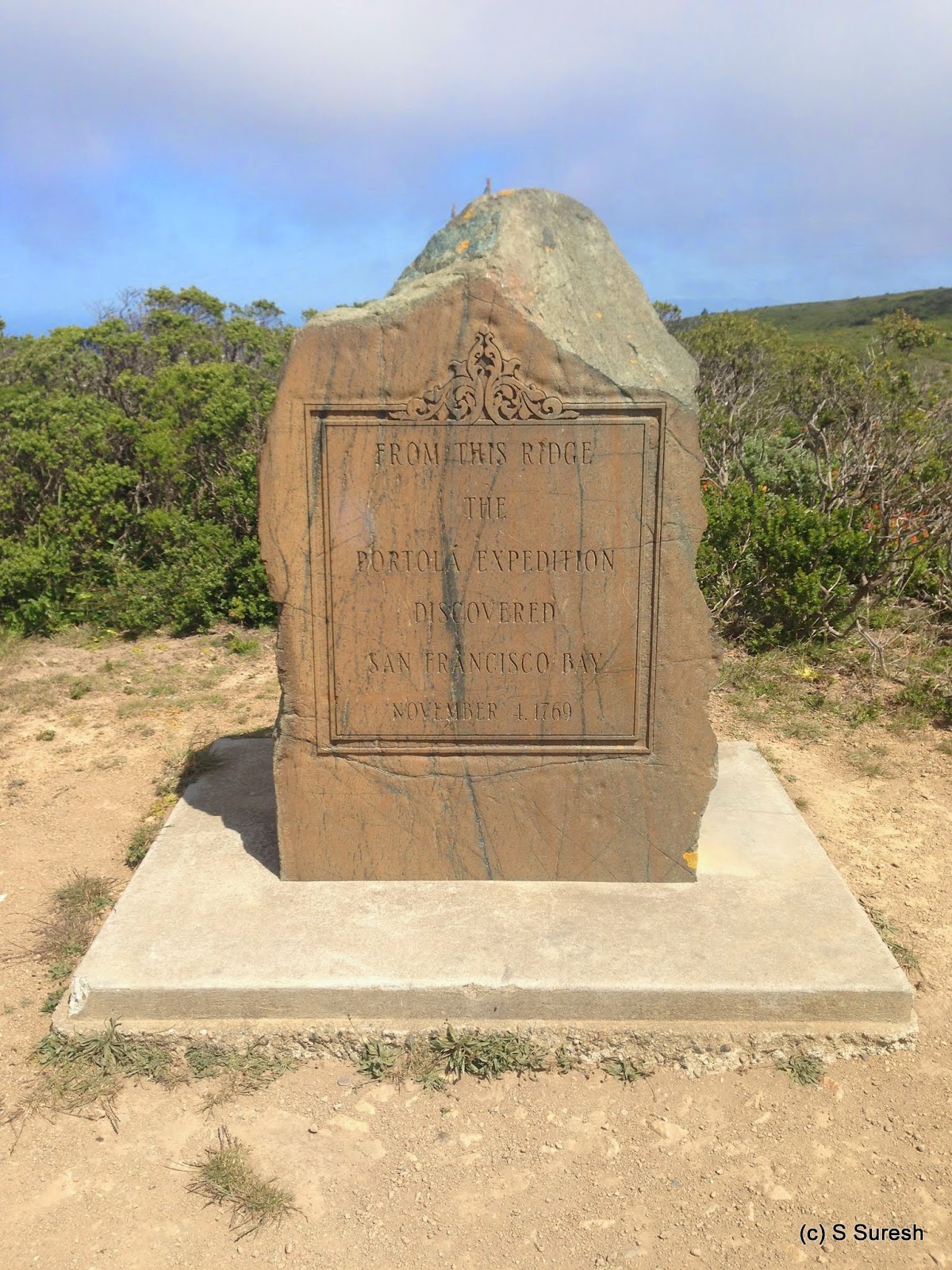
Sweeney Road Trail is a fire road dirt trail that is predominantly flat - set on a plateau. Right away, we came upon the Portola Discovery Site - the place from which San Francisco Bay was discovered on Nov 4, 1760. If you are a history buff, you'd enjoy this place. The dirt trail continues south until Portola Gate which provides access to Fitfield-Cahill Ridge, although you need permits and a reservation to access that area.
 |
| Sweeney Horse Trail |
We turned around at the gate. Instead of making this an out and back trip, we took Sweeney Meadow Trail and Sweeney Horse Trail which connected back to Sweeney Ridge Trail. It provided a nice change of pace and scenery. These two trails take you right down to the valley before climbing back to the plateau where the ridge trail runs.
Once we reached Sneath Lane Trail, our walk was essentially downhill all the way to the trail head. The hike involved a climb of about 800 feet; we completed the 6.4 mile out and back in about an hour and fifty minutes. The park has few more trails that are open for hiking with dogs - so we will be back again.
More pictures from our hike.
#Hiking #HikingWithDogs #SweeneyRidge #GGNRA


No comments:
Post a Comment