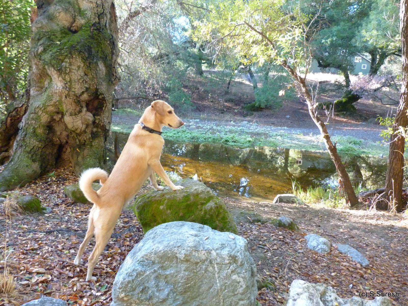
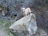
Apollo and I celebrated our 5 years of companionship with our first hike in Contra Costa county at the Diablo Foothills Regional Park. Bordered by Mt. Diablo State Park on the east and Shell Ridge Open Space on the west, this East Bay regional park has trails with plenty of variety and impressive views. I had parked in the Livorna staging area located at the end of Livorna Rd., Alamo (off Hwy 680).
The temperature was cool and crisp in the high 50s even with the bright sun shine. There was reasonable traffic this beautiful Sunday afternoon in the trails, possibly folks working off the Thanksgiving indulgences!
 |
| Foothills trail |
We started our hike from the Foothills trail, a wide dirt trail that quickly crosses over into Shell Ridge Open Space. There are several options to continue further into the Shell Ridge Open Space. We stayed on Foothills trail that was back within the regional park boundary.
 |
| Shell Ridge |
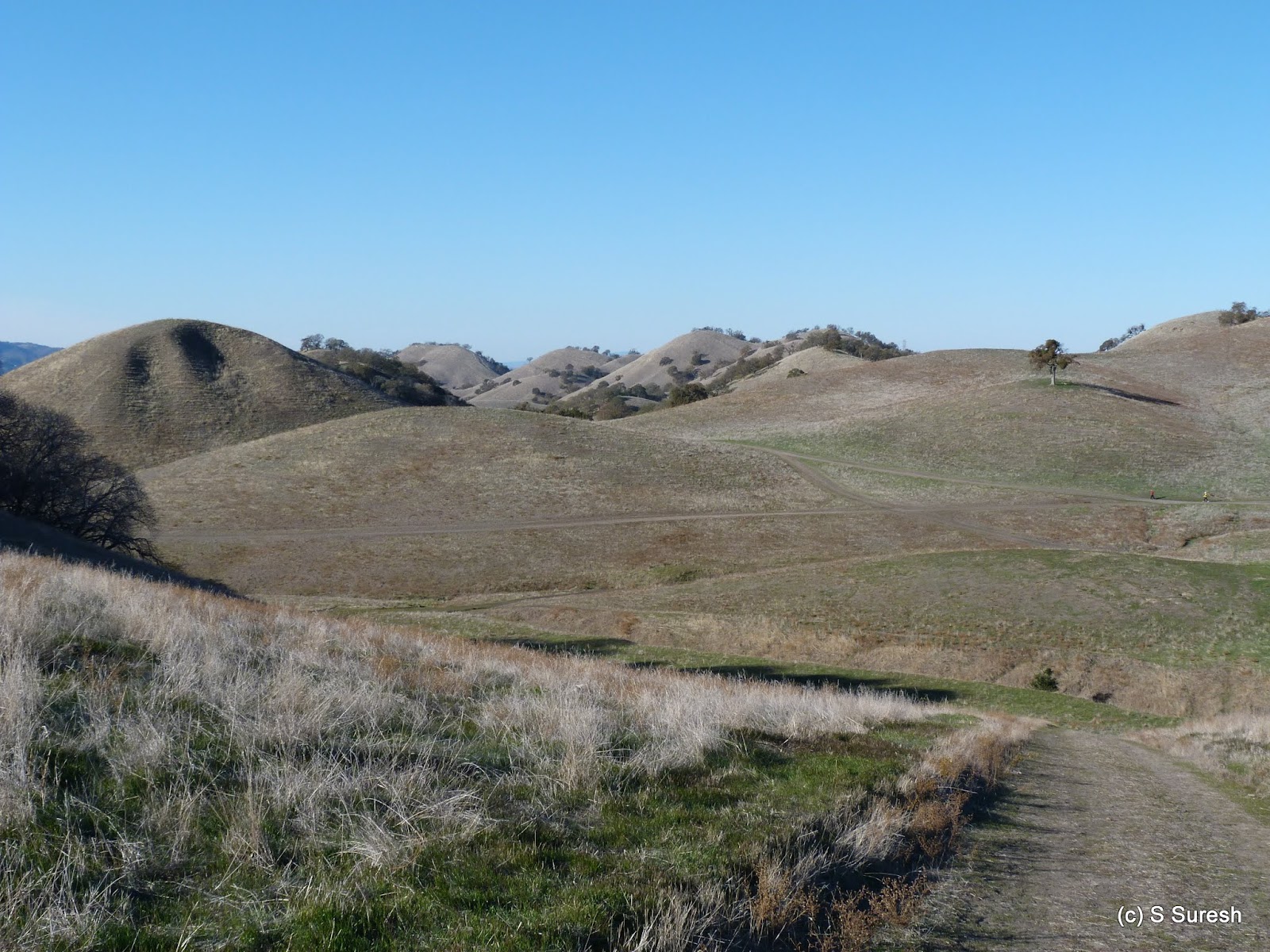
From Foothill trail, we turned into Stonegate trail. Taking us on top of the ridge and through several other trail intersections, this section of our walk offered great views of Shell ridge and its characteristic undulating hill formation, not unlike a camel back.
 |
| Buckeye Ravine |
We made our way from here to Buckeye Ravine trail. Descending sharply, in this stretch, we gave up the ~350 ft. elevation we had gained until now. This is a single track dirt trail that has posted signs of no-biking, but the allure of the rapid descend by the ravine made more than one biker bend the rule.
 |
| Castle Rock |
Just as it connects to Stage Road trail that runs along Pine Canyon Creek, Buckeye trail offers glimpses of Caste Rock, another impressive feature of our hike today. Castle Rock is on the border of Mt. Diablo State Park and is popular with mountain climbers.
 |
| Stage Road trail |
We turned right on Stage Road trail and walked about 1/2 a mile before coming to Little Yosemite trail. Part of Mt. Diablo SP, dogs are not allowed in that. We retraced our steps back and continued north on Stage Road trail. Over the next 1/2 mile or so, the trail not only had interesting rock formations on the sides but actually ran right over them.
 |
| Fairy Lantern trail |
We turned left on Fairy Lantern trail and subsequently connected to the northern section of Buckeye Ravine trail. These two sections and the short stretch we walked by Briones-Mt. Diablo regional trail were all uphill as we looped back to the spot where we had headed down by Buckeye Ravine trail.
If you thought Briones-Mt. Diablo Regional trail was a mouthful, brace yourself! The same trail has two other names, American Discovery trail and Mokelumne Coast-to-Crest trail! And we just walked a quarter mile in this trail with multiple names, each a mouthful!
 |
| Hanging Valley trail |
From this familiar spot with views of Shell Ridge, we headed south by Hanging Valley trail. The nearly 1 mile stretch continued to put us through our paces climbing up and down before we connected to Alamo trail.
 |
| Alamo trail |
The homestretch by Alamo trail to the staging area was easy. Alamo trail goes through the backyards of a residential neighborhood in the unincorporated area of Alamo before reaching the Livorna staging area.
We did nearly six and a half miles, climbing about 900 feet through several ups and downs along the way.
More pictures from our hike.
#Hiking #HikingWithDogs #DiabloFoothillsRegionalPark #EBRPD
It was good to hit the trails in bay area sporting ideal fall conditions after my travels and incessant monsoon rains in Chennai and cold/wintry conditions in London. Apollo and I headed off to Ed Levin County Park in Milpitas. I parked near the dog park, best accessed from Sandy Wool entrance (fee) located on Downing Rd, off Calaveras Rd / Hwy 680 in Milpitas.
The second entrance to the park is on Calaveras Rd. that serves the Spring Valley area. Dogs are not allowed in the trails in this section. I drove by this entrance and chanced upon a group of wild turkeys. One bird allowed me to get close enough to take a good photograph. Wishing the flock happy thanksgiving, we moved on!
Ed Levin Park serves as the ideal trail head for Monument Peak. However, I had decided not to take on that hike today and instead do a loop around the northern section of the park. We started our hike from Tularcitos trail, right by the dog park. The dirt trail quickly connects to Agua Caliente trail, which makes a sharp left and starts climbing up hill.
Agua Caliente trail intersects the Launch Site Rd as it makes its way through the mountains. Launch Site Rd is predominantly used by hang gliding enthusiasts with two launch spots on either side of where the trail and the road intersects.
The sun was out when we started the hike, but as we gained some elevation, we entered a stretch of heavy fog that progressively thickened. At one point, the visibility was reduced to about 40 feet. The fog was heaviest when Agua Caliente trail crossed Monument Peak Rd & trail.
We continued on Agua Caliente trail making a left after the water trough. There is no trail marker here for Agua Caliente trail, but it is hard to miss the trail going left at the water trough. You know you are on the right path if you cross Calera creek and come upon Calera Creek trail in quick succession.
We turned around here, taking Calera Creek trail heading south. The recent rains had resulted in the trail and the mountain side sporting a lush green grass cover by the creek. The fog had also burned off by now as the Calera Creek trail gradually descended, crossing the creek couple of times.
As the trail comes close to the Sandy Wool area, you will see the large open space ear marked for hang gliding on the left. We wrapped up our hike by connecting back to Tularcitos trail and making our way back to the dog park where I had parked the car.
More pictures from our four mile hike today.
#Hiking #HikingWithDogs #EdLevinPark #EdLevinCountyPark
Alameda Creek Regional Trail, a 12 mile trail on the banks of Alameda creek runs from Niles Canyon westward all the way to San Francisco Bay. There are two trails that run on both banks of the creek. A paved blacktop trail on the southern side and a dirt trail on the northern side that allows equestrians. I had parked in the Niles Creek staging area, the entrance to which is on Old Canyon Rd off Mission Blvd just north of its intersection with Mowry Ave.
The first thing that will strike you when you start the hike is how w-i-d-e the creek is. On top of it, the hillside on the north provided an impressive backdrop to start off our walk. The trail goes by an underpass at Old Canyon Rd and emerges on the other side by a railroad.
The trail runs parallel to the rail road until the underpass at Mission Blvd. Rail roads always have a fascination for me and it was cool to be there today seeing a Union Pacific diesel engine moving around in this section by the creek. The creek also becomes dry with a dam holding the water on one side in this section.
The trail curves around and passes by a pond on the left called Kaiser cove that belongs to a model boat club. In this section, there is a dirt trail that runs by the paved trail until the next underpass by BART tracks.
Coming off the BART track underpass, the trail runs by a residential area on the left until Isherwood Way where we turned around today. It is possible to connect to the dirt trail on the north by using the Sequoia bridge in this stretch. The north side trail also runs on the boundary of Quarry Lakes recreational area that we did not visit today.
Apollo and I enjoyed our mid morning walk today after the drenching rains yesterday. Alameda creek trail, especially the paved side is a great option to go to after rains if you want to avoid walking by muddy dirt tracks.
The riparian trail system will also give you an opportunity to see lots of birds. In addition to mallard ducks that is common in bay area, I also saw a blue heron, great egret, lesser scaups and a group of Canada geese that took flight as Apollo and I walked by them near the Kaiser cove pond.
Our out and back walk today was little over 6 miles, from Niles creek staging area until Isherwood Way. With more than 12 miles of trail one way, I will save the other sections for a rainy day this winter.
More pictures from our hike.
#Hiking #HikingWithDogs #AlamedaCreekTrail #EBRPD
Bay Farm Island, Alameda has a ~6 mile loop around the island that is part of the SF Bay Trail. I had walked the Shoreline Dr. in Alameda Island on day 3 of my SF Bay Walkabout. I was back here with Apollo and started our walk today from Shoreline Dr & Park St. Parking is easy with plenty of spots available on Shoreline Dr. and nearby streets.
A paved blacktop trail for pedestrians runs all along Shoreline Dr. from Crown Memorial Beach (Westline Dr.) all the way to Doolittle Dr. We walked only a short stretch of this today of which a portion of it was an undeveloped dirt trail right by the bay and behind a residential neighborhood.
This segment connects back to the black top bike trail that goes under Doolittle Dr. and crosses the bay by a bright blue draw bridge to Bay Farm island. We turned right and proceeded on the wooden bridge to start the Bay Farm Island Loop trail in a counter clockwise direction.
For the next mile and a half, in addition to the blacktop trail popular with cyclists and joggers with strollers, there is a dirt trail that runs by it that pedestrians and dog walkers gravitate to. As you walk in a westerly direction, the trail offers fantastic views of the bay bridge and San Francisco skyline.
As if the views were not enough, the crisp autumn morning by the bay treated us to a gentle sea breeze with the unmistakable salty freshness. The trail curves around the island in a south easterly direction for the next mile and a half. The beauty of the walk was only marred by a very noisy group of women talking about their lives happenings! The solution to this problem was surprisingly simple - not outrunning them but pausing to enjoy the scenery while they went ahead!
You will go right by the ferry terminal as the trail becomes more urban in character. Office complexes, including Peet's Coffee and manicured lawns on one side and bay waters on the other will set the stage for an urban walk by the bay in this section.
For the next mile, the trail runs parallel to Harbor Bay Pkwy with office complex dotting both sides. Abbott's labs and Oakland Raiders offices are in this section which no longer has the bay on one side, but is still pleasant to walk by.
The trail follows Harbor Bay Pkwy and turns in a northerly direction at the junction of Ron Cowan Pkwy. The next mile is unfortunately a dry section of this loop, with Oakland airport on one side and a golf complex on the other, with construction happening in both properties.
At the end of this drab section is Mount Trashmore! No, I am not joking. That is the name of the former landfill at the intersection of Doolittle Dr. & Harbor Bay Pkwy. The landfill is fenced off and the trail once again starts running by the bay on the home stretch of the loop. Well, it may be called Mt. Trashmore, but I was moved by the two quotes someone had painstakingly painted in the area.
The loop completes with this section coming back to the draw bridge. Crossing over the bridge and retracing our steps, we were back on Shoreline Dr. in Alameda island.
The 9+ mile walk, including the ~6 mile Bay Farm Island Loop trail was one of our longer excursions, but is not difficult and can be customized to suit the distance one would like to walk this trail.
More pictures from our walk today.
#Hiking #HikingWithDogs #SFBayTrail #BayFarmIslandLoopTrail #BayFarmIsland #CrownMemorialBeachPark
We were back for our fourth hike to Sunol Regional Wilderness today and used the main staging area by the Visitor Center on Geary Rd (off Hwy 680 / Calaveras Rd). With the soaking autumn rain from yesterday, I was prepared for the trails to be somewhat muddy today.
 |
| Alameda Creek |
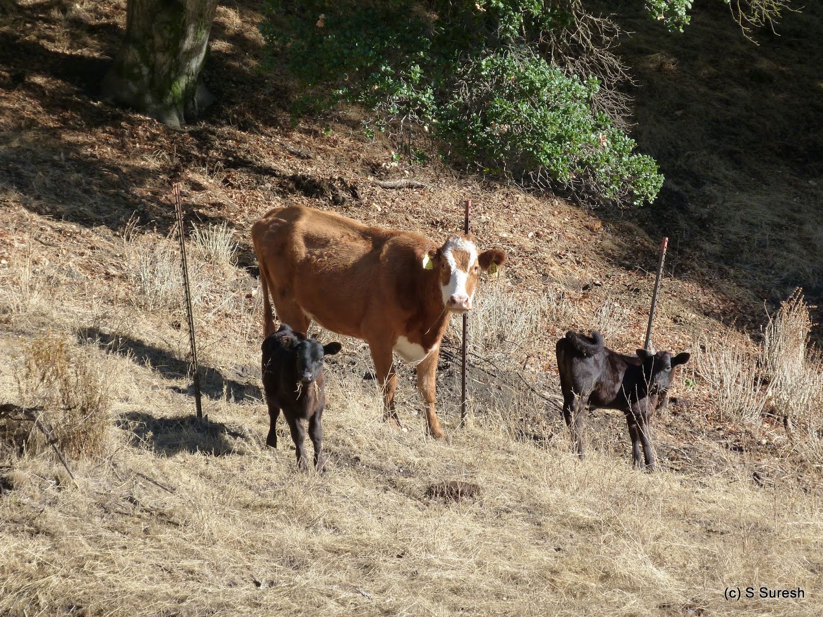
Crossing over the now familiar bridge on Alamada creek from the parking lot, we started walking left. Going by Alameda creek for a short distance, the trail was muddy, but not overtly so. In a short distance, we turned right on Flag Hill trail, which starts climbing steadily. For more than a mile, the single track dirt trail goes up through cattle grazing grounds.
The cows and new born calves were apprehensive of us as we walked past them. The calves quickly ran to their mothers which invariably took a step forward and kept a watch full eye over us until we were safely past them.
 |
| Flag Hill trail |
After the first mile, the trail starts ascending steeply through a narrow and rocky section right by a cliff, putting us through our paces before reaching Flag Hill. The 1000+ ft. elevation gain over a mile was swift and made us take a short breather at Flag Hill trail marker.
We continued by Flag Hill Road, a fire road on top of the hill. This section of our hike was easy, gradually descending a bit while providing expansive views of the mountains all around us.
At the next intersection, we continued ahead by Vista Grande Road. Also a fire road, the walk by Vista Grande still offers great views over an up hill section for the next mile. There are two overlook spots with park benches with brilliant 360 degree views of hillside and Calaveras reservoir in the distance.
From here, we took the Eagles View trail. An extremely narrow, single track trail that goes down hill by the mountain slopes, the 1/2 mile section takes you down to the a creek crossing. The warning signs about Eagles' View trail made sense especially when crossing over the creek.
 |
| Cave Rock Rd |
With views of the valley and High Valley camp ahead of us, we did two short segments by Eagle View Rd and Cave Rock Rd, both wide fire roads before turning left on Indian Joe Creek trail.
 |
| Indian Joe Creek trail |
Indian Joe Creek trail goes right by the creek for more than a mile, crossing over several times along the way. I am sure all these crossings would be more fun with the creek having water in it. There is also an impressive rock formation along this section.
We wrapped our hike walking by the Indian Joe Nature trail to reach the parking lot. My tracking software crashed right after we entered Eagles' View trail. We had completed the 1/2 mile section before I realized it had crashed. I'd say that we hiked about 6.8 miles today climbing nearly 1700 feet.
More pictures from our hike.
#Hiking #HikingWithDogs #SunolRegionalWilderness #FlagHill #VistaGrande #EaglesViewTrail #IndianJoeTrail #EBRPD