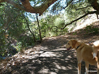
We were back for our fourth hike to Sunol Regional Wilderness today and used the main staging area by the Visitor Center on Geary Rd (off Hwy 680 / Calaveras Rd). With the soaking autumn rain from yesterday, I was prepared for the trails to be somewhat muddy today.
Crossing over the now familiar bridge on Alamada creek from the parking lot, we started walking left. Going by Alameda creek for a short distance, the trail was muddy, but not overtly so. In a short distance, we turned right on Flag Hill trail, which starts climbing steadily. For more than a mile, the single track dirt trail goes up through cattle grazing grounds.
The cows and new born calves were apprehensive of us as we walked past them. The calves quickly ran to their mothers which invariably took a step forward and kept a watch full eye over us until we were safely past them.
After the first mile, the trail starts ascending steeply through a narrow and rocky section right by a cliff, putting us through our paces before reaching Flag Hill. The 1000+ ft. elevation gain over a mile was swift and made us take a short breather at Flag Hill trail marker.
We continued by Flag Hill Road, a fire road on top of the hill. This section of our hike was easy, gradually descending a bit while providing expansive views of the mountains all around us.
At the next intersection, we continued ahead by Vista Grande Road. Also a fire road, the walk by Vista Grande still offers great views over an up hill section for the next mile. There are two overlook spots with park benches with brilliant 360 degree views of hillside and Calaveras reservoir in the distance.
From here, we took the Eagles View trail. An extremely narrow, single track trail that goes down hill by the mountain slopes, the 1/2 mile section takes you down to the a creek crossing. The warning signs about Eagles' View trail made sense especially when crossing over the creek.
With views of the valley and High Valley camp ahead of us, we did two short segments by Eagle View Rd and Cave Rock Rd, both wide fire roads before turning left on Indian Joe Creek trail.
Indian Joe Creek trail goes right by the creek for more than a mile, crossing over several times along the way. I am sure all these crossings would be more fun with the creek having water in it. There is also an impressive rock formation along this section.
We wrapped our hike walking by the Indian Joe Nature trail to reach the parking lot. My tracking software crashed right after we entered Eagles' View trail. We had completed the 1/2 mile section before I realized it had crashed. I'd say that we hiked about 6.8 miles today climbing nearly 1700 feet.
More pictures from our hike.
#Hiking #HikingWithDogs #SunolRegionalWilderness #FlagHill #VistaGrande #EaglesViewTrail #IndianJoeTrail #EBRPD
 |
| Alameda Creek |
Crossing over the now familiar bridge on Alamada creek from the parking lot, we started walking left. Going by Alameda creek for a short distance, the trail was muddy, but not overtly so. In a short distance, we turned right on Flag Hill trail, which starts climbing steadily. For more than a mile, the single track dirt trail goes up through cattle grazing grounds.
The cows and new born calves were apprehensive of us as we walked past them. The calves quickly ran to their mothers which invariably took a step forward and kept a watch full eye over us until we were safely past them.
 |
| Flag Hill trail |
After the first mile, the trail starts ascending steeply through a narrow and rocky section right by a cliff, putting us through our paces before reaching Flag Hill. The 1000+ ft. elevation gain over a mile was swift and made us take a short breather at Flag Hill trail marker.
We continued by Flag Hill Road, a fire road on top of the hill. This section of our hike was easy, gradually descending a bit while providing expansive views of the mountains all around us.
At the next intersection, we continued ahead by Vista Grande Road. Also a fire road, the walk by Vista Grande still offers great views over an up hill section for the next mile. There are two overlook spots with park benches with brilliant 360 degree views of hillside and Calaveras reservoir in the distance.
From here, we took the Eagles View trail. An extremely narrow, single track trail that goes down hill by the mountain slopes, the 1/2 mile section takes you down to the a creek crossing. The warning signs about Eagles' View trail made sense especially when crossing over the creek.
 |
| Cave Rock Rd |
With views of the valley and High Valley camp ahead of us, we did two short segments by Eagle View Rd and Cave Rock Rd, both wide fire roads before turning left on Indian Joe Creek trail.
 |
| Indian Joe Creek trail |
Indian Joe Creek trail goes right by the creek for more than a mile, crossing over several times along the way. I am sure all these crossings would be more fun with the creek having water in it. There is also an impressive rock formation along this section.
We wrapped our hike walking by the Indian Joe Nature trail to reach the parking lot. My tracking software crashed right after we entered Eagles' View trail. We had completed the 1/2 mile section before I realized it had crashed. I'd say that we hiked about 6.8 miles today climbing nearly 1700 feet.
More pictures from our hike.
#Hiking #HikingWithDogs #SunolRegionalWilderness #FlagHill #VistaGrande #EaglesViewTrail #IndianJoeTrail #EBRPD


No comments:
Post a Comment