Saturday, September 19, 2015

Joseph D Grant County Park 2015-09-18

This was our 2nd outing at Joseph D Grant park. We'd been here earlier this month and hiked from Grant Lake staging area. Today, we drove another 3 miles or so on Mt. Hamilton Road to the Twin Gates parking lot. There was a Coyote Advisory, not the standard note but specific info on recent sightings with a cautionary tone. 


Bonhoff trail
We crossed Mt. Hamilton road and started our hike on Bonhoff trail. The double track dirt trail goes in a southerly direction gradually descending before coming up on a four way intersection in about a mile. Apollo and I turned right on Foothill trail.


Foothill trail
Foothill trail offered us more shade than Bonhoff trail both from the vegetation as well as shadows from the mountains to our left. This trail also gradually descends over the next mile before coming up on Eagle lake and Hotel trail intersection.


Eagle Lake


Eagle lake and the area surrounding it is closed for habitat restoration. The effects of the drought was definitely visible at this lake and in the vegetation around it. 


The segment of Hotel trail that we covered today was again little more than a mile. Our walk in the northerly direction provided expansive views of the park in all directions. About 3 miles into the hike, Apollo and I stopped for a breather and enjoyed the panoramic views of Halls Valley and the mountains. Clear skies with excellent visibility made the experience all the more dramatic.


Lick Observatory

We had gradually descended nearly 800 feet from the Twin Gates trail head. Our last 1.6 miles in Canada de Pala trail to where we started involved gaining that elevation. At several points in the hike, you will get to see the Lick Observatory atop Mt. Hamilton.


We completed the 5+ mile hike in about 2 hours. One of our slower hikes but both Apollo and I are recovering from minor ailments and I didn't want to push ourselves today.


More pictures from our hike today.

#Hiking #HikingWithDogs #JosephDGrantCountyPark #JosephGrantCountyPark #JosephGrantPark #BonhoffTrail #FootHillTrail #HotelTrail #CanadaDePalaTrail #EagleLake

Thursday, September 3, 2015

Oyster Point - Point San Bruno (SF Bay Trail) 2015-09-03

Between Oyster Point and Point San Bruno, SF Bay Trail offers some great views of the bay. I had covered this stretch on day 5 of my SF Bay Walkabout and decided to come here with Apollo today. I parked in the Oyster Point Park / Beach public parking lot on Oyster Point Blvd, off Hwy 101. This section of the trail can be accessed from multiple locations and there are several other parking lots open to public close to the Bay Trail that you can use.


There are lot of office complexes in this area, including Genentech and several bio tech companies. We started our walk today with the one mile loop, shaped like a square north of the parking lot. This segment borders Oyster Cove Marina as well as offices. Finishing the loop, we were back at where I'd parked. There is a small beach by this park that is accessible, if you are so inclined.


From here, we followed the trail crossing the South San Francisco Ferry Terminal first and Oyster Point Marina and fishing pier next. The fishing pier as well as a ramp that goes close to the bay provided outstanding views and great photo opportunities.


The trail starts heading in a south westerly direction from here. As with all my bay trail hikes, I was able to see several birds this time as well, including a blue heron in close quarters, wading through the shallow waters. 


We walked until Point San Bruno, a small strip of a park that juts out into the bay. We turned around here and made our way back to where we started. The blue heron was still in the same spot, still willing to let me get close for a nice photograph. 


And close to the ferry terminal, there was a large gathering of Canada Geese that crossed our path. They seem to be the most common fowl one will come across in bay trail! 


We wrapped up our 4.5 mile walk today with the San Bruno Mountain State Park ahead of us. I could clearly spot the trails in those hills, but unfortunately, dogs are not welcome in that park. 

It is possible to extend the walk in either direction, if you so desire. The narrative from day 5 of my SF Bay Walkabout will give you ideas and options.

More pictures from our walk today.
#Hiking #HikingWithDogs #OysterPoint #PointSanBruno #SFBayTrail


Tuesday, September 1, 2015

Joseph D Grant County Park 2015-09-01

The biggest park in Santa Clara County, Joseph D Grant Park, is located up the east bay hills, on Mt. Hamilton Rd. in San Jose. Whether you choose to drive by Mt. Hamilton Rd. from Alum Rock Ave or by Quimby Rd, be prepared for 6~8 miles of windy, hilly roads to reach the park entrance. The park has an extensive 52 miles of hiking trails and is best visited in spring or fall. I parked at the Grant Lake staging area in Mt. Hamilton Rd., less than 1/4 mile from the main entrance (fee charged at the main entrance).

Grant Lake is quite close to the parking lot and can be reached by a quick walk. Continuing on Bernal trail would allow you to explore the shores of the lake. Apollo and I started off our hike exploring the Grant Lake area. There is an island in the lake and couple of birds, including a blue heron by the island. It was calming watching the still waters against the backdrop of mountains, marking a cool start to our day.


With several miles of trails, I decided to do a loop with Halls Valley & Los Huecos trails. Halls Valley trail starts close to Grant lake. This is a nice double track dirt trail, which stays at the lake level for a while before ascending gradually. Surprisingly, this was quite shaded for a good part making it a not so difficult hike today; it was also high 60s and quite cool for the most part. 


Halls Valley trail goes up the mountains in an easterly direction for about 2 miles. After a mile or so into the trail, the shade gives way to open hill side with some great views of hills all around. To the west, I could make out the hills of Sierra Azul & Almaden Quicksilver park and the now very familiar tower on Mt. Umunhum. We were also treated to some gorgeous gorges in this section.


Halls Valley trail meets Canada de Pala trail, a long trail that travels north-south. The northern section will take you to Antler point standing tall at 3000 feet. I had decided to turn south and walk for about 1/2 mile to connect to Los Huecos trail. By this time, we had climbed little more than 1000 feet. 


Just before turning right (and west) to Los Huecos trail, Lick observatory will be clearly visible from Canada de Pala trail. Both these trails are also double track dirt trails, although Los Huecos was narrowing in width every now and then. The next mile and a half was an easy descend, giving up the 1000 feet elevation we gained earlier. The gorges by Los Huecos trail were equally breathtaking as the ones we saw before. While Los Huecos trail is totally exposed, we were fortunate to have a gently wind blowing our way, making it a breeze to complete the descend.


On our way back, I decided to check out McCreery lake, taking the McCreery Lake trail, a single track dirt trail. Much smaller than Grant lake, there is a trail that loops around McCreery lake. Apollo was quite happy to check out the area and relax in the shade by the lake.


From here, we took the Lake View trail to reach the parking lot. We covered 6.5 miles today in more than two hours, climbing over 1000 feet. Joseph D Grant park presented a classic summer, dry, brown hillside to us today. And I expect it to be lush green rolling hills in spring, especially after some good rains.

More pictures from our hike today.
#Hiking #HikingWithDogs #JosephDGrantCountyPark #JosephGrantCountyPark #JosephGrantPark #HallsValleyTrail #GrantLake #LosHuecosTrail #McCreeryLake

Sunday, August 30, 2015

Baylands Nature Preserve (Sunset, Full Moon) 2015-08-29

We were back at Baylands Nature Preserve after a long break. Our previous hike here was in February and our hike today was a proper subset of what we did then. So, why did this hike merit a new blog entry rather than an update to my earlier post? Well, our walk today was one of a kind! A sunset walk in the preserve that overlapped with a full moon rise on what was a perfect blue sky summer evening and an opportunity to see wonderful birds by the bay definitely deserves a mention of its own.


Sunset today was at 7:41 pm. Apollo and I started our hike around 7 pm. The walk in Adobe Creek trail was familiar, except the setting was different. The sun was in the western horizon and the shadows were lengthening as we walked by the Baylands preserve. 


It was low tide when we walked and there were plenty of shore birds, especially American Avocets & Marbled Godwits in Charleston slough. On the other side of slough, by the wetlands called soap pond, I saw the largest gathering of American White Pelicans. The birds were seriously grooming themselves with several shorebirds and mallards giving them company.  


As the sun started setting, the sky was filled with an orange hue, providing a picturesque setting for the walk. Apollo was a willing model to pose for several pictures in the unique light setting drawing envious admiration from passers by!


After the sun had gone down, the next several minutes featured a fading deep red hue on the western horizon and light orange hue against the mountains on the eastern side. We had walked about 2 miles into the preserve by Adobe Creek trail and I decided to turn around rather than attempt a loop in the fading light.


If the breathtaking sunset was not enough, Aug 29th was a full moon day and the moon rise was at 7:42 pm, a minute after the sunset! Sure enough, over the next few minutes with the sunlight not fully gone, the full moon was breaking through the clouds on the eastern horizon. 


Slowly but surely, the moon was filling up the sky with its reflection showing up in the muddy waters of Charleston slough. Its not often one gets to see a full moon rise right after the sunset. Adobe Creek trail by full moon light took on a completely different look by 8:15 pm, painted by a dark blue hue in the ground, bright light of the moon on the sky against the backdrop of east bay city lights coming on.


By the time we reached the car at 8:30 pm, the moon was well up in the sky casting shadows with its light! We just did about 4 miles today focusing more on the scenery around us and taking in the beauty of the moment. 

I'd encourage you to check out the pictures from the evening.
#Hiking #HikingWithDogs #BaylandsPaloAlto #BaylandsNaturePreserve #AdobeCreekTrail #FullMoonHike #SunSetHike #SFBayTrail


Thursday, August 27, 2015

Rancho Corral de Tierra 2015-08-27

The newest addition to Golden Gate National Recreation Area (GGNRA), Rancho Corral de Tierra in Half Moon Bay offers panoramic views of the coast, mountains and miles of hiking trails. This nearly 4,000 acre property transferred from Peninsula Open Space Trust into GGNRA recently and is maintained by multiple agencies, including National Park Service. 


The fact that it is in early stages of development means not all trails are named. I also didn't find a map of the park when I visited today. I believe one of the best places to start exploring Rancho is from the trailheads located at the end of Coral Reef Ave in Half Moon Bay (off Hwy 1, about 4 miles north of Hwy 92).


There are two trail heads at Coral Reef Ave. We took the one of the left. The single track dirt trail looked easy enough at the start, for the first 1/2 mile or so as it made its way through a wooded area. The trail offered couple of choices along the way; we kept left, making our way to the mountains ahead of us. 

Some of the segments were dead ends - I presume these are trail segments in development. However, it was quite easy to make our way back to the main trail in the foothills section of the park.


After 1/2 a mile, the trail starts ascending up the mountains. I could clearly see the Pillar Point Bluff that we hiked earlier this month as well as Sweeney Ridge that we hiked from Shelldance Orchid Gardens staging area last month. And much like the Sweeney Ridge hike, this one is on the same mountain range with similar characteristics - steady climb up the multiple hills with short stretches of walk on ridge tops. 


Over the next mile and a quarter, we ascended nearly 800 feet. And along the way, had some awesome views of the HMB beach, Pillar Point Bluff and Mavericks beach, HMB airport and the various trails in Sweeney Ridge park. Not having a good map was a handicap, especially on a first visit to a location. 


Faced with a choice of continuing ahead in the hope of completing a loop or returning, we decided to do the latter. We had a late start today and it was a hot day. Apollo clearly indicated that he wanted to hang out more in the shade rather than trudge along when the mercury was beginning to hit mid 70s. 


If you read the map carefully, what Apollo, my daughter Sanjana and I did today was start off in San Carlos trail, head left, connect to French trail and turned around about 1/4 ~ 1/2 mile shy of Clipper Ridge trail. Our 3.5 mile hike involving an ascend of 800 feet took us about 80 minutes. 

More pictures from our hike today.
#Hiking #HikingWithDogs #RanchoCorralDeTierra #GGNRA


Tuesday, August 25, 2015

Los Alamitos Creek Trail 2015-08-25

Los Alamitos Creek Trail is a 4.7 mile multi-use trail running from Almaden Lake Park in the north to Harry Rd / McKean Rd in the south. Parking is available inside Almaden Lake Park (fee) or on the roadside at several locations. We started our walk from Almaden Park parking on Winfield Blvd (near Coleman Rd intersection) by the east entrance to the park. Dogs are allowed inside the park, but only on the east side (by Winfield Blvd). 


Almaden Lake

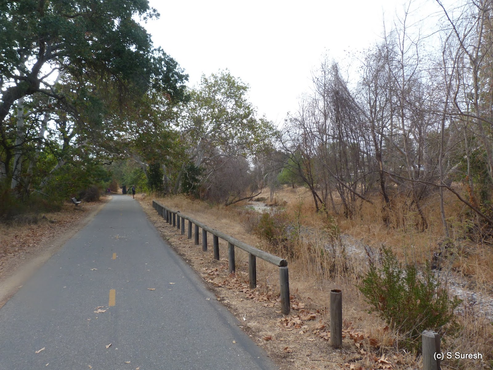
Our starting point, Almaden Lake Park, is a nice community park with lots of interesting facilities including a Bocce Ball Court. We walked little more than 1/4 mile by the Almaden Lake trail before connecting to Los Alamitos Creek (LAC) trail. LAC trail is paved, black-top trail running parallel to the creek. It also runs through several south San Jose residential neighborhood, so this is a well utilized trail with lots of bicyclists, joggers, walkers and dogs. 


There trail also doubles down as a fitness trail with more than 15 exercise stations. The scenery today was drab, the creek dry for most part and the foliage sporting a dull brown color. I do intend to check out this trail following the promised El Nino this winter. 


LAC trail has mile markers, with the zeroth mile just outside of Almaden Lake making it easy to track your hike. In addition, the multi-use trail has an exclusive equestrian path that is a dirt trail. On the way south, we went by the busy paved section. After Pfeiffer park, the trail crosses over to the west side of the creek, running by Camden Ave. 


Singer Park, turnaround point
It was quite impossible to make out that we passed by Pfeiffer park given how dry the vegetation was. There is a road crossing at Graystone Ln after which the trail winds close to Leland High School. Past the three mile mark, the trail reaches Singer park. We turned around at this point. 


Creekside equestrian path 
On the way back, we decided to take the equestrian path. From Singer park until the foot over bridge by Pfeiffer park, the equestrian path is a single track dirt trail running right by the creek amidst lots of trees and shade. After crossing the bridge, the equestrian path becomes a more exposed and much wider dirt trail, especially when it runs parallel to Pfeiffer Ranch Rd. 


The walk by the equestrian path provided a nice variation to our 6.4 mile walk today, although we didn't run into any horse riders. Apollo met plenty of dogs in our walk today. Located in an urban residential setting, this is a popular trail for dog owners.


And for those interested in a longer walk, LAC trail connects to Guadalupe River trail north of Almaden Lake which Apollo and I had hiked in March this year. And south of where we turned around at Singer park, the trail goes further down running on both sides of the Alamitos creek for about a mile.

More pictures from the walk today.
#Hiking #HikingWithDogs #LosAlamitosCreek #AlmadenLakePark

Sunday, August 23, 2015

Pleasanton Ridge Regional Park 2015-08-23

Pleasanton Ridge Regional Park is interesting in how it is laid out: more than 5200 acres spread pretty much north/south with just one staging area in Foothill Rd, off Hwy 680. The staging area, located in the south side of the park, can be reached by taking Calaveras Rd in Sunol (if traveling north) or Castlewood Dr (if traveling south).  In addition, the north and south sides are separated by Augustin Bernal Park belonging to the city of Pleasanton.  


Kilkare Canyon
We started our hike from Oak Tree Trail. A really wide fire road, Oak Tree Trail climbs steadily as it winds up the hills. About a mile and quarter later, Oak Tree Trail cuts Ridgeline Trail (marker #5). We continued on Oak Tree Trail, descending over the next 1/2 mile or so before it reached Thermalito Trail junction (marker #8). 


Thermalito Trail

We continued north on Thermalito Trail, turning right at marker #8. Thermalito trail provides great views of the Kilkare Canyon on the left and continues the climb up Pleasanton Ridge. It also provides some much needed shade when it runs parallel to Olive Grove Trail. We stayed little more than a mile and quarter in Thermalito Trail. 


Just after marker #13, there will be a pond on the left. The drought had left the pond nearly dry with a small strip of grass around it. It provided a unique photo opportunity to see this pond laid out like this. I am sure after the next winter rains, the scene would be dramatically different!


Ridgeline Trail
We turned around at marker #15 connecting to Ridgeline Trail. We had reached the highest point of our hike today as we continued south and a gentle descend by Ridgeline Trail that runs right on top of the Pleasanton Ridge. Ridgeline trail offers fantastic views of Sunol and Pleasanton and the Livermore hills on the left.


On the way back, we cut through Olive Grove Trail before continuing on Ridgeline Trail and reaching marker #5.  Woodlands Trail provided a variation from here to reach the staging area. Apollo had a field day yet again, being able to trot leash free for most of the hike. And my daughter Sanjana had joined me in the hike today, giving me a hand keeping Apollo on check as he did his best to explore the open spaces without control.


We did nearly 6 miles today, climbing little more than 1300 feet. With very little shade, this is an ideal spring time hike or cool summer morning hike. Except Woodlands trail, all others were multi-use, dirt trails that are quite wide.


More pictures from our hike today. 

With several more miles of hiking trails available in the north side, I expect to return to this park again.
#Hiking #HikingWithDogs #PleasantonRidgeRegionalPark #EBRPD #ThermalitoTrail #RidgelineTrail