Wednesday, July 8, 2015

Eaton Park, Big Canyon Park 2015-07-08

Eaton Park and Big Canyon Park in San Carlos, located off Hwy 280 & Edgewood Road on Brittan Ave, are more than merely neighborhood parks. Combining a hike in both of these parks can provide an interesting walk on rugged mountain terrain with some excellent views of the bay. I had intended to hike both parks on the same day, but as it turned out, I had to do them on two separate days. On both days, I parked on Brittan Ave right by the entrance to both parks. Combining these hikes together can make for a nice 6 mile loop with a decent cardio workout climbing some stairs and going uphill along the way.

Eaton Park 2015-07-03

Jaya and Jana joined us on the hike today. It turned out that we had a late start and it was a warm summer day, so we were able to explore Eaton Park and just a little of Big Canyon Park. Right opposite Big Canyon Park, there is a sign that points to Eaton Park. The trail can be reached by climbing a flight of stairs. Do familiarize yourself with the way the trails are laid out from the map by the stairs. 

The trails are not named. What we did today covered most of the trails in Eaton Park, starting from the Brittan Ave trail head. The dirt trails are single-track and shaded for the most part. We stayed left at the first fork, some 0.4 miles into the hike. At the second fork less than a quarter-mile from here, we turned right. The trail to the left will lead you to the Tramanto Dr trail head. 


Exploring further, we reached a spot with a sign board to the other three trail heads - by Brittan Ave, Loma Dr, and Eaton Ave. All these sections are all quite small and can be easily explored in one stretch.

We were back at the Brittan Ave trail head about an hour into the hike. We explored the park on the other side of the road briefly before deciding to call it a day as a group. Overall, we covered 3.2 miles at a leisurely pace in 1h:24m.

Few more pictures from Eaton Park hike.


Big Canyon Park 2015-07-08

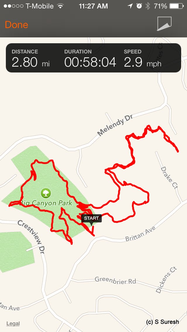
As with Eaton Park, the trails in Big Canyon Park are also not named. The terrain is quite similar to Eaton Park. As you walk in from Brittan Ave, you will notice two sign boards marking the start of the trails. Apollo and I started off hiking by the trail on our left.

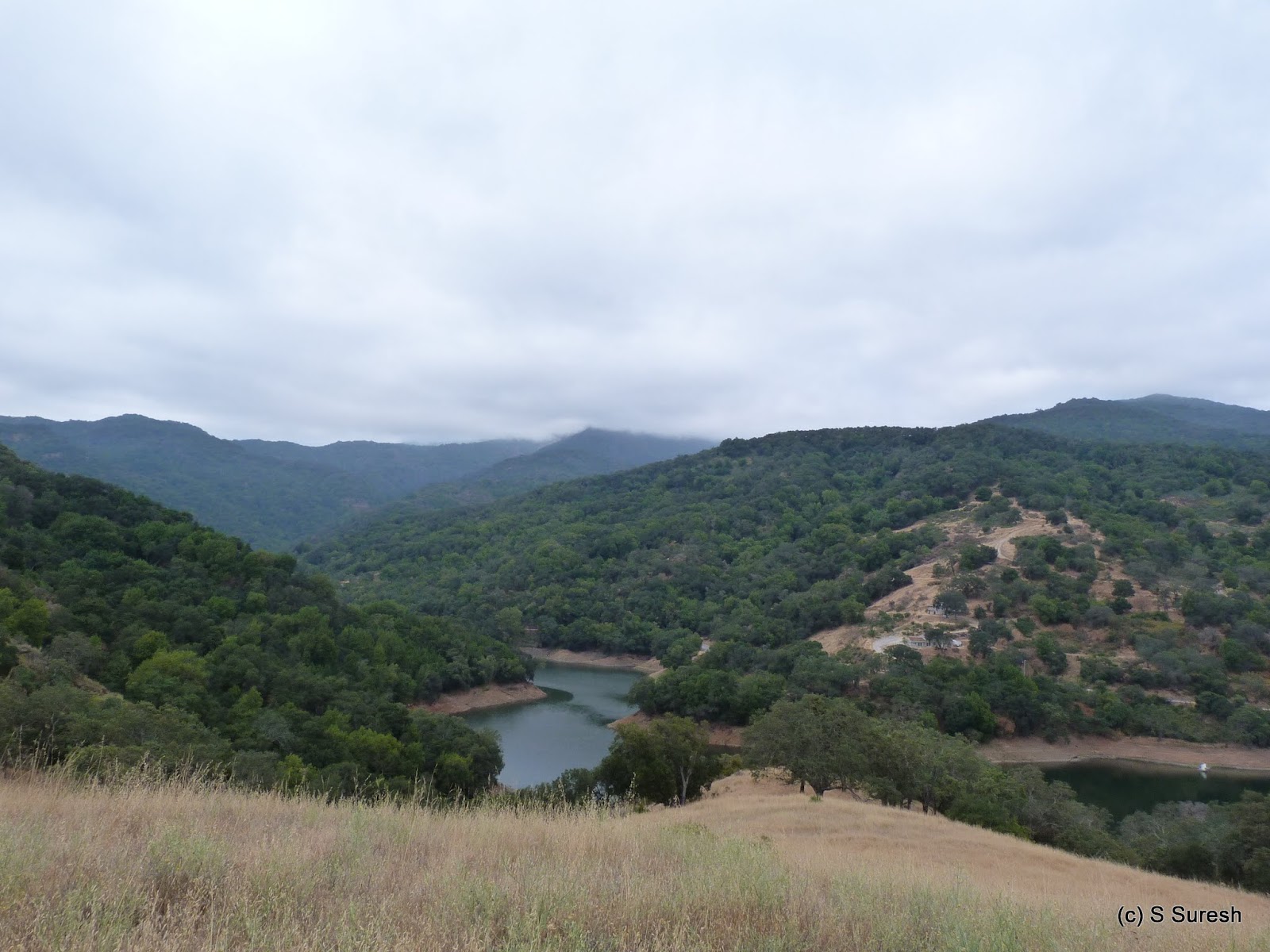
The first three-fourths of a mile or so involves climbing some 300 feet on a rugged, single-track dirt trail up the mountains. The well-shaded trail is quite picturesque with occasional but nice views of the gorges and the distant bay. A mile from the start, you will come up on a fork. If you take the one on the right, it will quickly loop you back to the start, making it a 1.5 mile loop at best.


We took the trail on the left and continued for another quarter-mile or so before reaching another fork. The one on the right has multiple steps. We again stayed to the left. This stretch goes through the mountains and crosses a water drain with a narrow, ladder-like steps. About 0.4 miles from the second fork, this trail ends.

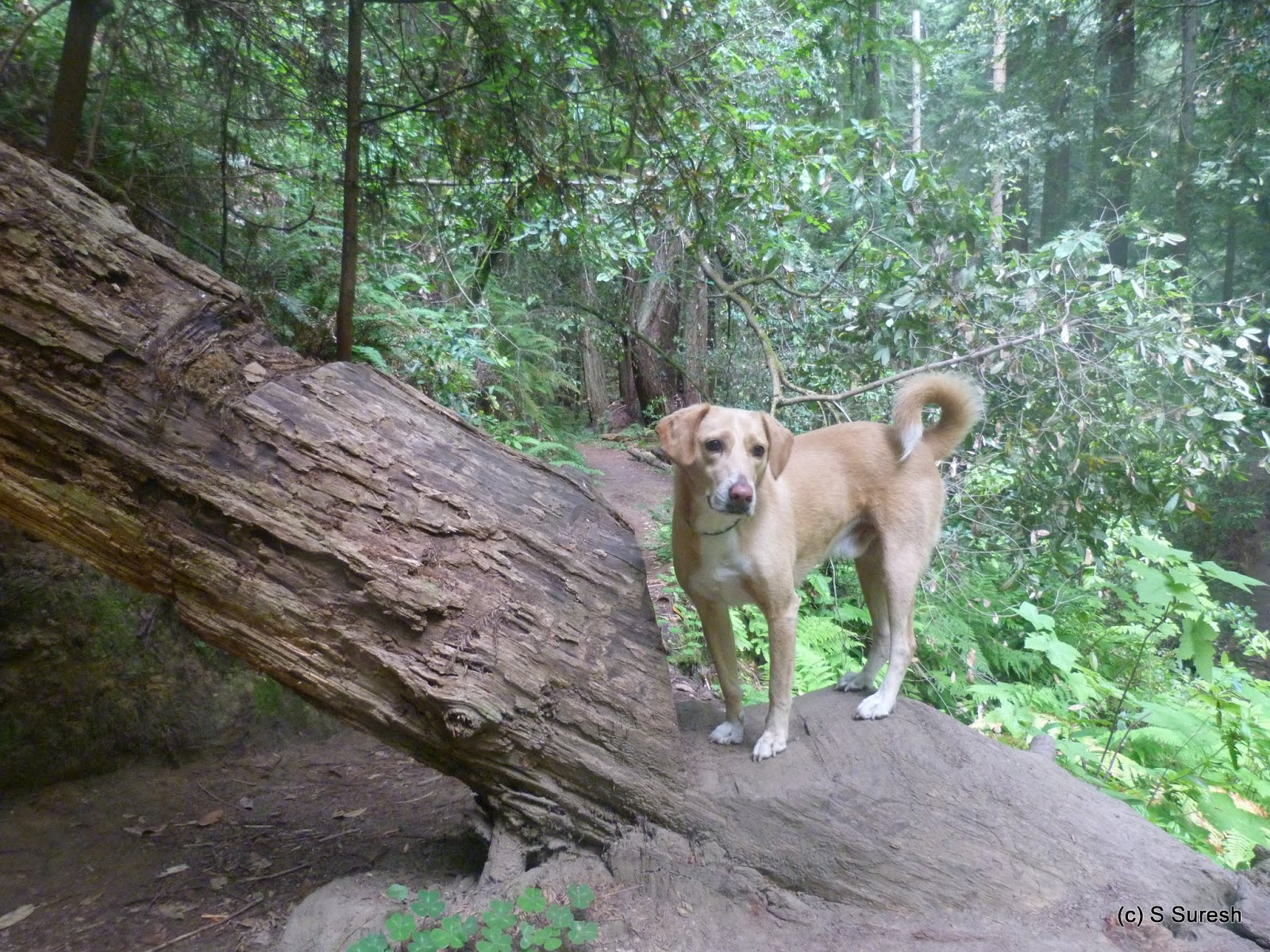
Apollo and I turned back and when we reached the second fork, took the steps down. In a short while, this trail will run by Brittan Ave and lead you to the trail head and complete a nice loop. All told, this was a 2.8 mile hike which we completed in less than an hour.


Some more pictures from Big Canyon Park hike.

#Hiking #HikingWithDogs #EatonPark #BigCanyonPark


Tuesday, July 7, 2015

Almaden Quicksilver County Park 2015-07-07

Webb Canyon Rd
This is our fourth visit to the Almaden Quicksilver County Park starting from a different location. The entrance by Webb Canyon Rd is the smallest by far and has street parking by the gate. Webb Canyon Rd entrance is located off Almaden Expwy / Trinidad Ave / Elwood Rd. 
Webb Canyon Trail


My plan was to cover some more of the 34+ miles of trails in this huge park. The loop I'd decided to hike today was Webb Canyon Trail -> New Almaden Trail -> Prospect #3 -> Randol Trail -> Mine Hill Trail -> Cinnabar Trail -> New Almaden Trail -> Webb Canyon Trail

A short walk involving a gentle climb by Webb Canyon Rd past the gate took us to Webb Canyon Trail. From here, we took the single-track dirt trail to reach the intersection of the now very familiar New Almaden Trail. Taking a left here, Apollo and I walked the 1.3 mile stretch to Prospect #3 Trail. As always, Apollo was happy to pose for photographs at my bidding and close to the Prospect #3 Trailjunction, I asked him to check out a tree bark. He surprised me by jumping straight up for one of the best shots I have of my boy! I am suspecting that he must have some cat and goat genes in him to do the tree and rock climbing he has demonstrated!
Randol Trail

A short quarter-mile stretch but 400+ feet climb by Prospect #3 took us to the Randol Trail intersection. We had hiked this section of Prospect #3 when we hiked this park for the first time on March 2nd. Unlike the single-track New Almaden Trail, Randol Trail is a wide fire road but still had lot of shade. The scenery was quite interesting. It almost felt like fall, with vivid colors and dry grass. Unfortunately, it wasn't fall and I suspect these are just the colors of the California drought!

Sierra Azul, Guadalupe Reservoir

A pleasant 1.5 mile walk on Randol Trail got us to Mine Hill Trail, right by Guadalupe Reservoir. The neighboring Sierra Azul Preserve was covered with clouds at the mountain top, providing a great view. And the weather was near perfect - high 60s/low 70s, cloudy and cool with a gentle breeze, making this hike that much more enjoyable. 

New Almaden Trail

A short stretch by Mine Hill and Cinnabar Trail - we'd done this short stretch on our third hike at the park on June 10th. I should have mentioned this before, but at 0.1 mile length, Cinnabar Trail is the shortest named trail I've hiked! Turning right at New Almaden Trail, we made our way back to Webb Canyon Trail and to the park entrance.

We did the 5.8 mile hike today in just less than 2 hours. Including the Prospect #3 ascent, we ended up climbing some 750+ feet. I suspect with one more trip, we would've hiked every trail of this park, if not every single mile of it.

More pictures from the hike today.
#Hiking #HikingWithDogs #AlmadenQuickSilverPark #AlmadenQuickSilverCountyPark


Sunday, July 5, 2015

Land of Medicine Buddha, Forest of Nisene Marks 2015-07-05

We celebrated America's 239th Independence Day with a retreat to the Land of Medicine Buddha in Soquel, next to Santa Cruz. The 100 acre property borders the huge Forest of Nisene Marks State Park and provides several hiking opportunities, in addition to being a place of spiritual retreat. LMB is located at 5800 Prescott Rd, Soquel, CA and is not hard to reach if you follow the navigation directions. There is plenty of parking for overnight guests inside the campus and enough parking for day guests outside. You can pick up a map of the property and trails from the reception.


Walking inside the hilly campus will provide a nice workout as you explore the various places of interest there. Up a hill from the parking lot area is the Ksitigarbha Garden. Further ahead is the Wish-fulfillment Temple. On July 4th, we did the 1.2 mile Eight Verses Trail together as a family, with the promise of a special dog blessing. The trail head for the Eight Verses Trail is located between the Ksitigarbha Garden and the Temple and clearly marked. It is best completed as a clockwise loop.


8 verses trail
We also hiked the 2 mile loop walking counter-clockwise, and a part of it is shared with the Eight Verses Trail. To complete this loop, you will leave the LMB property and enter the enchanted forests belonging to the Forests of Nisene Marks State Park.
2 mile loop

The first portion of the hike is through tall redwood trees and is absolutely breathtaking. It was afternoon and sunny when when we started the hike. Inside the forest, there were several stretches with thick shade to keep the sun and heat at bay.


More than a mile into the walk, you will come to the "prayer flags" location. Turn left here to head back to LMB property; the 2 mile loop ends just by the stupa that is currently under construction.


There is also a beautiful 6+ mile loop with much of the trail inside the Forest of Nisene Marks. I didn't want to miss the opportunity to hike that with Apollo. On the 5th, the two of us hit the trail bright and early at 6 am. We did the 6 mile loop in a counter-clockwise direction, a portion of which was a repeat from the 2 mile loop. 


Prayer Flag
Instead of turning left at the "prayer flags," we turned right and headed deeper into the forest. The dirt trail is well-maintained, although there are no markers or signs. If you study the map carefully and heed its cautionary notes, you cannot go wrong.


Forest of Nisene Marks
I must admit hiking this trail for two hours in the morning with the sun barely out was a surreal experience. One of those rare moments when I could actually listen to the sound of silence! The wide dirt trail will become a narrow, single-track trail through the forests, predominantly through redwood trees. More than 3 miles into the hike, you will find a T-junction. Do not take the trail to the right - it leads you to Aptos. Go straight - there are some LMB flags and directions to the campus attached to the redwood tree here. 


Bates Creek crossing
From this point, the trail gently gives up the ~700 feet you'd have gained until now. The trail then zig-zags its way through the forests until it crosses the Bates Creek. With barely a trickle of water in it, it wasn't a problem getting across, although I suspect that crossing the creek after rains would result in wet feet. 


After this crossing, the trail pretty much runs parallel to the creek on your right. At multiple places, I found huge trees fallen down across the trail requiring you to either jump over or crawl beneath to get across. There are also several opportunities to get closer to the creek in this stretch, should you feel adventurous enough to do it.


The trail ends at Prescott Rd, just by the LMB campus, before the bridge that runs across the creek. There is a short stretch that can be slightly tricky, when the narrow trail runs by the slope with tight footing just before the trail ends. Surprisingly, it started raining lightly and for a while, I wasn't even sure if it was rain or just heavy mist and early morning dew that we experienced all along the hike.


More pictures from the hikes.
#Hiking #HikingWithDogs #LandOfMedicineBuddha #ForestOfNiseneMarks #RedwoodHikes

Thursday, July 2, 2015

Thornewood Open Space Preserve 2015-07-02

Thornewood Open Space Preserve is one of the smaller Midpeninsula Regional Open Space District preserves. Apollo and I barely managed 4 miles today in this compact preserve off Hwy 84 (La Honda Road) in Woodside. Like the previous MROSD preserve we hiked at, Coal Creek Open Space Preserve, Thornewood is also easy to miss. The entrance to the preserve from the winding La Honda Rd is about 1.5 miles from the Portola Rd intersection. The entrance is marked by a red brick wall with a 0.1-mile paved blacktop road leading you to the parking lot.


Schilling Lake Trail
This may be a small preserve, but don't let that stop you from visiting this beautiful place. From the parking lot, the only option is to take the Schilling Lake Trail. Three-quarters of a mile of the winding, single-track trail will take you to Schilling Lake, an eco-sensitive pond. Be warned, though - the pond is covered with algae and does not make a fine sight!


Bridle Trail
From there, we headed back and turned right onto Bridle Trail. Bridle Trail is also three-quarters of a mile long, descending some 500 feet before it reaches Martin Creek. This is a magnificent segment, winding down through a forest of majestic redwood trees. 


Old La Honda Rd entrance

I happened to meet another ranger and had another great conversation about open spaces managed by MROSD. Every time I've conversed with a ranger, I've learned something new. The ranger mentioned that there is an unofficial trail that runs by the creek to Schilling Lake. And that it is all right for hikers to use it and explore the preserve! 


Trail by Martin Creek
From where Bridle Trail meets the creek, the trail goes forward another quarter mile or so to Old La Honda Road where there is space to park a few cars and enter this preserve. On the way back, I took the ranger's suggestion and went by the unofficial trail by the creek. It was remarkably scenic and very rugged. There were probably half a dozen places where trees had fallen and we had to either jump over or crawl under narrow gaps. At couple of spots, it made sense for Apollo to go under the fallen trees while I had to jump over.

Schilling Lake


Taking this road less traveled got us back to Schilling Lake and created a loop instead of an out and back hike on Bridle Trail.


It was another warm summer day, but we didn't feel a thing in this heavily wooded preserve. From Schilling Lake, we retraced our steps back by the Schilling Lake Trail to the parking lot. Our 3.7 mile hike took us about an hour and ten minutes. 

More pictures from our hike today.
#Hiking #HikingWithDogs #ThornewoodOpenSpacePreserve #SchillingLake #MROSD


Saturday, June 27, 2015

Coal Creek Open Space Preserve 2015-06-27

Coal Creek is the sixth Midpeninsula Regional Open Space District (MROSD) preserve we've hiked, the other five being Pulgas Ridge, Windy Hill, Fremont Older, St. Joseph's Hill and Sierra Azul. A compact preserve offering about 5 miles of trails, Coal Creek Open Preserve is located off Skyline Blvd, about a mile north of the Skyline Blvd & Page Mill Rd. 
Skyline Blvd entrance


It is very easy to miss the preserve entrance! My recommendation is to park in the vista point parking lot and start your hike from Cloud's Rest Trail. We parked a little ahead, close to 20000 Skyline Blvd, near Crazy Pete's Rd. 

Crazy Pete's Rd trail

Passing by a handful of private residences, about a half mile walk by Crazy Pete's Rd will get you to Gate CC05 and into the preserve. We continued straight ahead on the trail until we reached Alpine Rd. The nearly one-mile stretch single-track trail to Alpine Rd is through a heavily wooded area that offers plenty of shade.

Alpine Rd - Mtn bike hwy!

Alpine Rd is right at the boundary of the preserve - and it felt very much like a mountain bike highway! We had several bikers cross us in both directions in this narrow dirt road through the hills. 
We turned right onto Meadow Trail after about three-fourths of a mile on Alpine Rd. As with all other trails in this preserve, this is also a narrow dirt trail through the woods for a while before it opened up for some great views towards the west. Meadow Trail meets Cloud's Rest Trail. Turning left would have taken us to Skyline Blvd near the vista point parking lot. We turned right to Alpine Rd and retraced a small portion of our walk earlier.


On the return, we took the slightly longer Coal Road to the entrance at gate CC05. On this stretch, I got to meet a ranger and engage in a great conversation about the preserves, specifically their policy around dog friendliness while my daughter, Sanjana, attended to Apollo. Another half mile walk by Crazy Pete's Rd got us back to Skyline Rd where we'd parked the car.


The 5 mile hike through the preserve took us nearly an hour and forty five minutes involving a couple of descents and climbs. It isn't too strenuous, with probably about 900 feet of gentle climbing overall.

More pictures from our hike today.
#Hiking #HikingWithDogs #CoalCreekOpenPreserve #MROSD


Thursday, June 25, 2015

Union Pacific Railroad Trail 2015-06-25

We were back at the Union Pacific Railroad in Cupertino, essentially picking up from where we left off when we hiked Joe's Trail at Saratoga de Anza earlier this month. I had an early start to complete the hike before it got too hot on what promised to be another near 100F summer day. I parked on Prospect Road near the Stelling Rd intersection, just past the tracks. 


This section of the Union Pacific Railroad runs through Cupertino's residential neighborhood by Stelling Road initially and cuts across Seven Springs Pkwy, Rainbow Dr, McClellan Rd, Bubb Rd and Steven Creeks Blvd. Google Map marks the segment between Rainbow Dr and McClellan Rd as the Union Pacific Trail, although the entire segment I did today is an unofficial trail used typically by folks living in the neighborhood. To my understanding, Cupertino is evaluating constructing a formal trail connecting to Joe's Trail at Saratoga de Anza and beyond - essentially linking Steven Creeks Trail to Los Gatos Creek Trail.


Around the one-mile marker from Prospect Rd, you will cross Regnart Creek and observe a huge oak tree with a tree house and branches running across the creek. On our way back, we used this spot to rest and let Apollo cool off a bit.


Dry pond behind Apollo
The trail runs by a groundwater recharge pond near McClellan Rd. As a stark reminder of our drought, this pond was bone dry today! 

McClellan Rd, Bubb Rd, and Stevens Creek Blvd are busy roads. If you don't want to dart across, it is easy to use a pedestrian crosswalk round the corner to safely get to the other side of the road. 


Sidney and Apollo
Just when I was thinking that this was likely to be somewhat of an uninteresting hike, we met Sidney. Apollo and Sidney hit it off well and Sidney got Apollo to chase him as they ran happily at break neck speeds by the tracks! 


All the way from Prospect Rd until Stevens Creek Blvd, there was a steady stream of joggers, dog walkers and bikers sharing this unofficial multi-use trail! 

North of Stevens Creek Blvd, the traffic was much lighter. We went as far as Hwy 280, which is when the railroad curves around and starts running parallel to 280, a little more than 3 miles from Prospect Rd. 


Our 6.2 mile out and back hike took about an hour and forty five minutes. The map you see by the side recorded the hike until Regnart Creek on the way back, where we took a water break. 

Anyone who loves railroads should check this out. If you combine it with Joe's Trail, you can make this a nearly 12 mile out and back hike by the railroad.

More pictures from the hike today.
#Hiking #HikingWithDogs #UnionPacificRailroadTrail #UnionPacificTrail


Tuesday, June 23, 2015

Sunol Regional Wilderness (Little Yosemite) 2015-06-23

Sunol Regional Wilderness, managed by East Bay Regional Parks District, is an amazing park with scenic trails and gorgeous views. The park can be accessed by taking Calaveras Blvd off Hwy 680 in Sunol (not Milpitas) and turning left onto Geary Rd in about four miles. There is a fee to park on weekends. We used the first parking lot on the left as we entered the park, where the visitor's center is located. There are several other parking lots situated throughout the park.

With several available trails, I'd decided to keep our hike to about 5 miles and check out Little Yosemite. We started at the Indian Joe Nature Trail. The trail head can be reached by crossing over Alameda Creek on a foot bridge. Alameda Creek still had a trickle of water flowing through it. 


Running parallel to the creek, Indian Joe Trail is somewhat shaded. A little ahead, this trail connects to Canyon View Trail. The walk on Canyon View Trail offered some breathtaking views of the canyon on the right as it slowly weaved through the mountains.


I was lucky enough to photograph a Turkey Vulture soaring high in this stretch of the trail. Even though the park was open for grazing, the cattle we came across today were staying in the shade rather than venturing out by the dry hills.


After crossing McCorkle Trail to reach Little Yosemite, we turned right onto Cerro Este Road. Little Yosemite is a cool spot, popular with adventure seekers who climb the huge rocks and boulders right in Alameda Creek. Apollo - the eternal adventure seeker - and I slowly made our way to the gorge and the creek. Even if you don't feel comfortable making the descent, this is an excellent spot to include in your Sunol Wilderness hike route.


After a water break, we headed back up Cerro Este Road. Over the next mile, we climbed some 600 feet and turned left onto McCorkle Trail. While Cerro Este Road is a fire road with very little shade, McCorkle Trail provides some relief from the sun.

We connected back to Canyon View Trail and retraced our steps on Indian Joe Nature Trail to reach the parking lot just as the temperature was getting to the low 80s and making the hike a bit uncomfortable, especially for Apollo. We could've done more, but an earlier start or a cooler day would have made it easier.

Our 5 mile hike today took less than two hours - one of our slower outings even though we only had to climb up a little more than 1000 feet in two stretches. With plenty more trails, we'll definitely be back at Sunol Wilderness a few more times. 

Serious hikers can trek the Ohlone Wilderness Trail between Mission Peak Preserve and Sunol Wilderness or between Sunol Wilderness and Del Valle Regional Park. Both require permits and will probably take the better part of the day to complete just one way.

More pictures from our hike today.
#Hiking #HikingWithDogs #SunolRegionalWilderness #LittleYosemite #EBRPD