Sunday, August 23, 2015

Pleasanton Ridge Regional Park 2015-08-23

Pleasanton Ridge Regional Park is interesting in how it is laid out: more than 5200 acres spread pretty much north/south with just one staging area in Foothill Rd, off Hwy 680. The staging area, located in the south side of the park, can be reached by taking Calaveras Rd in Sunol (if traveling north) or Castlewood Dr (if traveling south).  In addition, the north and south sides are separated by Augustin Bernal Park belonging to the city of Pleasanton.  


Kilkare Canyon
We started our hike from Oak Tree Trail. A really wide fire road, Oak Tree Trail climbs steadily as it winds up the hills. About a mile and quarter later, Oak Tree Trail cuts Ridgeline Trail (marker #5). We continued on Oak Tree Trail, descending over the next 1/2 mile or so before it reached Thermalito Trail junction (marker #8). 


Thermalito Trail

We continued north on Thermalito Trail, turning right at marker #8. Thermalito trail provides great views of the Kilkare Canyon on the left and continues the climb up Pleasanton Ridge. It also provides some much needed shade when it runs parallel to Olive Grove Trail. We stayed little more than a mile and quarter in Thermalito Trail. 


Just after marker #13, there will be a pond on the left. The drought had left the pond nearly dry with a small strip of grass around it. It provided a unique photo opportunity to see this pond laid out like this. I am sure after the next winter rains, the scene would be dramatically different!


Ridgeline Trail
We turned around at marker #15 connecting to Ridgeline Trail. We had reached the highest point of our hike today as we continued south and a gentle descend by Ridgeline Trail that runs right on top of the Pleasanton Ridge. Ridgeline trail offers fantastic views of Sunol and Pleasanton and the Livermore hills on the left.


On the way back, we cut through Olive Grove Trail before continuing on Ridgeline Trail and reaching marker #5.  Woodlands Trail provided a variation from here to reach the staging area. Apollo had a field day yet again, being able to trot leash free for most of the hike. And my daughter Sanjana had joined me in the hike today, giving me a hand keeping Apollo on check as he did his best to explore the open spaces without control.


We did nearly 6 miles today, climbing little more than 1300 feet. With very little shade, this is an ideal spring time hike or cool summer morning hike. Except Woodlands trail, all others were multi-use, dirt trails that are quite wide.


More pictures from our hike today. 

With several more miles of hiking trails available in the north side, I expect to return to this park again.
#Hiking #HikingWithDogs #PleasantonRidgeRegionalPark #EBRPD #ThermalitoTrail #RidgelineTrail

Friday, August 21, 2015

Sunol Regional Wilderness 2015-08-21

We were back at Sunol Regional Wilderness for the third time, our previous visits were to Little Yosemite area and Maguire Peak. We used the same staging area that we did for Little Yosemite, parking by the Visitor Center on Geary Rd (off Hwy 680 / Calaveras Rd).

My intent was to hike the Flag Hill trail and more today. From the parking lot, after crossing over the bridge, we turned left walking along Alameda creek. The junction for the trail showed up quickly enough, but there was a trail going ahead that wasn’t marked in the map. Curiosity got the better of me and I took that trail. It led to a gate demarking cattle grazing area with a scenic spot by the creek on the other side. We spent some time exploring the spot and started walking by the creek.

I knew this wasn’t a formal trail. But the walk by the creek was shaded and inviting. A very young calf stopped nursing as we approached it; with the cow and the calf giving us a cautious look, we went past them. I saw a rough dirt road come up on our right and continued on it. While it wasn’t a mapped trail, this road opened up to a nice large hillside that wasn’t difficult to climb.

I suspect that Flag Hill was on our left as we made our way through the hillside. Before long, I realized that we’d walked more than 2 miles into the cattle grazing wilderness area. Along the way, in addition to cattle grazing, we also saw deer in the open and they ran away as soon as they realized they had company.

Turnaround point
I presumably could’ve continued ahead with the hope of catching one of the named trails. But the terrain became somewhat steep and more wooded that I decided not to continue the wilderness exploration any longer. With no map and cell phone coverage, I essentially used few landmarks I’d memorized to retrace our step cross checking with the GPS map that Sports Tracker utility drew along the way.

Apollo was off leash much of this walk, thanks to the dog friendly rules in EBPRD. By the time we were back on Flag Hill trail, we’d already hiked 4.5+ miles, so I decided to wrap the walk with the Shady Glen trail loop.  Shady Glen is a single track dirt trail little more than ½ mile long. It connects to Hayward Rd and loops back to the trail head by the Visitor Center.

Going off trails is not recommended in general and discouraged/prohibited in certain parks. What we did though was use reasonably well-formed trails in the cattle grazing hillside. Our unplanned 5.3 mile excursion in the wilderness was absolutely enjoyable and will probably work for those with a sense of adventure.

More pictures from our hike.
#Hiking #HikingWithDogs #SunolWilderness #SunolRegionalWilderness #ShadyGlenTrail #EBRPD


Tuesday, August 18, 2015

Sanborn County Park (Skyline Trail) 2015-08-18

Sanborn County Park is located in the city of Saratoga. Apollo and I hiked the Skyline Trail that runs by the Skyline Blvd. I'd parked at the Indian Rock entrance that is directly across Castle Rock State Park on Hwy 35 / Skyline Blvd 2.5 miles south of its junction with Hwy 9 from Saratoga.


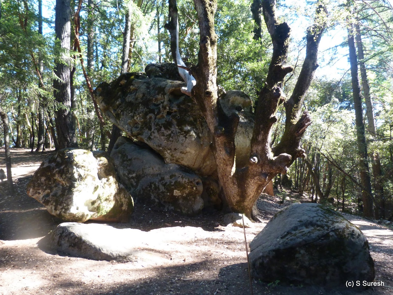
Right at this entrance, there is a short loop around various rock formations in Indian Rock area. Set amidst coast redwood, madrone and oak, the unusual rock formations were quite something. Sometimes, the rocks and trees were so close to each other that it would seem like the trees and rocks were fused together! You will find one such unusual rock/tree near the Indian Rock entrance. 


Apollo was eager to check out as many of them as possible, showing no hesitation if I encouraged him to climb some rocks that were easy and safe. 


We took the Skyline Trail, traveling south. The trail is set on a ridge, is fairly level with occasional gentle grade. The trail winds parallel to Skyline Blvd and has more access points from Skyline Blvd. It was a warm summer day; yet, the trail was completely shaded making it an easy morning hike. 

We walked until the Sanborn trail junction, nearly 2 miles from where we started and turned around. The sign said dogs are not allowed in Sanborn trail. Given how warm it was going to get, I decided not to go into the newly opened John Nicholas trail today. Instead, I decided to go north of the where we started to check out Summit rock. 


We made our way back to the entrance and continued north on Skyline Trail. Unfortunately, dogs are not allowed on the Summit loop trail; nor are they allowed 1/2 a mile north of the Indian Rock entrance. We had to turn around and make our way to the trail head. 


Still, this was a respectable 5 mile hike which we completed in about 100 minutes. Sanborn park has several more miles of trails, and I intend to check out more of it over time. And the next time, I will definitely have a bug repellent - this hike takes the honors for "bugging" me the most!

More pictures from our hike today.
#Hiking #HikingWithDogs #SanbornCountyPark #SanbornPark #SkylineTrail #IndianRock

Friday, August 14, 2015

Shoreline Area, Mountain View, 2015-08-14

Apollo and I  hiked the Stevens Creek Trail in June, but we had turned around at Hwy 101. There is a portion of this trail north of 101 that allows dogs. Picking up from the trail head located at the end of La Avenida St. in Mountain View (off Shoreline Rd), Apollo & I improvised an interesting hike today.


Dogs are allowed on Stevens Creek Trail only until Crittenden Ln. This stretch of the trail is a paved, multi-use segment shared by cyclists and pedestrians. Built on a levee and running by the Stevens Creek, this is a busy trail on weekends and weekdays alike. A cloudy and cool start to the day made it easy for us to jog portions of our hike.


We turned left onto Crittenden Ln from the trail. The half-mile stretch on this road runs by Google office buildings initially before coming up on an open stretch of hillside, part of the Shoreline Nature Habitat. There is a dirt trail system in the hills, but dogs are not allowed in there.


I turned right on Shoreline Rd. A quarter-mile walk will get you to  Shoreline Park. While dogs are not allowed in the park, there is a dog park right by the entrance to Shoreline Park. It is one of the cleanest dog parks I've seen. It wasn't crowded when we went there, but there were a couple of dogs with whom Apollo had a field day playing chase.


From here, we walked back on Shoreline Rd towards the city, with Shoreline Amphitheater on our right. There is a fitness circuit trail on the left which can be accessed from Shoreline Rd as well as Charleston Rd. Apollo and I did a portion of the trail before heading back on Shoreline Rd.


We completed the loop to the La Avenida trailhead walking by the Computer History Museum, making it a 3.8 mile hike. This is a completely flat and easy loop that includes the Stevens Creek Trail, Shoreline Dog Park, and a walk by Google office buildings amidst the tree-lined Shoreline Rd. 

Few more pictures from our hike today.
#Hiking #HikingWithDogs #StevensCreekTrail #ShorelineDogPark


Update 2015-08-19

Apollo and I repeated this hike with couple of minor variations. From La Avenida trailhead, it is possible to hike right by the creek as opposed to the paved blacktop road on top of the levee. The gravel trail is at the same level Stevens Creek is at. It is preferred by some joggers and has the advantage of lighter traffic, especially as there are no bicycles.


The second variation we tried today was to skip the dog park and do the fitness circuit trail completely. The 1 mile fitness trail is a loop with entry possible from Shoreline Rd and Charleston Rd. I tried my hand at some of the exercise spots with Apollo paying disinterested attention to what I was doing!

I've also augmented the album with a handful of photographs from our 3.9 mile walk today.
#Hiking #HikingWithDogs #StevensCreekTrail #FitnessTrail

Tuesday, August 11, 2015

Villa Montalvo County Park 2015-08-11

Situated behind the prestigious Montalvo Art Center and Villa Montalvo, this Santa Clara County Park is a hidden gem. Located at 15400 Montalvo Rd, the park can be accessed by taking Montalvo Rd off Hwy 9 (Los Gatos - Saratoga Rd) in the city of Saratoga. Hikers are required to use Parking Lot #4, which is large and can easily accommodate some ~25 cars.


Apollo and I started off hiking the Lookout Trail from the parking lot. We kept left at the first few intersections to stay on the Lookout Trail and reach Lookout Point a little more than three-fourths of a mile from the trail head. The single-track dirt trail steadily winds up the hills and soon enters a dense redwood forest. The nearly 500-foot climb takes you to Lookout Point, which offers panoramic views of the hills and valley, the city of Saratoga, and the Bay Area.


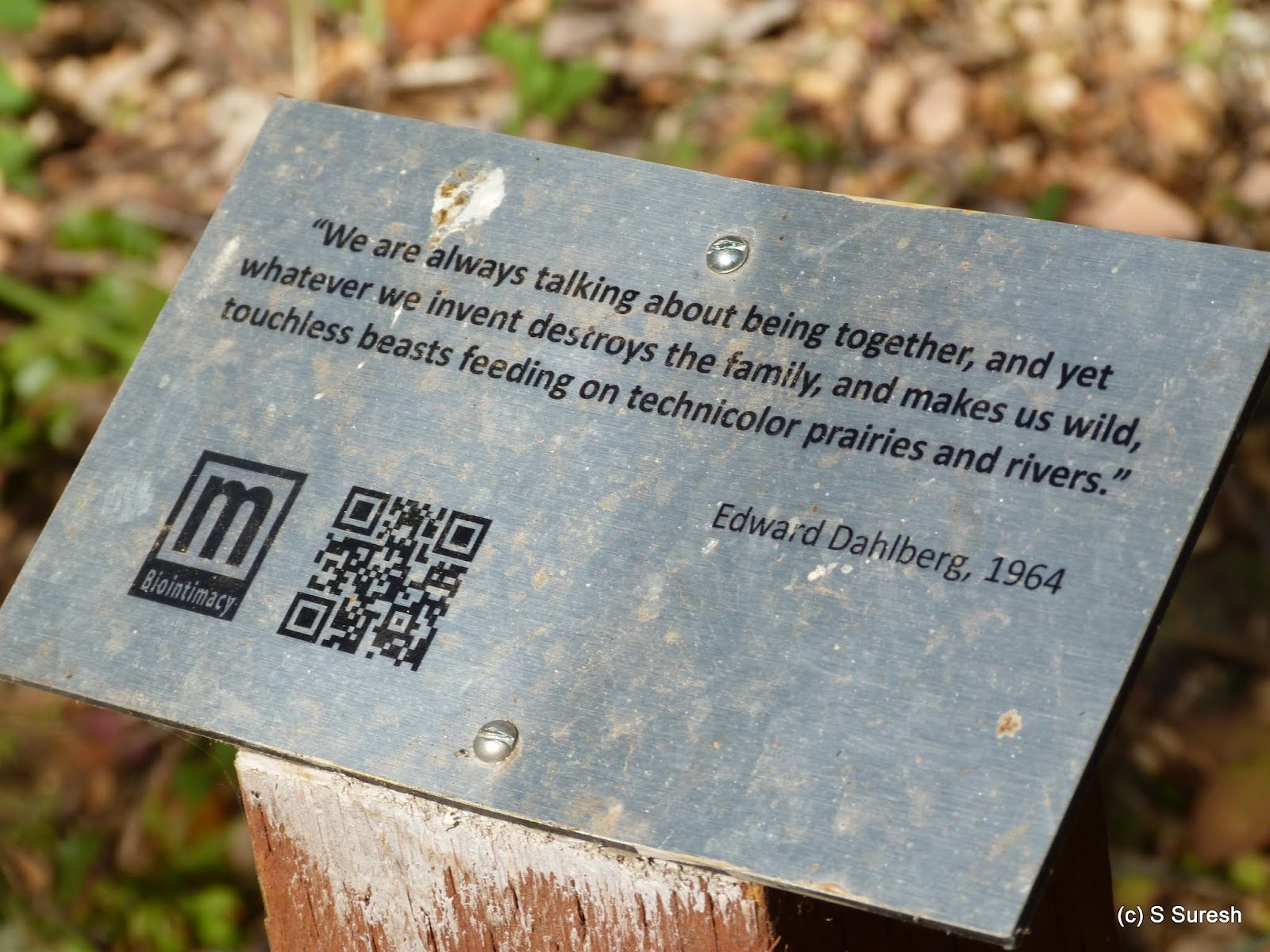
The park has several short, named trails. On the way down from Lookout Point, we kept left on Lookout Trail to reach the Orchard Trail loop. The North and South Orchard Trails offer a shaded walk through redwood, oak and pine trees with several interesting quotes interspersed along the trails. 


After doing portions of the Orchard Trail loop, we spent some more time hiking the Creek Trail and Redwood Trail forming a nice long loop that ends in Lookout Trail. Along the way, we also got to see an interesting piece of art, called the Nest, by Steven Siegel in 2005. The Nest is essentially made of newspapers containing news items following Hurricane Katrina, with much of the paper coming from the local San Jose Mercury News.


As always, Apollo had a field day posing with a bust of John Muir, sitting on a chair and a tree that had fallen on the trail. 


The 3.2 mile hike involved climbing nearly 800+ feet. Much of the hike is completely shaded and a perfect spot for a summer outing. 

More pictures from our hike today.
#Hiking #HikingWithDogs #VillaMontalvoCountyPark 


Update 2015-08-13


I kicked off my birthday with a hike again at Villa Montalvo, this time with my daughter Sanjana and my faithful Apollo. We made our way to Lookout Point, from where the view was brighter on what was a much clearer beginning to the day. 


We continued to the west side of the park, taking Lookout Trail. As I mentioned earlier, there are lot of short, named trails in this park. I focused today on portions of N Orchard Trail and Redwood Trail that I didn't do earlier. And we wrapped up the hike by joining Lookout Trail and making our way back to the trail head at parking lot 4.


We covered exactly 3 miles today, but at a much brisker pace. Not having to slow down to take photographs and document the hike in detail certainly helped to speed up the hike at this beautiful location. 

#Hiking #HikingWithDogs #VillaMontalvoCountyPark #LookoutPoint


Sunday, August 9, 2015

Long Ridge Open Space Preserve 2015-08-09

This is the shortest hike we've done, yet the location is nice enough that I decided to do post a blog entry. Long Ridge Open Space Preserve belongs to Midpeninsula Regional Open Space District (MROSD). The dog friendly segment of this preserve can be accessed by parking in the Grizzly Flat parking area off Skyline Blvd (Hwy 35), 3.3 miles north of the Hwy 9 intersection. The same parking area doubles as the lot for trails in the Upper Stevens Creek Park, where dogs are not allowed. 


Apollo and I started the hike at Peters Creek Trail, a 0.4 mile segment that ends at the Bay Ridge Trail. Peters Creek Trail is a single-track dirt trail through the woods with some views of the hillside and forests of Lone Ridge. 


Dogs are only allowed on the north side of Ridge Trail. The 0.7 mile segment will take you to the intersection of Portola Heights Rd and Skyline Blvd. Also a single-track dirt trail, this segment is slightly more exposed, but we were hiking quite early in the morning and were covered by the shadows of the hills. 

While Long Ridge has several more miles of trails, only this one-mile segment is open to dogs. We retraced our steps back by Ridge Trail and Peters Creek Trail to the Grizzly Flat parking area, making this a little more than a two-mile hike. 


It's a shame that more MROSD preserves aren't open for hiking with dogs. Having talked to couple of rangers during my hikes to Thornwood and Coal Creek Open Preserves, I appreciate the thought process that goes into restricting preserves from dogs. That said, I feel Long Ridge can certainly open more trails for hiking with dogs and I intend to approach MROSD with the suggestion.


Few more pictures from the hike today.
#Hiking #HikingWithDogs #LongRidgeOpenSpacePreserve #MROSD

Thursday, August 6, 2015

Pillar Point Bluff 2015-08-06

Hiking by the Pacific Coast is a fine choice for any day and absolutely perfect on a summer morning. The coast is typically 10-15 degrees cooler than inland. We went to the Pillar Point area on Moss Beach to take advantage of that weather. Parking is available at the end of West Point Ave, accessible from Capistrano Rd or Cypress Ave from Hwy 1, about 6 miles north of Half Moon Bay - although I parked off street at the end of Princeton Ave / W Point Ave.


We started our walk in the beach overlooking Pillar Point Harbor. A short walk got us to the trail that goes towards Maverick's Beach from the West Shoreline Access parking lot. The walk to the beach is about three-quarters of a mile. Depending upon the tide, you may be able to walk on the beach, wading in the water. 


Maverick's Beach is an impressive spot. With huge cliffs on one side and the majestic ocean on the other with dangerous rocks, the location was absolutely astounding. Maverick's Beach is a destination for big-wave surfers and the famous invite-only surfing contest. 


We headed back to the parking lot at the end of W Point Ave. Crossing over the street, there is a short paved road that leads you to the trails on top of the cliffs and to Pillar Point Bluff. Once you reach the top, you will have the option of walking a trail that hugs the precipice and the ocean or others that are slightly inland.


Whatever you choose to do, the views of the ocean, the beach, and the rocks from the top of the cliff are simply breathtaking. I would advise caution when walking here, especially with your dog. Be sure-footed and stay at a safe distance from the edge.


After a short while, the trail goes more inland and eventually ends at the intersection of Ocean Blvd and Bernal Ave. There is a second entrance to this area from Bernal Ave which has more information about the Pillar Point Bluff area. The trails that run on top are named in honor of Jean Lauer, who had helped preserve these lands and made it accessible to everyone.


On our return, we walked for a while and overlooked the Half Moon Bay Airport and Hwy 1 beyond. There is a parking lot on Airport Road that also provides access to the Pillar Point Bluff area.


We wrapped up our hike by walking a short distance on W Point Ave to where I'd parked my car, a road that borders the Pillar Point Salt Marsh area on one side.


It was a classic summer morning with temperatures in the mid-60s. Fog and low visibility provided the perfect setting for our 5+ mile hike covering Pillar Point Harbor, Maverick's Beach, and the trails in the Pillar Point Bluff area. 


More pictures from our hike today.
#Hiking #HikingWithDogs #PillarPointBluff #PillarPointHarbor #JeanLauerTrail #MavericksBeach #CoastalTrail