One of the first few hikes we'd done in February was at Sierra Azul Open Space Preserve. After a long break, we were back at this beautiful preserve to try few other trails in the Kennedy-Limekiln area. The trails in the section we hiked today actually commence from Alma Bridge Rd in the Lexington Reservoir County Park. Parking for a handful of vehicles is available off street on Alma Bridge Rd (trail head is about 1.6 miles from Hwy 17 N exit). If you are coming down Hwy 17 S, take Bear Creek Rd exit and follow the directions to Alma Bridge Rd.
The road side parking offers great views of the Lexington reservoir and the Santa Cruz mountains. We started our hike from Priest Rock trail. The wide fire road dirt trail climbs gradually from Alma Bridge Rd. In the first 1/4 mile or so, the trail goes by some tall and mature madrone trees and oaks before opening up.
Until you cross over into the Sierra Azul property, Priest Rock trail climbs up gradually. Right after you cross the border, the trail starts ascending somewhat steeply. I'd say most hikers will notice this unless they are exceptionally fit. Over the next 1/2 - 3/4 mile, the climb is relentless. As always, Apollo negotiated the climb better than me!
Don't let that intense climb come in the way of looking behind you or around you to enjoy the views of the reservoir and the mountains as you steadily gain altitude. The heavily wooded mountain side all around is a stark contrast from most hikes that sport a lush green in spring and a brown face in summer and fall.
Our turnaround point was the intersection of Priest Rock and Limekiln trails. The junction is on a plateau with sweeping views all around. Both Priest Rock and Limekiln trails start at Alma Bridge Rd, cross over at this junction and go further into the preserve. We turned left on Limekiln trail hiking back towards Alma Bridge Rd.
Limekiln trail is also a wide dirt trail. However, it is definitely more rugged than the other. In addition, we were walking in a westerly direction with the sun behind us. Limekiln trail is also very well shaded winding through the forests of Sierra Azul. The lighting was perfect, mountains majestic, the trail rugged and nicely shaded by the woods making the next 2+ miles one of the best hikes we've done recently.
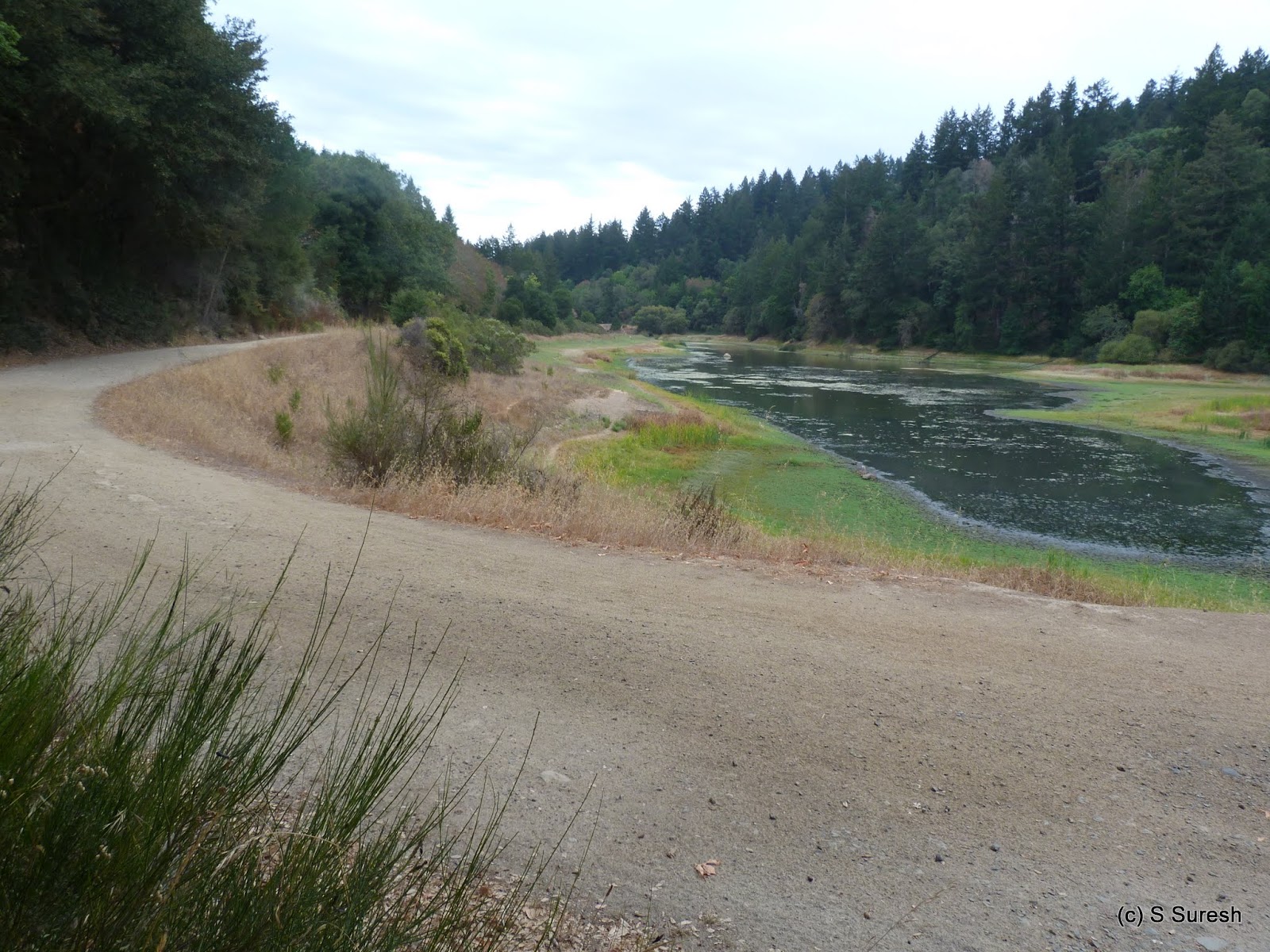
The beauty and serenity was only disturbed for a brief while by the heavy machinery and trucks when we hiked close to the Lexington quarry. The descend was gradual all the way as Limekiln trail took us out of Sierra Azul and into Lexington Reservoir park once again. The trail runs parallel to Alma Bridge Rd for a while before going up the mountains for one short stint.
We had to walk a brief while (between 1/4 - 1/2 mile) on Alma Bridge Rd to reach where I'd parked the car by Priest Rock trail. The low water levels in the reservoir was quite obvious as we completed our 5+ mile loop that involved about 1100 feet ascend.
More pictures from our hike today.
#Hiking #HikingWithDogs #SierraAzulOpenSpacePreserve #MROSD #SierraAzul #LimeKilnTrail #PriestRockTrail
Soquel Demonstration State Forest is one of the eight state administered parks with the goal of demonstrating sustained-yield timber management, education, research and recreation. The main entrance is located at 29400 Highland Way, Los Gatos, off Summit Rd & Hwy 17. Located in the Santa Cruz mountains, the last 4 miles leading to the entrance is by narrow, winding roads. Plenty of road side parking is available on Highland Way. There is also a parking lot inside that was open today that can be accessed by crossing a narrow bridge.
Apollo and I started our hike by crossing the bridge over Soquel Creek. The first 3/4 mile or so from Highland Way trail head is through a private property. Hinh's Mill Rd is a wide dirt trail that winds its way through the forest filled with redwood, douglas fir and tanoak trees. This is a forest with active logging and you will see plenty of evidence of it all the way.
SDSF is popular location with mountain bikers. While equestrians and hikers are welcome, they are definitely in the minority. Today, I was the only person on foot while there were plenty of bikers zipping by us, couple of them with their dogs running with them.
That we were in the minority didn't bother Apollo who, as always, had a great time today. These days, he almost reads my mind and decides on where to pose for a photo.
Hinh's Mill Rd is a 2.3 mile long trail before coming up on the first intersection with Sulphur Springs Rd. From the trail head, it is an easy ~400 feet descend to this spot. I turned left on Sulphur Springs Rd and walked another 1/2 mile or so to the Corral trail junction. This 1/2 mile stretch climbs up ~200 feet. Along the way, you will see two helipad locations.
SDSF borders Forest of Nisene Marks which we had hiked from the Land of Medicine Buddha in July. A classic hike in the woods, I saw several trees that had unique characteristics in how it was growing.
All the trails are essentially fire roads with more mountain bike tracks than foot prints. We turned around at this point and made our way back. It is possible to extend the hike from Sulphur Springs Rd junction to create a loop, but they will add at least 4+ miles to the ~5 mile out and back segment by Hinh's Mill Rd.
We completed our 6 mile hike that involved about 600 feet ascend overall. There are no paper maps of the trails available at the trail head. If you need one, please print a map before heading there.
More pictures from our hike today.
#Hiking #HikingWithDogs #SoquelDemonstrationStateForest #SDSF #RedwoodHikes
John Nicholas trail in Sanborn park is a multi-use trail that opened to the public in April 2015. The 5.3 mile trail runs from Black Rd to Skyline trail close to the Sunnyvale Mountain staging area. We had hiked the Skyline trail near Indian Rock in August. The Sunnyvale Mountain parking lot is about 4.5 miles south on Skyline Blvd from its intersection with Hwy 9.
I had decided to hike from the Skyline side rather than from Black Rd. A short 1/4 mile stretch by Skyline trail from the parking lot brought us to John Nicholas trail. This is a double track dirt trail that winds down through the forests of Sanborn park. Over the next 3.4 miles, the trail descends nearly 1200 feet before it reaches the Lake Ranch reservoir.
Within the first 1/2 mile, there is a vista point with an impressive view of the valley and mountains of the east bay, including Mt. Diablo. The view is somewhat restricted by trees, but it is nice nevertheless. And there is a rugged bench to sit and enjoy if you so desire.
 |
| Bank on it, bikers! |
I suspect that this will fast become a mountain bikers favorite place. There were several places that the trail was done just so to make it interesting to bikers. I noticed more than a handful of spots with nice curves in the trail that mountain bikers can bank on for a thrilling ride, especially downhill!
The segment to Lake Ranch reservoir is filled with switchbacks. As the crow flies, this is barely a mile, but hikers will cover it in over 3 miles due to the continuous switchbacks! But that should hardly be a reason for concern as the trail takes you deeper into the woods with some interesting tree and rock formations.
The weather today was cool with a light drizzle when we started the hike. As we neared the reservoir, the drizzle became a light rain and I happened to see a lush green portion of the forest making me feel that I was in some rain forest for that moment. A sight for sore eyes in California! Crossing over three brand new wooden bridges over Lyndon Canyon creek, we reached Lake Ranch reservoir.
 |
| Lake Ranch Reservoir |
The area by the lake is wide open and much brighter, even though the reservoir was hurting from the drought. The trail also widens to a fire road and hugs around the lake before turning south towards Black Rd. The trail is more level and doesn't involve any ascend or descend until it reaches Black Rd.
 |
| Black Road |
Having hiked John Nicholas trail end to end, I realized that if we walked up by Black Rd and Skyline Blvd, we will shave couple of miles off the out & back hike. With the pavement recently re-paved and the moisture from the rain, Black Rd was literally a black road.
We had to be very careful and keep an eye & ear out for passing traffic and get out of their way. Fortunately, the traffic was light and those driving were considerate. We steadily climbed up Black Rd, gaining more than half of the 1200 feet over the next mile.
Close to Skyline Blvd, road repaving was in progress with one lane traffic for a short while. We were held for several minutes by a construction worker before he spoke into his radio - "sending a pedestrian and a dog now".
 |
| Skyline Blvd. |
The walk by Black Rd and Skyline Blvd could very well have been part of a multi-use trail - it was scenic all the way, except for traffic. The home stretch on Skyline Blvd was uneventful, involving us having to regain the remaining 400 ft. or so over the next 2.5 miles. I was sad to see a deer roadkill that was moved off to the side of the road. But the hike ended with me spotting three deer negotiating a steep hillside and running away from us.
I was impressed that we covered nearly nine miles involving a 1200 feet climb at a respectable pace. For those not wanting to go on the road or a shorter variation, there are multiple options. An out and back hike can be done from either Black Rd or Sunnyvale Mountain parking lot on Skyline Blvd to the extent you are comfortable with.
More pictures from the hike.
#Hiking #HikingWithDogs #SanbornCountyPark #JohnNicholasTrail #SanbornPark
Located in the heart of Silicon Valley, Martial Cottle Park is a historic agricultural farmland that now belongs to Santa Clara County Park. Belonging to the Cottle-Lester families for more than 150 years, the last descendant transferred the ownership to SCC Park so that future generations can appreciate what it was like in our very own backyard before the technology revolution.
The main entrance to the park is from 5283 Snell Ave. However, several other entries to the perimeter trail and park is possible from Branham Lane, Chynoweth Ave (at Barron Park Dr and Duesenberg Dr). Low 60s marked a classic fall start to the day and our walk from Chynoweth Ave (at Barron Park Dr) entrance.
A paved, multi-use trail goes around the perimeter of this agricultural land. This is a fairly new park and the trail itself was opened only in 2014. The trail crosses the Canoas creek, the bridge still looking brand new. The farm land is fenced and is still actively used for organic farming by Jacobs farms.
The trail turns eastward at Branham Lane and runs parallel to it for a while. At the intersection of Snell Ave, the trail turns south and leads you to the main entrance. Behind the main entrance is a visitors center and a large informational board describing the history of the ranch along with current developments in the valley, California, US and world. Very nicely done!
By the visitors center is also a huge lawn, a children's play area and several picnic spots, each named after the descendants of the Cottle-Lester family. Apollo was extraordinarily curious today and had his nose to the ground until we came up on the visitors center and lawns. Continuing past the area, the trail goes by the park offices before turning west at Chynoweth Ave (near Duesenberg Dr).
Chynoweth Ave is not a through street for vehicular traffic, but the trail runs through the farm and got us to the place where I'd parked my car. As I walked this easy 3 mile loop, I was amazed at the determination of the Cottle-Lester family to preserve this small piece of history, not just for themselves but for everyone.
Come here for a family picnic; or for a walk with your dog. Choose a time of day when it is nippy to enjoy the smell of the land. I've a reminder to myself to visit this park again in spring when it will be filled with vibrant colored flowers and fresh fruits and vegetables.
More pictures from our walk today.
#Hiking #HikingWithDogs #MartialCottlePark
My fifth hike to the peak this year, third from Ohlone college trail head. This was definitely a special hike with the astronomical calendar full of unique events unfolding: a full moon that happens to be a super moon and a lunar eclipse that would show up as a blood moon. Leaving Apollo behind for this venture, I did an evening hike up to the peak to see the sunset and observe the lunar phenomenon.
It was a muggy start to the hike, the temperature was in the low 80s with heavy cloud cover. I took the same route as with the previous two occasions from this trail head - Peak trail that climbs steadily up the hills and subsequently running parallel to Mills Creek Rd providing a nice shade cover. There was heavy traffic with lots of people making their way up, although there were just couple of them with their dogs.
I had reached the open meadow where the main approach from Stanford Ave, Ohlone Wilderness trail meets the Peak trail from Ohlone college around 6 pm. I decided to approach the peak from the far side and in the process hike Grove Moore trail that I have not done thus far. This meant going down couple of hundred feet before Grove Moore trail starts ascending again.
 |
| Western Sky |
The additional climb was rewarded with a break from the crowds. For the next 1/2 hour, as I approached the peak hiking by Grove Moore, Horse Heaven and Peak trails, I didn't meet any other hiker. To boot, the sun had broken free from the clouds and there were several excellent views of the mountains and the valleys on either side of Mission Peak swathed with the orange red hue of the setting sun.
 |
| Eastern Sky |
I took a longish break at the top enjoying the beautiful sunset. The lingering clouds on the western sky took on a red hue that progressively darkened as the sun set making it a breathtaking experience.
Unfortunately, the clouds on the eastern sky were so thick that I couldn't see the rise of the super moon. The moon did break free from the cloud couple of times during the eclipse - offering us the blood moon face.
 With the twilight fading, moon eclipsed and behind clouds most of the time, I had to descend in the dark with the aid of a flash light. The valley was covered with lights against the fading light. Being familiar with this trail definitely helped, something I would recommend as a pre-requisite to those intending to do a night hike.
The blood moon that eluded me at the peak showed up as a bright super moon at the foot hill, in the final stages of the eclipse.
My hike today involved climbing 2300+ feet covering more than 8 miles, albeit with a long break at the peak. Having climbed this bay area favorite through all possible approaches, I will give Mission Peak a rest for rest of the year.
Here are some more pictures from my hike.
#Hiking #MissionPeak #EBRPD #SuperMoonHike
Located in the southwestern corner of San Francisco, Lake Merced Park offers a nice, paved trail that loops around the lake in an urban setting. Plenty of free parking is available around the lake. There are parking lots in John Muir Rd, Lake Merced Blvd (near Brotherhood way) on the south side, Skyline Blvd & Harding Rd on the west side and Lake Merced Blvd & Sunset Blvd on the north side.
We started our walk today from John Muir Rd going in a clockwise direction. A pair of seagulls posed for a nice picture to kick off our walk.
With some construction and restoration happening, there were stretches where the lake was hidden from view today by fencing. Along side the paved black top trail, there was also a dirt trail going round the lake for those inclined to use it - typically joggers.
The trail turns northward at Skyline Blvd. At the intersection of Skyline Blvd and John Muir Rd is Fort Funston Park, another dog friendly park that offers a more rugged setting. Continuing up on Skyline Blvd, we crossed the entrance to Harding park, the city owned golf course that is flanked by Lake Merced in three directions.
Turning right on Lake Merced Blvd, we continued walking eastward until Sunset Blvd. At Sunset Blvd, Apollo decided to pose for a photo that I couldn't pass on!
Taking the steps that leads to a foot bridge separating the north and west lake segments (terminology in informational boards by the two water bodies), we crossed over into the Harding Park & golf course. I checked with a caddy inside, who mentioned that it is okay to walk inside the course. It looks like people typically walk around the north lake (bounded by Skyline Blvd, Lake Merced Blvd and the golf course/Harding Rd).
Apollo and I walked by the north lake a while. This is the first time I have walked inside a golf course. The setting of this golf course - lush green lawns (using recycled water), blue skies with interesting cloud formations against the lake offered some outstanding views today.
Instead of doing the north lake loop and repeat a portion of our walk, I decided to turn and walk the other direction, by the west lake, inside the golf course. I was hoping that there would be an exit at end of the lake. That exit eluded me and I ended up walking inside the golf course all the way to the 14th hole.
I talked to a maintenance person who pointed the way out through the maintenance area. She was kind person and we had a good conversation, but public is not allowed in this area, so I recommend that folks take the trail on the north side of the lake closely bordering Lake Merced Blvd, even though it would probably be dry and uninspiring once Lake Merced Blvd turns south.
The park info mentions that this is a 4.5 mile loop. With our excursions inside the Harding Park & golf course, we ended up walking another mile.
Here are some more pictures from our walk today.
#Hiking #HikingWithDogs #LakeMercedPark #HardingPark






 With the twilight fading, moon eclipsed and behind clouds most of the time, I had to descend in the dark with the aid of a flash light. The valley was covered with lights against the fading light. Being familiar with this trail definitely helped, something I would recommend as a pre-requisite to those intending to do a night hike.